
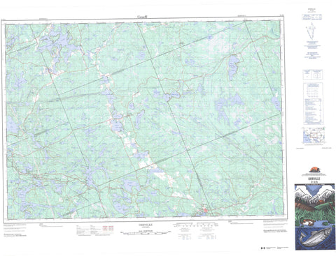
031E05 Orrville Canada topo map, 1:50,000 scale
031E05 Orrville NRCAN topographic map.
Includes UTM and GPS geographic coordinates (latitude and longitude). This 50k scale map is suitable for hiking, camping, and exploring, or you could frame it as a wall map.
Printed on-demand using high resolution, on heavy weight and acid free paper, or as an upgrade on a variety of synthetic materials.
Topos available on paper, Waterproof, Poly, or Tyvek. Usually shipping rolled, unless combined with other folded maps in one order.
- Product Number: NRCAN-031E05
- Parent Topo: TOPO-031E
- Map ID also known as: 031E05, 31E5, 31E05
- Unfolded Size: Approximately 26" high by 36" wide
- Weight (paper map): ca. 55 grams
- Map Type: POD NRCAN Topographic Map
- Map Scale: 1:50,000
- Geographical region: Ontario, Canada
Neighboring Maps:
All neighboring Canadian topo maps are available for sale online at 1:50,000 scale.
Purchase the smaller scale map covering this area: Topo-031E
Spatial coverage:
Topo map sheet 031E05 Orrville covers the following places:
- Beley Bay - Cameron Bay - Long Arm - Rosseau Bay - Beley Point - Rossmoyne Point - Otter Lake Narrows - Mountain Chute - Cardwell - Christie - Conger - Ferguson - Foley - Humphrey - McDougall - McKellar - McMurrich - Monteith - Muskoka - Parry Sound - Ryerson - Spence - Arrowhead Island - Birch Island - Bluebell Island - Booze Island - Coffee Island - Elysee Island - Fair Island - Fort Island - Fraser Island - Iroquois Island - Jean Island - Lillie Island - Nina Island - Norwin Island - Oak Island - Pauls Island - Pine Island - Prospect Island - Round Island - Rusholme Island - Slocum Island - Woodburn Island - Acton Lake - Agnes Lake - Avis Lake - Axe Lake - Baby Lake - Back Lake - Bard Lake - Barfoot Lake - Barnes Lake - Bear Lake - Belfry Lake - Berry Lake - Big Horn Lake - Blackwater Lake - Blair Lake - Blue Lake - Boy Lake - Brennan Lake - Bright Lake - Brush Lake - Burnside Lake - Burr Lake - Campbell Lake - Capton Lake - Carruthers Lake - Cashen Lake - Cask Lake - Clear Lake - Cochrane Lake - Concession Lake - Cook Pond - Corfe Lake - Cornish Lake - Cosh Lake - Cramadog Lake - Crowder Lake - Dainty Lake - Day Lake - Deavy Lake - Dell Lake - Diamond Lake - Dora Lake - Draycot Lake - Dube Lake - Dubé Lake - Duck Lake - Dutcher Lake - Ellis Lake - Eustace Lake - Faris Lake - Fifteen Mile Lake - First Lake - Flaxman Lake - Forbes Lake - Forget Lake - Fraser Lake - Fresque Lake - Frey Lake - Fume Lake - Funston Lake - Gilbank Lake - Gilboe Lake - Glendening Lake - Good Lake - Greer Lake - Haighton Lake - Haines Lake - Harris Lake - Heaslip Lake - Hoben Lake - Home Lake - Horn Lake - Horseshoe Lake - Huard Lake - Hydes Lake - Isabella Lake - Jelso Lake - Johns Lake - Johnston Lake - Kight Lake - Killeen Lake - Kimmins Lake - Lake Joseph - Lake Rosseau - Lane Lake - Liebeck Lake - Lingen Lake - Linger Long Lake - Lioness Lake - Little Long Lake - Little Manitouwaba Lake - Little Seguin Lake - Little Whitefish Lake - Loney Lake - Long Lake - Long Lake - Long Lake - Lorenz Lake - Lovell Lake - Lower Fry Lake - Malzan Lake - Manitouwaba Lake - Manitouwabing Lake - Mann Lake - Maple Lake - Martin Lake - Martini Lake - McCan Lake - McCauley Lake - McDonald Lake - McGee Lake - McGowan Lake - McGruther Lake - McLean Lake - McNutt Lake - Meadow Lake - Mill Lake - Miller Lake - Mohan Lake - Motley Lake - Muddle Lake - Munnery Lake - Murdock Lake - Mutton Lake - Napken Lake - Neville Lake - Nineteen Lake - Oastler Lake - Obright Lake - Okane Lake - O'Kane Lake - Orme Lake - Ottaway Lake - Otter Lake - Pender Lake - Pepper Lake - Petty Lake - Pickey Lake - Pirie Lake - Plate Lake - Poag Lake - Ponsford Lake - Proud Lake - Purcell Lake - Rankin Lake - Richmond Lake - Ruebottom Lake - Rutter Lake - Ryder Lake - Salmon Lake - Santa Lake - Scime Lake - Scott Lake - Second Lake - Shanty Lake - Sovereign Lake - Spectacle Lake - Standing Lake - Stanzel Lake - Star Lake - Stata Lake - Storm Lake - Sucker Lake - Sugar Lake - Tabor Lake - Tatai Lake - Ten Mile Lake - Third Lake - Tilt Lake - Tongue Lake - Trout Lake - Trout Lake - Tub Lake - Tucker Lake - Turtle Lake - Upper Fry Lake - Vair Lake - Vinett Lake - Virtue Lake - Vowel Lake - Watson Lake - Weeden Lake - Wetmore Lake - Whitefish Lake - Wilson Lake - Winch Lake - Windfall Lake - Woods Lake - Wright Lake - Yarrow Lake - Muskoka - Christie - Foley - Humphrey - Magnetawan - McDougall - McKellar - McMurrich - McMurrich/Monteith - Muskoka Lakes - Ryerson - Seguin - Strong - The Archipelago - Axe Lake Wetland Conservation Reserve - Bear Lake Peatland Conservation Reserve - Cardwell Township Old Growth Conservation Reserve - Dutcher Lake Conservation Reserve - Horseshoe Lake Conservation Reserve - Long Lake-Lancelot Creek Conservation Reserve - Monteith Forest Conservation Reserve - Oastler Lake Provincial Park - Seguin Chutes Conservation Reserve - Seguin River Conservation Reserve - Hab Rapids - Indian Rapids - Ragged Rapids - Serpent Rapids - Beggsboro Creek - Blackstone River - Boyne River - Broad River - Haines Creek - Horn Creek - Lawrason Creek - Little Seguin River - Manitouwabing River - Rosseau River - Seguin River - Shadow River - Axe Lake - Banbury - Bear Cave - Bear Lake - Black Road - Blackstone - Brignall - Broadbent - Dockmure - Dufferin Bridge - Edgington - Falding - Falding Platform - Haines Lake - Hayes Corners - Hekkla - Holmur - Horseshoe Lake - Humphrey - Humphry - Hurdville - Inholmes - Jarlsberg - North Seguin - Orrville - Otter Lake - Port Cockburn - Rosseau - Rosseau Road - Seguin Falls - Shannon Hall - South Parry - Swords - Turtle Lake - Whitehall


