
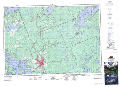
031E03 Bracebridge Canada topo map, 1:50,000 scale
031E03 Bracebridge NRCAN topographic map.
Includes UTM and GPS geographic coordinates (latitude and longitude). This 50k scale map is suitable for hiking, camping, and exploring, or you could frame it as a wall map.
Printed on-demand using high resolution, on heavy weight and acid free paper, or as an upgrade on a variety of synthetic materials.
Topos available on paper, Waterproof, Poly, or Tyvek. Usually shipping rolled, unless combined with other folded maps in one order.
- Product Number: NRCAN-031E03
- Parent Topo: TOPO-031E
- Map ID also known as: 031E03, 31E3, 31E03
- Unfolded Size: Approximately 26" high by 36" wide
- Weight (paper map): ca. 55 grams
- Map Type: POD NRCAN Topographic Map
- Map Scale: 1:50,000
- Geographical region: Ontario, Canada
Neighboring Maps:
All neighboring Canadian topo maps are available for sale online at 1:50,000 scale.
Purchase the smaller scale map covering this area: Topo-031E
Spatial coverage:
Topo map sheet 031E03 Bracebridge covers the following places:
- Archer's Bay - Babies Bay - Boyd Bay - Burnt Island Bay - Cedar Bay - Green Bay - Hammel Bay - Hammell's Bay - Long Bay - Menominee Bay - Milford Bay - Sandy Bay - Sandy Cove - Shanty Bay - Skinner Bay - Stephens Bay - Strawberry Bay - Walkers Bay - Whiskey Bay - Whitehouse Bay - Yolanda Bay - Boyers Beach - Cedar Beach - Kirbys Beach - Black Point - Clovelly Point - Greenwood Point - Greey Point - Grey Point - Halls Point - Hamblys Point - Hemlock Point - Hudsons Point - Joli Point - Kareen Point - Needler Point - Norway Point - Pine Needle Point - Point William - Price Point - Strawberry Point - Walkers Point - Whiskey Point - Baysville Narrows - The Cut - The Narrows - Bracebridge Falls - Crozier Falls - Hanna Chute - High Falls - May Chutes - Slater Falls - South Falls - Wilsons Falls - Brunel - Cardwell - Draper - Franklin - Macaulay - McLean - Monck - Muskoka - Muskoka - Oakley - Ridout - Stephenson - Watt - Wood - Aksarben Island - Aquila Island - Ashlee Island - Auricula Island - Balthaycock Island - Baxter Island - Bigwin Island - Birch Island - Bonner Island - Brant Island - Brigadoon Island - Browning Island - Buck Island - Burnt Island - Burnt Island - Caisses Island - Castle Island - Cedar Island - Chalmers Island - Champion Island - Cheboygan Island - Cherry Island - Chief Island - Christmas Island - Cinderwood Island - Clifton Island - Columbia Island - Crown Island - Crown Island - Dawson Island - Delamere Island - Duck Island - Duncan Island - Echo Island - Eilean Gowan Island - Ensko Island - Evergreen Island - Fairholm Island - Fairview Island - Ferrie Island - Firebrand Island - Fox Island - Frank Island - Gall Island - Gossamer Island - Grandview Island - Green Island - Gull Island - Hanes Island - Hanney Island - Hepburn Island - Hepburnita Island - Heward Island - Hilo Island - Hugel Island - Isobel Island - Jibilto Island - Judy Island - Jupiter Island - Kelley Twins Islands - Langmaids Island - Laridae Island - Lovell Island - MacBeth Island - Marco Island - Mariebianca Island - McVittie Island - Mickle Island - Mikado Island - Miller Island - Millichamp Island - Monte Christo Island - Monte Cristo Island - Nine Mile Island - Oak Island - Old Woman Island - Palmos Island - Pancake Island - Perry Island - Pine Island - Pratt Island - Punch Island - Rebecca Island - Regatta Island - Rob Roy Island - Rock Island - Rock Island - Rockwood Island - Rocky Island - Roothog Island - Rosebud Island - Round Island - Sailors Rest Island - Seagull Island - Shamrock Island - Squirrel Island - Stanley Island - Stonewall Island - Stuart Island - Summer Island - The Brothers - Tondern Island - Urania Island - Valentine Island - Vernon Island - Waite Island - Walkers Island - Wildwood Island - Wilson Island - Young Island - Zephyr Island - Allen Lakes - Alport Lake - Angel Lake - Artie Lake - Atkins Lake - Axle Lake - Beattie Lake - Big Orillia Lake - Big Stephen Lake - Bigwind Lake - Bird Lake - Bonnie Lake - Bunn Lake - Camel Lake - Chain Lake - Clear Lake - Clearwater Lake - Cowan Lake - Crosson Lake - Devine Lake - Dickie Lake - Dunn Lake - East Buck Lake - Echo Lake - Ellis Lake - Ennis Lake - Fawn Lake - Fleming Lake - Fleming Lake - Fraser Lake - Gardiner Lake - Gilleach Lake - Goodman Lake - Grandview Lake - Gullfeather Lake - Halfway Lake - Healey Lake - Heeney Lake - Heney Lake - High Lake - Hillman Lake - Jackson Lake - Keyhole Lake - Lake Muskoka - Lake of Bays - Laut Lakes - Laut Lakes - Leech Lake - Lena Lake - Leonard Lake - Lily Lake - Little Leech Lake - Little Orillia Lake - Longs Lake - Lower Schufelt Lake - Lower Twin Lake - Lynch Lake - Lynx Lake - Mainhood Lake - Mary Lake - McKay Lake - McRey Lake - Menominee Lake - Montgomery Lake - Montgomery Lake - Moot Lake - Moth Lake - North Healey Lake - Nutt Lake - Palmer Lake - Parker Lake - Pine Lake - Porcupine Lake - Pretzel Lake - Ril Lake - Rileys Lake - Rose Lake - Sage Lake - Saw Lake - Schufelt Lake - Shack Lake - Shapter Lake - Skeleton Lake - Spence Lake - Stoneleigh Lake - Tackaberry Lake - Three Mile Lake - Threemile Lake - Toms Lake - Tongua Lake - Tooke Lake - Tucker Lake - Upper Twin Lake - Utterson Lake - West Buck Lake - Whitehouse Lake - Wildcat Lake - Wood Lake - Woodbine Lake - Wrist Lake - Haliburton - Muskoka - Anson, Hindon and Minden - Cardwell - Draper - Franklin - Lake of Bays - Lutterworth - Macauley - McLean - McLean - Medora and Wood - Minden Hills - Monck - Monck - Muskoka - Muskoka Lakes - Oakley - Ridout - Snowdon - Watt - Bigwind Lake Provincial Park - Shack Creek Wetland Conservation Reserve - Flynn Rapids - Rocky Rapids - Bastedo Creek - Black River - Brandy Creek - Cache Creek - Clear Creek - Heeney Creek - Heney Creek - Kawpakwakog River - Lancelot Creek - Lynx Creek - McKay Creek - Menominee Creek - Muskoka River - North Branch Muskoka River - North Muskoka River - Outlet Creek - Sage Creek - Sharpe Creek - South Branch Muskoka River - South Muskoka River - Spence Creek - Stoneleigh Creek - Wadis Creek - Devils Elbow - Hairpin Bend - Freds Rock - Gull Rocks - Jibilto Shoal - Bracebridge - Gravenhurst - Huntsville - Alport - Bangor Lodge - Bardsville - Barlochan - Baysville - Beatrice - Beaumaris - Bigwin - Browning Island - Browns Brae - Cedar Village - Chekipag - Clear Lake - Echo Beach - Fairview Island - Falkenburg Station - Fraserburg - Glenmount - Golden Beach - Grandview - Inverness Lodge - Lakewood - Milford Bay - Monsell - Muskoka Lodge - Newholm - Nith Grove - Norway Point - Parkersville - Port Sydney - Purbrook - Raymond - Roxbourgh - Springdale Park - St. Elmo - Stephens Bay - Stoneleigh - Sunset Beach - Ufford - Ullswater - Utterson - Valley Green Beach - Wahawin - Walkers Point - Willow Beach - Ziska - Muskoka Canyon


