
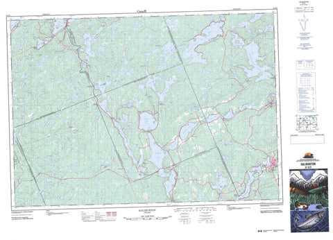
031E02 Haliburton Canada topo map, 1:50,000 scale
031E02 Haliburton NRCAN topographic map.
Includes UTM and GPS geographic coordinates (latitude and longitude). This 50k scale map is suitable for hiking, camping, and exploring, or you could frame it as a wall map.
Printed on-demand using high resolution, on heavy weight and acid free paper, or as an upgrade on a variety of synthetic materials.
Topos available on paper, Waterproof, Poly, or Tyvek. Usually shipping rolled, unless combined with other folded maps in one order.
- Product Number: NRCAN-031E02
- Parent Topo: TOPO-031E
- Map ID also known as: 031E02, 31E2, 31E02
- Unfolded Size: Approximately 26" high by 36" wide
- Weight (paper map): ca. 55 grams
- Map Type: POD NRCAN Topographic Map
- Map Scale: 1:50,000
- Geographical region: Ontario, Canada
Neighboring Maps:
All neighboring Canadian topo maps are available for sale online at 1:50,000 scale.
Purchase the smaller scale map covering this area: Topo-031E
Spatial coverage:
Topo map sheet 031E02 Haliburton covers the following places:
- Dummitt Bay - Dunnett Bay - Echo Bay - Five Mile Bay - Little Girl Bay - Minden Bay - Trading Bay - White Trout Bay - Dorset Narrows - Ox Narrows - The Narrows - Anson - Dysart - Eyre - Guilford - Haliburton - Havelock - Hindon - Minden - Muskoka - Ridout - Sherborne - Stanhope - Brown Island - Constance Island - Crozier Island - Deer Island - Elstone Island - Goat Island - Harper Island - Kirkwood Island - Norah's Island - Reuben Island - St. Margaret Island - Amaleen Lake - Anson Lake - Austin Lake - Avery Lake - Baker Lake - Barnum Lake - Bat Lake - Beech Lake - Bentarm Lake - Bentshoe Lakes - Berrycan Lake - Big Brother Lake - Big East Lake - Big Hawk Lake - Big Orillia Lake - Bitter Lake - Black Lake - Blackberry Lake - Blackcat Lake - Blotter Lake - Blue Chalk Lake - Blueglass Lake - Bone Lake - Boshkung Lake - Brady Lake - Bridge Pond - Browns Lake - Buckhorn Lake - Buckskin Lake - Burdock Lake - Campstool Lake - Carcass Lake - Cat Lake - Chub Lake - Cinder Lake - Circular Lake - Claypack Lake - Clean Lake - Clear Lake - Coleman Lake - Coulter Lake - Cow Lake - Cranberry Lake - Cream Lake - Cruiser Lake - Dan Lake - Dawson Ponds - Duck Lake - Eagle Lake - East Paint Lake - Ernest Lake - Fagan Ponds - Fly Lake - Grant Lake - Grass Lake - Green Lake - Grindstone Lake - Grouse Lake - Guilford Lake - Gun Lake - Halls Lake - Head Lake - Herb Lake - Hindon Lake - Horse Lake - Hurricane Lake - Insula Lake - Jean Lake - Jill Lake - Kabakwa Lake - Kashagawigamog Lake - Kawagama Lake - Kelly Lake - Kennisis Lake - Ketch Lake - Klaxon Lake - Knife Lake - Kushog Lake - Lake of Bays - Lipsy Lake - Little Avery Lake - Little Boshkung Lake - Little Brother Lake - Little Cruiser Lake - Little East Lake - Little Elsie Lake - Little Hawk Lake - Little Hindon Lake - Little Jean Lake - Little Kennisis Lake - Little Margaret Lake - Little Orillia Lake - Little Paul Lake - Little Redstone Lake - Little Shoe Lake - Little Soyers Lake - Little Sunken Lake - Little Wren Lake - Longline Lake - Lower Crane Lake - Lower Welch Lake - Macdonald Lake - Maple Lake - Margaret Lake - Marsden Lake - Martin Lake - McDonald Lake - McEwen Lake - McKeown Lake - Michabo Lake - Mink Lake - Mirror Lake - Mooney Lake - Moosetrack Lake - Mountain Lake - Mouse Lake - Mug Lake - Nehemiah Lake - Nunikani Lake - Orley Lake - Otterhead Lake - Paint Lake - Paint Lake - Pairo Lakes - Partridge Lake - Paul Lake - Pauper Lake - Pelaw Lake - Pine Lake - Pivot Lake - Plastic Lake - Poker Lake - Porcupine Lake - Ranger Lake - Raven Lake - Red Chalk Lake - Red Pine Lake - Redstone Lake - Ridout Lake - Ril Lake - Ronald Lake - Roundabout Lake - Sand Lake - Saskatchewan Lake - Saucer Lake - Second Lake - Sherborne Lake - Shoe Lake - Shoelace Lake - Silver Buck Lake - Silver Doe Lake - Silverlynn Lake - South Jean Lake - South McDonald Lake - Soyers Lake - Splatter Lake - Sprat Lake - St. Mary Lake - St. Nora Lake - String Lake - Sugarbowl Lake - Sunken Lake - Teapot Lake - Tedious Lake - Three Brothers Lakes - Three Island Lake - Tingey Lake - Tom Lake - Twelve Mile Lake - Twisty Lake - Upper Crane Lake - Welch Lake - Wildgoose Lake - Wolfden Lake - Wolfkin Lake - Wren Lake - Haliburton - Muskoka - Algonquin Highlands - Anson, Hindon and Minden - Dysart, Dudley, Harcourt, Guilford, Harburn, Bruton, Havelock, Eyre and Clyde - Franklin - Lake of Bays - Lutterworth - McLean - Minden Hills - Ridout - Sherborne, McClintock and Livingstone - Sherborne, McClintock, Livingstone, Lawrence and Nightingale - Sherborne, Stanhope, McClintock, Livingstone, Lawrence and Nightingale - Snowdon - Stanhope - Bigwind Lake Provincial Park - Clear Lake Conservation Reserve - Plastic Lake and Dawson Ponds Conservation Reserve - Anson Creek - Austin Creek - Avery Creek - Barnum Creek - Black River - Blackberry Creek - Blackcat Creek - Boshkung River - Buckhorn Creek - Cache Creek - Cat Creek - Chalk Creek - Cinder Creek - Clear Creek - Drag River - East Redstone River - Elsie Creek - Eyre Creek - Gull River - Harburn Creek - Hawk Creek - Hindon Creek - Hollow River - Horse Creek - Hurricane Creek - Kennisis River - Ketch Creek - Klaxon Creek - Little Kennisis River - Margaret Creek - Martin Creek - McDonald Creek - Orillia Creek - Paul Creek - Pauper Creek - Poker Creek - Redstone Brook - Redstone River - Ridout Creek - Saskatchewan Creek - Shoelace Creek - Sickle Creek - Silver Buck Creek - South Jean Creek - Soyers Creek - St. Mary Creek - Welch Creek - Bracebridge - Blairhampton - Boskung - Brady Lake - Buttermilk Falls - Carnarvon - Dorset - Eagle Lake - Goulds - Gould's - Grove Park - Grove Park Lodge - Haliburton - Halls Lake - Hindon Hill - Kennisis Lake - Little Hawk Lake - Maple Lake - Maple Ridge - Peterson Corner - Pine Springs - West Guilford


