
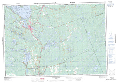
031D14 Gravenhurst Canada topo map, 1:50,000 scale
031D14 Gravenhurst NRCAN topographic map.
Includes UTM and GPS geographic coordinates (latitude and longitude). This 50k scale map is suitable for hiking, camping, and exploring, or you could frame it as a wall map.
Printed on-demand using high resolution, on heavy weight and acid free paper, or as an upgrade on a variety of synthetic materials.
Topos available on paper, Waterproof, Poly, or Tyvek. Usually shipping rolled, unless combined with other folded maps in one order.
- Product Number: NRCAN-031D14
- Parent Topo: TOPO-031D
- Map ID also known as: 031D14, 31D14
- Unfolded Size: Approximately 26" high by 36" wide
- Weight (paper map): ca. 55 grams
- Map Type: POD NRCAN Topographic Map
- Map Scale: 1:50,000
- Geographical region: Ontario, Canada
Neighboring Maps:
All neighboring Canadian topo maps are available for sale online at 1:50,000 scale.
Purchase the smaller scale map covering this area: Topo-031D
Spatial coverage:
Topo map sheet 031D14 Gravenhurst covers the following places:
- Bear Bay - Boot Bay - Brydon Bay - Cliff Bay - Deep Bay - Doe Bay - Duck Bay - Ennis Bay - Grant Bay - Hunters Bay - Jeanneret Bay - Lily Bay - Maple Cove - McLean Bay - Mounts Bay - Muskoka Bay - Patterson's Bay - Portage Bay - Rose Bay - Shadow Bay - South Bay - Sunny Bay - Sunset Bay - Suttaby Bay - Welsh Bay - West Bay - Wood's Bay - Big Point - Birch Point - Bluff Point - Campfire Point - Christenson Point - Coca Point - Deer Point - Ellison Point - Gordon Point - Grandview Point - Iron City Point - Joseph Point - Lauderdale Point - Lions Head - Long Point - McLaughlin Point - Monahan Point - Montcalm Point - Oak Point - Parkers Point - Petes Point - Picnic Point - Prospect Point - River Point - Shantyman Point - View Point - Wilderness Point - Lighthouse Narrows - McDonald Channel - McDonald's Cut - Portage Bay Cut Channel - Portlock Channel - Second Cut - Silver Narrows - Kawartha Lakes - Big Eddy - Coopers Falls - First Cut - Matthias Falls - Matthiasville Falls - Sparrow Chute - Sparrow Lake Chute - Trethewey Falls - Wasdell Falls - Dalton - Digby - Draper - Longford - Matchedash - Morrison - Muskoka - Muskoka - Ontario - Orillia - Rama - Ryde - Wood - Anderson Island - Auburn Island - Aultdowie Island - Baldrock Island - Bass Island - Beechgrove Island - Bell Island - Berkinshaw Island - Big Island - Birch Island - Bivouac Island - Bonnett Island - Boyd Island - Broomleigh Island - Browning Island - Burnt Island - Canary Island - Canyon Island - Caraquette Island - Carl Island - Channel Island - Channel Island - Channel Island - Cherokee Island - Chief Island - Clark Island - Coo-ee Island - Craigenputtock Island - Cranberry Island - Crawford Island - Daisy Island - Davidson Island - Dawson Island - Dead Horse Island - Dead Horse Island - Denison Island - Diamond Island - Doris Island - Driftwood Island - Duquesne Island - Edward Island - Eleanor Island - Eleanor Island - Empress Island - Ennis Island - Erin Island - Ernest Island - Evans Island - Evans Island - Evergreen Island - Fitton Island - Flo Island - Gairney Island - Good Luck Island - Grainger Island - Grandview Island - Grant Island - Greavette Island - Green Island - Gull Island - Halbusal Island - Harma Island - Helena Island - Henry Island - Henry Island - Heydon Island - Hider Island - High Island - Hilda Island - Hill Island - Hookery Island - Indian Island - Java Island - John Island - Katago Island - Kerr Island - Lalla Rookh Island - Laurel Island - Lighthouse Island - Lightwood Island - Lily Island - Lindhill Island - Long Island - Lucile Island - Margaret Island - Marie Island - Mary Island - Mary Island - McCormick Island - Mile Island - Mill Island - Miller Island - Oak Island - Onaway Island - Orillia Island - Outer Island - Paul Island - Percy Island - Petes Island - Picnic Island - Pine Island - Pine Island - Plum Pudding Island - Przemysl Island - Rama Island - Rankin Island - Regina Island - Rex Island - Rose Island - Rose Island - Round Island - Second Island - Silver Island - Sims Island - Snake Island - Speer Island - Split Rock - Squaw Island - Stenson Island - Sumatra Island - Taylor Island - Theobald Island - Tiffany Island - Townsley Island - Treasure Island - Wade Island - Watson Island - Wesley Island - Whitt Island - Wildcat Island - Wilma Island - Wolf Island - Bailey Lake - Barkway Lake - Bass Lake - Bearpaw Lake - Beatty's Lake - Beaver Lake - Ben Lake - Blackmoore Lake - Boot Lake - Browns Lake - Buck Lake - Buck Lake - Buck Lake - Cabin Lake - Carp Lake - Clearwater Lake - Cornall Lake - Cranberry Lake - Cull Lake - Deer Lake - Deer Lake - Doe Lake - Doeskin Lake - Eastern Lake - Fawn Lake - Frock Lake - Gartersnake Lake - Grass Lake - Gull Lake - Horn Lake - Hunter's Lake - Island Lake - Ivy Lake - Jerita Lake - Jevins Lake - Kahshe Lake - Lake Muskoka - Lamorie Lake - Little Cranberry Lake - Little Lake - Little Sunny Lake - Logan Lake - Long Lake - Long Lake - Long Turtle Lake - Loon Lake - Lowe Lake - Lower Eagle Lake - Lower Eastern Lake - Matchedash Lake - Middle Muldrew Lake - Mink Lake - Moore Lake - Moose Lake - Morrison Lake - Muldrew Lakes - North Longford Lake - North Muldrew Lake - Paul's Lake - Pigeon Lake - Pine Lake - Prospect Lake - Rainy Lake - Raven Lake - Reay Lake - Reay Lake - Riley Lake - Robinson Lake - Rock Lake - Round Lake - Ryde Lake - Sidetrack Lake - Silver Lake - South Longford Lake - South Muldrew Lake - South Muldrew Lake - Sparrow Lake - Spence Lake - Spence Lake - Sunny Lake - Swamp Lake - Swampy Lake - Thinn Lake - Three Mile Lake - Turtle Lake - Uley Lake - Upper Eagle Lake - Weismuller Lake - Wright's Lake - Indian Landing - Middle Lake Landing - Patterson's Landing - Pikes Peak - Three Sister Bluffs - Muskoka - Simcoe - Victoria - Bexley - Bobcaygeon/Verulam - Carden - Carden/Dalton - Cardwell - Dalton - Eldon - Emily - Fenelon - Laxton, Digby and Longford - Manvers - Mara - Mariposa - Medora and Wood - Medora and Wood - Monck - Morrison - Muskoka - Muskoka Lakes - Ops - Orillia - Rama - Ramara - Ryde - Severn - Somerville - Verulam - Watt - Bethune Memorial House National Historic Site of Canada - Dalton Digby Wildlands Provincial Park - Draper Township Conservation Reserve - Eleanor Island Bird Sanctuary - Eleanor Island National Wildlife Area - Jevins & Silver Lake Conservation Reserve - Jevins and Silver Lake Conservation Reserve - Kahshe Lake Barrens Conservation Reserve - Lieu historique national du Canada de la Maison-Commémorative-Bethune - Lieu historique national du Canada de la Voie-Navigable-Trent--Severn - Loon Lake Wetland Conservation Reserve - Morrison Lake Wetland Conservation Reserve - Muldrew Barrens Conservation Reserve - Refuge d'oiseaux de l'Île Eleanor - Réserve nationale de faune de l'Île-Eleanor - Torrance Barrens Conservation Reserve - Trent--Severn Waterway National Historic Site of Canada - Big Eddy Rapids - McDonald Rapids - Ragged Rapids - Andrews Creek - Anson Creek - Beav Creek - Beaver Creek - Black River - Cache Creek - Cranberry River - Gartersnake Creek - Gartersnake River - Gold Creek - Green's Creek - Hawkrock River - Hoc Roc River - Jevins Creek - Kahshe River - Loon-Turtle Creek - Montgomery Creek - Morrison Creek - Morrison Creek - Morrison Creek - Muldrew Creek - Muskoka River - Pigeon Creek - Riley Creek - Riley Creek - Severn River - South Beaver Creek - South Branch Muskoka River - South Channel - South Kahshe River - South Muskoka River - Sunny Creek - Thrasher Creek - Indian Portage - Middle Portage - Upper Portage - Goose Rock - Gull Rock - High Island Shoal - Long Island Shoal - Rose Rock - Snub Rock - Twin Rocks - Whip-poor-will Rock - Wiancko Shoal - Bracebridge - Gravenhurst - Barkway - Black Bridge - Browning Island - Coopers Falls - Crawford Island - Germania - Glen Echo - Hamlet - Houseys Rapids - Jevins - Kahshe Lake - Kilty Switch - Kilworthy - Klueys Bay - Lewisham - Malta - Matthias - Matthiasville - Morrison Lake - Morrison Landing - Muldrew Lake - Muskoka - Muskoka Beach - Muskoka Falls - Muskoka Junction - Muskoka Wharf - Port Stanton - Ragged Rapids - Ramona - Reay - Riley Lake - Sadowa - Sanitarium - Severn - Severn Bridge - Sopher's Landing - South Falls - Sparrow Lake - Sparrow Lake - Uffington - Vankoughnet - Washago - West Gravenhurst - Devil's Gulch - Green's Marsh


