
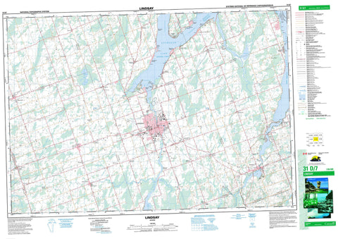
031D07 Lindsay Canada topo map, 1:50,000 scale
031D07 Lindsay NRCAN topographic map.
Includes UTM and GPS geographic coordinates (latitude and longitude). This 50k scale map is suitable for hiking, camping, and exploring, or you could frame it as a wall map.
Printed on-demand using high resolution, on heavy weight and acid free paper, or as an upgrade on a variety of synthetic materials.
Topos available on paper, Waterproof, Poly, or Tyvek. Usually shipping rolled, unless combined with other folded maps in one order.
- Product Number: NRCAN-031D07
- Parent Topo: TOPO-031D
- Map ID also known as: 031D07, 31D7, 31D07
- Unfolded Size: Approximately 26" high by 36" wide
- Weight (paper map): ca. 55 grams
- Map Type: POD NRCAN Topographic Map
- Map Scale: 1:50,000
- Geographical region: Ontario, Canada
Neighboring Maps:
All neighboring Canadian topo maps are available for sale online at 1:50,000 scale.
Purchase the smaller scale map covering this area: Topo-031D
Spatial coverage:
Topo map sheet 031D07 Lindsay covers the following places:
- Goose Bay - Kennedy Bay - Long Point Bay - Ball Point - Killabys Point - Long Point - Kawartha Lakes - Brock - Cavan - Eldon - Emily - Fenelon - Harvey - Manvers - Mariposa - Ops - Peterborough - Verulam - Victoria - Islands in the Trent Waters Indian Reserve 36A - Réserve indienne Islands in the Trent Waters 36A - Green Island - Nigger Island - Emily Lake - Goose Lake - Kawartha Lakes - Lake Scugog - Pigeon Lake - Sturgeon Lake - Baldy Hill - Hogsback - Mount Horeb - Mount Nebo - Durham - Ontario - Peterborough - United Counties of Northumberland and Durham - Victoria - Bexley - Bobcaygeon/Verulam - Brock - Carden - Carden/Dalton - Cavan - Cavan-Millbrook-North Monaghan - Dalton - Eldon - Emily - Fenelon - Galway and Cavendish - Galway-Cavendish and Harvey - Harvey - Laxton, Digby and Longford - Manvers - Mariposa - North Monaghan - Ops - Ops - Somerville - Verulam - Emily Provincial Park - Ken Reid Conservation Area - Lieu historique national du Canada de la Voie-Navigable-Trent--Severn - Trent--Severn Waterway National Historic Site of Canada - East Cross Creek - Emily Creek - Fleetwood Creek - Jackson Creek - Layton River - Mariposa Brook - Martin Creek - McLaren Creek - Pearns Creek - Pigeon River - Potash Creek - Scugog River - Staples River - Stony Creek - White's Creek - Cambray - Cambray Station - Cameron - Cedar Glen - Cowan's Bay - Cresswell - Cunningham's Corners - Daytona Beach - Daytonia Beach - Downeyville - Dunsford - Elm Tree Corners - Fee Landing - Fee's Landing - Feir Mill - Fox's Corners - Glandine - Glenarm - Glenway Village - Grasshill - Greenhurst-Thurstonia - Hall - Hartley - Hickory Beach - Hillhead - Hillhead Corners - Islay - Jones Siding - Keneden Park - Kenhill Beach - Kennedy Bay - Kenrei Park - Kings Wharf - Lakeview Estates - Linden Valley - Lindsay - Little Britain - Long Beach - Manilla - Manilla Junction - Mariposa - McKenzie - McKenzie Crossing - Mount Horeb - Oakwood - O'Donnell Landing - Omemee - Omemee West - Ops - Pickerel Point - Pleasant Point - Pleasant Point Station - Powles Corners - Rea Station - Reaboro - Salem Corners - Sandy Point - Snug Harbour - Southview Estates - Sturgeon Point - Taylor Corners - Thurstonia Park - Victoria Place - Woodville - Zion - Grassy Marsh


