
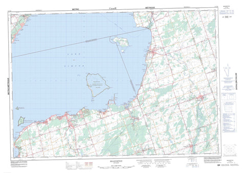
031D06 Beaverton Canada topo map, 1:50,000 scale
031D06 Beaverton NRCAN topographic map.
Includes UTM and GPS geographic coordinates (latitude and longitude). This 50k scale map is suitable for hiking, camping, and exploring, or you could frame it as a wall map.
Printed on-demand using high resolution, on heavy weight and acid free paper, or as an upgrade on a variety of synthetic materials.
Topos available on paper, Waterproof, Poly, or Tyvek. Usually shipping rolled, unless combined with other folded maps in one order.
- Product Number: NRCAN-031D06
- Parent Topo: TOPO-031D
- Map ID also known as: 031D06, 31D6, 31D06
- Unfolded Size: Approximately 26" high by 36" wide
- Weight (paper map): ca. 55 grams
- Map Type: POD NRCAN Topographic Map
- Map Scale: 1:50,000
- Geographical region: Ontario, Canada
Neighboring Maps:
All neighboring Canadian topo maps are available for sale online at 1:50,000 scale.
Purchase the smaller scale map covering this area: Topo-031D
Spatial coverage:
Topo map sheet 031D06 Beaverton covers the following places:
- Beaverton Harbour - Bradens Bay - Cook's Bay - Woods Bay - McCrae Beach - McRae Beach - Moores Beach - Sunnybrook Beach - Bald Point - Blackbird Point - Centre Point - Duclos Point - Eagle Point - Jacksons Point - Mara Point - Mossington Point - North Point - Sawlog Point - Sibbald Point - Sibbalds Point - South Point - Woodman Point - Kawartha Lakes - Brock - Eldon - Georgina - Mara - Mariposa - North Gwillimbury - Ontario - Oro - Thorah - Uxbridge - Chippewas of Georgina Island First Nation - Chippewas of Georgina Island First Nation 33A - Chippewas of Georgina Island First Nation Indian Reserve - Chippewas of Georgina Island First Nation Indian Reserve 33A - Georgina Island Indian Reserve 33 - Georgina Island Indian Reserve 33A - Réserve indienne Chippewas of Georgina Island First Nation - Réserve indienne Chippewas of Georgina Island First Nation 33A - Réserve indienne Georgina Island 33 - Réserve indienne Georgina Island 33A - Fox Island - Georgina Island - Sand Islands - Snake Island - Thorah Island - Lake Simcoe - Gibson Hill - Little Hell Hill - Durham - Ontario - Simcoe - United Counties of Northumberland and Durham - Victoria - York - Bexley - Bobcaygeon/Verulam - Brock - Carden - Carden/Dalton - Dalton - Eldon - Emily - Fenelon - Laxton, Digby and Longford - Manvers - Mara - Mariposa - Ops - Oro-Medonte - Rama - Ramara - Somerville - Thorah - Uxbridge - Verulam - Duclos Point Provincial Nature Reserve - Lieu historique national du Canada de la Voie-Navigable-Trent--Severn - Sibbald Point Provincial Park - Trent--Severn Waterway National Historic Site of Canada - Allingham Creek - Beaver River - Beaverton River - Black River - Burts Creek - Hawkestone Creek - Layton River - Pefferlaw Brook - Pefferlaw River - Talbot River - Uxbridge Brook - Vrooman Creek - White's Creek - Zephyr Creek - The Devils Elbow - Bald Shoal - Big Shoal - Centre Shoal - Eight Mile Shoal - Fox Island Shoal - Hawkestone Shoal - Jimmy Warren Shoal - Long Shoal - Mara Shoal - McCrae Shoal - McRae Shoal - Oro Reef - Snake Rocks - Townline Shoal - White Shoal - Willow Rocks - Woodman Shoal - Georgina - Alsops Beach - Argyle - Baldwin - Balfour Beach - Barrillia Park - Beaverton - Beaverton East - Belhaven - Bradens Bay - Briars Park - Brighton Beach - Cannington - Cedar Beach - Cedar Beach - Cedarhurst - Cedarhurst Beach - Crescent Beach - Derryville - Duclos Point - Eastbourne - Egypt - Ethel Park - Filey Beach - Franklin Beach - Gamebridge - Gamebridge Beach - Gamebridge East - Gamebridge East Station - Gamebridge Station - Gamebridge West Station - Georgina Island - Greenwater - Hawkestone - Hawkestone Beach - Holmes Point - Horneville - Island Grove - Island View Beach - Jackson Point - Jacksons Point - Keswick - Lorneville - Maple Beach - Marina Estates - McLennan's Beach - McRae Beach - Moorelands - Mossington Park - Orchard Beach - Orchard Grove - Oro Park - Palm Beach - Paradise Beach - Parkside Beach - Pefferlaw - Port Bolster - Pugsley Crossing - Riverview Beach - Roche Point - Roches Point - Royal Beach - Saginaw - Sedores - Simcoeside - Sunderland - Sunkist Beach - Sunset Beach - Sutton - Sutton West - Thorah Beach - Thorah Island - Udora - Vachell - Vallentyne - Virginia - Virginia Beach - Vroomanton - Waddington Beach - Wilfrid - Willow Beach - Woodville - Woodville Station


