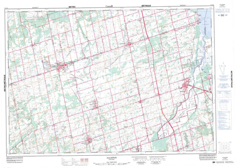
031D04 Alliston Canada topo map, 1:50,000 scale
031D04 Alliston NRCAN topographic map.
Includes UTM and GPS geographic coordinates (latitude and longitude). This 50k scale map is suitable for hiking, camping, and exploring, or you could frame it as a wall map.
Printed on-demand using high resolution, on heavy weight and acid free paper, or as an upgrade on a variety of synthetic materials.
Topos available on paper, Waterproof, Poly, or Tyvek. Usually shipping rolled, unless combined with other folded maps in one order.
- Product Number: NRCAN-031D04
- Parent Topo: TOPO-031D
- Map ID also known as: 031D04, 31D4, 31D04
- Unfolded Size: Approximately 26" high by 36" wide
- Weight (paper map): ca. 55 grams
- Map Type: POD NRCAN Topographic Map
- Map Scale: 1:50,000
- Geographical region: Ontario, Canada
Neighboring Maps:
All neighboring Canadian topo maps are available for sale online at 1:50,000 scale.
Purchase the smaller scale map covering this area: Topo-031D
Spatial coverage:
Topo map sheet 031D04 Alliston covers the following places:
- Cook Bay - Cook's Bay - Adjala - Dufferin - East Gwillimbury - Essa - Grey - Innisfil - King - Mono - Mulmur - North Gwillimbury - Simcoe - Tecumseth - Tosorontio - West Gwillimbury - Brookdale Lake - Lake Simcoe - Tottenham Pond - Base des Forces canadiennes Borden - Borden Range and Training Area - Canadian Forces Base Borden - Champ de tir et champ de manoeuvre Borden - Dunn Hill - Dunns Hill - Gulley Hill - Mill Hill - Mono Hills - Nottawa Hill - Oak Ridges - Piper Hill - Rich Hill - Sharp Hill - Sharps Hill - Sheldon Hill - Dufferin - Grey - Simcoe - York - Adjala - Adjala-Tosorontio - Essa - King - Mulmur - Tecumseth - Tecumseth - Tecumseth - Tosorontio - West Gwillimbury - West Gwillimbury - Alliston Pinery Provincial Nature Reserve - Beattie Pinery Provincial Park - Earl Rowe Provincial Park - Scanlon Creek Conservation Area - Tottenham Conservation Area - Bailey Creek - Beeton Creek - Boyne River - Cookstown Creek - Holland River - Holland River - Holland River East Branch - Innisfil Creek - Keenansville Creek - Nottawasaga River - Penville Creek - Pine River - Schomberg River - Sheldon Creek - Wilson Creek - Alliston, Beeton, Tecumseth and Tottenham - Bradford West Gwillimbury - East Gwillimbury - Georgina - Innisfil - Mono - New Tecumseth - Achill - Allimil - Alliston - Ansnorveldt - Arlington - Athlone - Ballydown Beach - Baxter - Bayview Beach - Beeton - Bethesda - Bond Head - Bond-Head - Bradford - Churchill - Colgan - Cookstown - Coulson - Coulson's Hill - Deerhurst - Dunkerron - Egbert - Elmgrove - Everett - Fennell - Fintona - Gilford - Gilford Beach - Glenville - Hockley - Keenansville - Kettleby - Loretto - Newton Robinson - Nicolston - Penville - Pinkerton - Randall - Rich Hill - River Drive Park - Rosemont - Schomberg - Schomberg Heights - Sheldon - Shore Acres - Thompsonville - Tioga - Tottenham - Tuam - West Essa - Hockley Valley - The Hollows - Holland Marsh


