
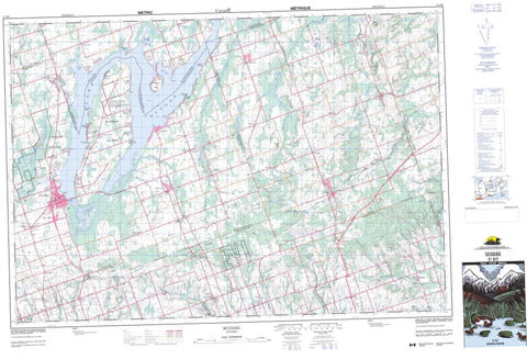
031D02 Scugog Canada topo map, 1:50,000 scale
031D02 Scugog NRCAN topographic map.
Includes UTM and GPS geographic coordinates (latitude and longitude). This 50k scale map is suitable for hiking, camping, and exploring, or you could frame it as a wall map.
Printed on-demand using high resolution, on heavy weight and acid free paper, or as an upgrade on a variety of synthetic materials.
Topos available on paper, Waterproof, Poly, or Tyvek. Usually shipping rolled, unless combined with other folded maps in one order.
- Product Number: NRCAN-031D02
- Parent Topo: TOPO-031D
- Map ID also known as: 031D02, 31D2, 31D02
- Unfolded Size: Approximately 26" high by 36" wide
- Weight (paper map): ca. 55 grams
- Map Type: POD NRCAN Topographic Map
- Map Scale: 1:50,000
- Geographical region: Ontario, Canada
Neighboring Maps:
All neighboring Canadian topo maps are available for sale online at 1:50,000 scale.
Purchase the smaller scale map covering this area: Topo-031D
Spatial coverage:
Topo map sheet 031D02 Scugog covers the following places:
- King's Bay - Starr Bay - Ball Point - Pine Point - Scugog Point - Stephenson Point - Williams Point - Kawartha Lakes - Oshawa - Brock - Cartwright - Cavan - Clarke - Darlington - Durham - East Whitby - Hope - Manvers - Mariposa - Northumberland - Ops - Peterborough - Reach - Scugog - Scugog - Victoria - Whitby - Mississauga's of Scugog Island - Mississauga's of Scugog Island Indian Reserve 34 - Réserve indienne Mississauga's of Scugog Island 34 - Réserve indienne Scugog 34 - Scugog Indian Reserve 34 - Birch Island - Platten Island - Scugog Island - Seven Mile Island - Washburn Island - Brown Lake - Fallis Pond - Lake Scugog - McKinnon Pond - Anthony Hill - Bunker Hill - Durham - Northumberland - Ontario - Peterborough - United Counties of Northumberland and Durham - Victoria - Bexley - Bobcaygeon/Verulam - Brock - Carden - Carden/Dalton - Cartwright - Cavan - Cavan-Millbrook-North Monaghan - Clarke - Dalton - Darlington - East Whitby - Eldon - Emily - Fenelon - Hope - Laxton, Digby and Longford - Manvers - Mariposa - North Monaghan - Ops - Reach - Scugog - Somerville - Verulam - Enniskillen Conservation Area - Baxter Creek - Blackstock Creek - Bowmanville Creek - Cavan Creek - East Cross Creek - East Oshawa Creek - Fleetwood Creek - Ganaraska River - Jackson Creek - Janetville Creek - Layton River - Mackie Creek - Mulligan Creek - Nonquon River - Orono Creek - Oshawa Creek - Pigeon River - Soper Creek - Stalker Creek - Wilmot Creek - Clarington - Newcastle - Port Hope - Port Hope and Hope - Whitby - Aldred's Beach - Ashburn - Ballyduff - Bethany - Blackstock - Brady - Brunswick - Burketon Station - Burton - Cadmus - Caesarea - Carnegie Beach - Cedar Shores - Dranoel - Enfield - Enniskillen - Fingerboard - Fleetwood - Fralick's Beach - Franklin - Gerrow's Beach - Gillson's Point - Glamorgan - Haydon - High Point - Highland Beach - Honey's Beach - Janetville - Kendal - Kirby - Lakeside Beach - Layton - Leskard - Lifford - Lotus - Manchester - Manvers - McLaren's Beach - Mount Carmel - Myrtle - Myrtle Station - Nestleton - Nestleton Station - New Park - Newman's Beach - Oakdene Point - Pine Point - Pontypool - Port Hoover - Port Hoover - Port Perry - Port View Beach - Prince Albert - Prospect - Purple Hill - Raglan - Scugog - Scugog Centre - Scugog Point - Seagrave - Shirley - Sonya - St. Christopher - Starr's Beach - Sunrise Beach - Sunset View - Tapley - Tyrone - Valentia - Viewlake - Williams Point - Yelverton - Cavan Bog


