
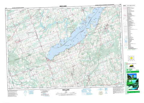
031D01 Rice Lake Canada topo map, 1:50,000 scale
031D01 Rice Lake NRCAN topographic map.
Includes UTM and GPS geographic coordinates (latitude and longitude). This 50k scale map is suitable for hiking, camping, and exploring, or you could frame it as a wall map.
Printed on-demand using high resolution, on heavy weight and acid free paper, or as an upgrade on a variety of synthetic materials.
Topos available on paper, Waterproof, Poly, or Tyvek. Usually shipping rolled, unless combined with other folded maps in one order.
- Product Number: NRCAN-031D01
- Parent Topo: TOPO-031D
- Map ID also known as: 031D01, 31D1, 31D01
- Unfolded Size: Approximately 26" high by 36" wide
- Weight (paper map): ca. 55 grams
- Map Type: POD NRCAN Topographic Map
- Map Scale: 1:50,000
- Geographical region: Ontario, Canada
Neighboring Maps:
All neighboring Canadian topo maps are available for sale online at 1:50,000 scale.
Purchase the smaller scale map covering this area: Topo-031D
Spatial coverage:
Topo map sheet 031D01 Rice Lake covers the following places:
- Burrison's Bay - McGregor Bay - Curtis Point - Foley Point - Hatrick Point - Herkimer Point - Idylwilde Point - Jubilee Point - Ley Point - Picnic Point - Pine Tree Point - Plum Point - Prickly Point - Rainy Point - Roach Point - Sager Point - Sand Point - Shearer Point - Wallace Point - Alnwick - Cavan - Clarke - Haldimand - Hamilton - Hope - Monaghan - North Monaghan - Northumberland - Otonabee - Percy - Peterborough - South Monaghan - Alderville First Nation - Alderville Indian Reserve 37 - Hiawatha First Nation 36 - Hiawatha First Nation Indian Reserve 36 - Hiawatha Indian Reserve 36 - Réserve indienne Alderville 37 - Réserve indienne Hiawatha 36 - Réserve indienne Hiawatha First Nation 36 - Réserve indienne Sugar Island 37A - Sugar Island Indian Reserve 37A - SugarIsland 37A - Black Island - Close Point - Cow Island - East Grape Island - Grasshopper Island - Harmony Island - Harris Island - Hickory Island - Long Island - Lower Foley Island - Margaret Island - Mink Islands - Muskrat Island - Paudaush Island - Prison Island - Rack Island - Sheep Island - Spook Island - Sugar Island - Tic Island - Tick Island - Upper Foley Island - West Grape Island - West Sugar Island - White Island - Rice Lake - Beech Hill - Bell's Hill - Caldwell's Hill - Cruse's Hill - Dean Hill - Dean's Hill - Jamieson's Hill - McBurney's Hill - Oak Hill - Parson's Hill - Poplar Hill - Pork Hill - Robb's Hill - Durham - Northumberland - Ontario - Peterborough - United Counties of Northumberland and Durham - United Counties of Northumberland and Durham - Alnwick - Alnwick/Haldimand - Cavan - Cavan-Millbrook-North Monaghan - Cavan-Monaghan - Clarke - Darlington - Haldimand - Hamilton - Hope - North Monaghan - Otonabee - Otonabee-South Monaghan - Percy - Seymour - South Monaghan - Lieu historique national du Canada de la Voie-Navigable-Trent--Severn - Peter's Woods Provincial Nature Reserve - Serpent Mounds Provincial Park - Trent--Severn Waterway National Historic Site of Canada - Baltimore Creek - Baxter Creek - Burnley Creek - Cavan Creek - Cobourg Brook - Gage Creek - Ganaraska River - Goose Creek - Indian River - Kent Creek - Lepers Creek - North Ganaraska River - Otonabee River - Percy Creek - Shelter Valley Brook - Shelter Valley Creek - Squirrel Creek - Steamboat Creek - Stoney Creek - Wood Duck Creek - Hiawatha Shoal - Sunken Island - Campbellford/Seymour - Campbellford/Seymour, Percy, Hastings - Clarington - Newcastle - Port Hope - Port Hope and Hope - Trent Hills - Alderville - Bailieboro - Baltimore - Bensfort - Bensfort Bridge - Bensfort Corners - Bewdley - Bomanton - Burnley - Camborne - Campbellcroft - Campbelltown - Carmel - Cavan - Cavan Station - Cedar Valley - Centreton - Cold Springs - Creighton Heights - Crystal Springs - Davidson's Corners - Decker Hollow - Dunnette Landing - Eddystone - Elizabethville - Fairmount - Fenella - Fraserville - Garden Hill - Gores Landing - Hall Landing - Halstead Beach - Harwood - Hiawatha - Ida - Keene - Kendry - Little Germany - Lorenz - Mathers Corners - McCracken Landing - Millbrook - Millvalley - Osaca - Pengelly Landing - Perrytown - Plainville - Precious Corners - Quay - Robin Landing - Roseneath - Rossmount - South Monaghan - Springville - Stewart Hall - Taits Beach - The Gully - Thomstown - Wallace Point - Zion - Cavan Bog


