
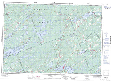
031C15 Sharbot Lake Canada topo map, 1:50,000 scale
031C15 Sharbot Lake NRCAN topographic map.
Includes UTM and GPS geographic coordinates (latitude and longitude). This 50k scale map is suitable for hiking, camping, and exploring, or you could frame it as a wall map.
Printed on-demand using high resolution, on heavy weight and acid free paper, or as an upgrade on a variety of synthetic materials.
Topos available on paper, Waterproof, Poly, or Tyvek. Usually shipping rolled, unless combined with other folded maps in one order.
- Product Number: NRCAN-031C15
- Parent Topo: TOPO-031C
- Map ID also known as: 031C15, 31C15
- Unfolded Size: Approximately 26" high by 36" wide
- Weight (paper map): ca. 55 grams
- Map Type: POD NRCAN Topographic Map
- Map Scale: 1:50,000
- Geographical region: Ontario, Canada
Neighboring Maps:
All neighboring Canadian topo maps are available for sale online at 1:50,000 scale.
Purchase the smaller scale map covering this area: Topo-031C
Spatial coverage:
Topo map sheet 031C15 Sharbot Lake covers the following places:
- Big Black Bay - Cranberry Bay - Doran Bay - East Bay - Hawley Bay - Kirk Cove - Little Black Bay - McCrimmon Bay - McIlquham Bay - McLeans Bay - Smiths Bay - Thompsons Bay - Warners Bay - Antoine Point - Buck Point - Burneys Point - Coutlee Point - Echo Point - Hepner Point - Narrows Point - Squaw Point - Stormy Point - The Promontory - The Narrows - Kings Chute - Kings Falls - Ragged Chute - Barrie - Bathurst - Clarendon - Dalhousie - Frontenac - Kennebec - Lanark - Miller - North Sherbrooke - Olden - Oso - Palmerston - South Sherbrooke - Big Boundary Island - Big Island - Big Island - Blueberry Island - Boundary Island - Bradleys Island - Burnt Island - Campbells Island - Cheese Island - Colonel Island - Cooley Island - Craig Island - Cranberry Island - Crusoe Island - Doyles Island - Frenches Island - Frenchs Island - Graceys Island - Green Island - Green Islands - Hausermans Island - Hencoop Island - Honeymoon Island - Housermans Island - Lanes Island - Long Island - Long Island - Lynns Island - Maxwell Island - O'Connell Island - Pinecrest Island - Riders Island - Round Island - Shibley Island - Sister Island - Skull Island - Three Sisters Islands - Upper Sister Island - Abs Lake - Antoine Lake - Ardoch Lake - Armstrongs Lake - Attewell Lake - Barbers Lake - Barrs Lake - Beaver Lake - Big Gull Lake - Black Lake - Bobs Lake - Bolton Lakes - Calvin Lake - Cards Lake - Chain Lakes - Chambers Lake - Charles Lake - Clarendon Lake - Clear Lake - Conboy Lake - Conboys Lake - Cox's Lake - Coxvale Lake - Crains Lake - Cranberry Creek Lake - Cranberry Lake - Crooked Creek Lake - Crooked Lake - Crooks Creek Lake - Cross Lake - Crotch Lake - Cucumber Lake - Dalhousie Lake - Davern Lake - Deep Lake - Deer Lake - Deer Lake - Deer Lake - Dennies Lake - Dodds Lake - Elbow Lake - Elphin Lake - Fagan Lake - Farrell Lake - Farren Lake - Fawn Lake - Ferguson Lake - Fergusons Mud Lake - Frog Lake - Gibsons Lake - Hicks Lake - Hungry Lake - Ink Lake - Izatt Lake - James Lake - Johnson Lake - Kashwakamak Lake - Kennebec Lake - Kings Lake - Kirkham Lake - Kring Lake - Lake of the Hills - Larby Lake - Little Cards Lake - Little Green Lake - Little Mink Lake - Little Mud Lake - Little Rock Lake - Little Round Lake - Little Silver Lake - Little Twin Lakes - Long Narrow Lake - Loon Lake - Lukeward Lake - Lyons Lake - Maberly Lake - Malcolm Lake - Mannerheim Lake - McDougalls Mud Lake - McGees Pond - McGowan Lake - McLaughlin Lake - McLeans Lake - Miller Lake - Millers Lake - Mink Lake - Mosquito Lake - Mud Lake - Otter Lake - Palmerston Lake - Patterson Lake - Payes Lake - Pennick Lake - Penny Lake - Pine Lake - Portage Lake - Purdons Lake - Purdons Mud Lake - Quebec Lake - Rainbow Lake - Rock Lake - Rock Lake - Rock Lake - Rockcliffe Lake - Round Lake - Schonauer Lake - Sharbot Lake - Shaw Lake - Silver Lake - Silver Lake - Silvery Lake - Smith Lake - Sparrow Lake - Spruce Lake - Spruce Lake - Struthers Lake - Stump Lake - Sucker Lake - Swaugers Lake - Trombleys Lake - Twin Island Lake - Twin Lake - Twin Lakes - Vanalstine Lake - Warrens Lake - Watsons Lake - White Lake - Youngs Lake - Adams Hill - Boundary Hill - Elbow Hill - Gemmills Hill - Gordons Hill - Hydro Hill - Madawaska Highlands - Roger Hill - Smiths Hill - Stewarts Hill - Wilson Hill - Frontenac - Lanark - Barrie - Bathurst - Bathurst Burgess Sherbrooke - Central Frontenac - Clarendon and Miller - Dalhousie and North Sherbrooke - Darling - Hinchinbrooke - Kennebec - Lanark - Lanark Highlands - Lavant - Lavant, Dalhousie and North Sherbrooke - North Burgess - North Frontenac - North West Lanark - Olden - Oso - Palmerston and North and South Canonto - South Sherbrooke - Tay Valley - Crotch Lake Conservation Reserve - Hungry Lake Conservation Reserve - Sharbot Lake Provincial Park - Silver Lake Provincial Park - Birch Rapids - Otter Rapids - Sidedam Rapids - Whitefish Rapids - Antoine Creek - Black Creek - Bolton Creek - Boundary Creek - Buckshot Brook - Buckshot Creek - Conns Creek - Cranberry Creek - Cranberry Creek - Crooked Creek - Davern Creek - Dead Creek - Fairs Creek - Fall River - Gordons Creek - Gull Creek - Little Antoine Creek - Long Sault Creek - McLarens Creek - McLarens Depot Snye - Mississippi River - Mosquito Creek - Pauls Creek - Purdons Creek - Sharbot Creek - Silver Lake Creek - Swamp Creek - Tay River - Ward's Creek - Wesleys Creek - Gull Rock - Three Sisters Rocks - Ardoch - Bolingbroke - Bolingbroke Siding - Bolingbroke Station - Burke Settlement - Cedarholm - Clarendon Station - Coxvale - Dalhousie Lake - Donaldson - Elphin - Feldspar - Fernleigh - Henderson - High Falls - Kirk Cove - Maberly - Maberly Station - McDonald Corners - McDonalds Corners - McDonald's Corners - McLaren Depot - Mississippi Station - Oso - Oso Station - Plevna - Pratt Corners - Robertsville - Seouls Corners - Sharbot Lake - Snow Road Station - Ungava - Zealand


