
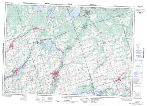
031C05 Campbellford Canada topo map, 1:50,000 scale
031C05 Campbellford NRCAN topographic map.
Includes UTM and GPS geographic coordinates (latitude and longitude). This 50k scale map is suitable for hiking, camping, and exploring, or you could frame it as a wall map.
Printed on-demand using high resolution, on heavy weight and acid free paper, or as an upgrade on a variety of synthetic materials.
Topos available on paper, Waterproof, Poly, or Tyvek. Usually shipping rolled, unless combined with other folded maps in one order.
- Product Number: NRCAN-031C05
- Parent Topo: TOPO-031C
- Map ID also known as: 031C05, 31C5, 31C05
- Unfolded Size: Approximately 26" high by 36" wide
- Weight (paper map): ca. 55 grams
- Map Type: POD NRCAN Topographic Map
- Map Scale: 1:50,000
- Geographical region: Ontario, Canada
Neighboring Maps:
All neighboring Canadian topo maps are available for sale online at 1:50,000 scale.
Purchase the smaller scale map covering this area: Topo-031C
Spatial coverage:
Topo map sheet 031C05 Campbellford covers the following places:
- Bend Bay - Breckenridge Bay - Burnt Point Bay - Clark Bay - Contact Bay - Crowe Bay - Cumming Bay - Dorrie Bay - King Bay - Richardson Cove - Sawmill Bay - Wilson Bay - Birch Point - Burnt Point - Coles Point - Dope Point - Dorrie Point - Dunn Point - Gibson Point - Green Point - Halfbreed Point - Halfway Point - Lee Point - Long Point - Marsh Point - Oak Point - Skunk Point - Stony Point - Back Channel - Birch Narrows - Blind Channel - Blue Hole - Danger Narrows - Northumberland Narrows - Quinte West - Healey Falls - Ranney Fall - Ranney Falls - Asphodel - Belmont - Dummer - Hastings - Huntingdon - Madoc - Marmora - Murray - Northumberland - Percy - Peterborough - Rawdon - Seymour - Sidney - Armour Island - Bass Rock Island - Big Island - Birch Island - Cedar Island - Clarks Island - Coughlins Island - Couglins Island - Dark Island - Graham Island - Hardy Island - Haunted Island - Hickory Island - Huycke Island - Lunch Island - Marys Island - McCann Island - Meyers Island - Mink Island - Nappan Island - Oak Island - Peloe Island - Picnic Island - Preston Island - Raft Island - Schooner Island - Scriver Island - Ship Island - Sidonia Island - Slaughter Island - Steam Mill Island - Stony Island - Wilson Island - Banker Lake - Barry Lake - Belmont Lake - Beloporine Lake - Crowe Lake - Hermiston Lake - Killoran Lake - Lamey Lake - Lost Lake - Mud Lake - Mud Lake - Oak Lake - O'Melia Lake - Round Lake - Rylstone Lake - Seymour Lake - Stevenson Lake - Candy Mountain - Ferris Hill - Holbrook Mountain - Oak Hills - Pyears Hill - Sullivans Hill - Vardy Ridge - Hastings - Northumberland - Peterborough - Asphodel - Asphodel-Norwood - Belmont and Methuen - Centre Hastings - Douro - Douro-Dummer - Dummer - Havelock-Belmont-Methuen - Huntingdon - Madoc - Marmora - Marmora and Lake - Murray - Percy - Rawdon - Seymour - Sidney - Stirling-Rawdon - Ferris Provincial Park - Lieu historique national du Canada de la Voie-Navigable-Trent--Severn - Sager Conservation Area - Trent--Severn Waterway National Historic Site of Canada - Beaver Creek - Beloporine Creek - Chrysal Creek - Crowe River - Hoards Creek - Marsh Creek - Moira River - Ouse River - Percy Creek - Plato Creek - Puffball Creek - Rawdon Creek - Squire Creek - Trent River - Trout Creek - Hagues Reach - Haig's Reach - Percy Reach - Woodland Bend - Flat Rock - Stony Rock - Campbellford/Seymour - Campbellford/Seymour, Percy, Hastings - Trent Hills - Allan Mills - Anson - Ashby Mill - Belmar - Blairton - Blairton Station - Bonarlaw - Brickley - Brinkworth - Burnbrae - Campbellford - Chase Corners - Connellys - Crow Bridge - Crowe Bridge - English Line - Freeman Corners - German Landing - Glen Ross - Glenross - Godolphin - Green Acres - Harold - Hastings - Havelock - Healey Falls - Hoards - Kellers - Kellers - Marmora - Marmora Station - McConnel Landing - Menie - Minto - Mount Pleasant - Norwood - Oak Lake - Peterson - Peterson Siding - Pethericks Corners - Petherwick Corners - Polmont - Preneveau - River Valley - Round Lake - Rush Point - Rylstone - Sarginson - Sine - Spring Brook - Springbrook - Stanwood - Stirling - Sunnybrae - Tiffin - Trent River - Wellman - West Corners - Westview - Woodland - Murray Marsh


