
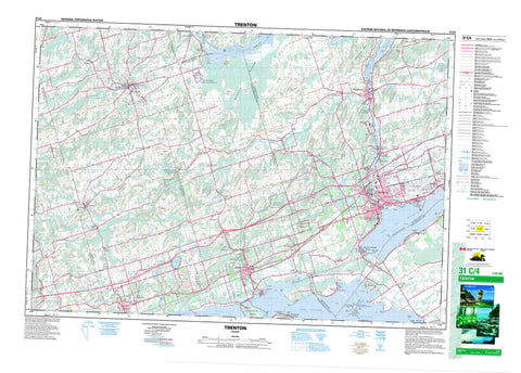
031C04 Trenton Canada topo map, 1:50,000 scale
031C04 Trenton NRCAN topographic map.
Includes UTM and GPS geographic coordinates (latitude and longitude). This 50k scale map is suitable for hiking, camping, and exploring, or you could frame it as a wall map.
Printed on-demand using high resolution, on heavy weight and acid free paper, or as an upgrade on a variety of synthetic materials.
Topos available on paper, Waterproof, Poly, or Tyvek. Usually shipping rolled, unless combined with other folded maps in one order.
- Product Number: NRCAN-031C04
- Parent Topo: TOPO-031C
- Map ID also known as: 031C04, 31C4, 31C04
- Unfolded Size: Approximately 26" high by 36" wide
- Weight (paper map): ca. 55 grams
- Map Type: POD NRCAN Topographic Map
- Map Scale: 1:50,000
- Geographical region: Ontario, Canada
Neighboring Maps:
All neighboring Canadian topo maps are available for sale online at 1:50,000 scale.
Purchase the smaller scale map covering this area: Topo-031C
Spatial coverage:
Topo map sheet 031C04 Trenton covers the following places:
- Bay of Quinte - Boat Harbour - Bradley Bay - Calf Pasture Cove - Popham Bay - Presqu'ile Bay - Stoneburg Cove - Wellers Bay - Young Cove - Bald Head Beach - Barcovan Beach - Bald Head - Becroft Point - Calf Pasture Point - Carley Point - Indian Point - Meyers Point - Onderdonk Point - Pine Point - Presqu'ile Peninsula - Salt Point - Sherwood Point - Shoal Point - Smoke Point - Spencer Point - Stony Point - Sugar Point - The Carrying Place - Twelve O'Clock Point - Way Point - Woods Point - Young Point - Blind Channel - Blue Hole - Prince Edward - Quinte West - Alnwick - Ameliasburgh - Brighton - Brighton - Cramahe - Haldimand - Hastings - Murray - Northumberland - Percy - Prince Edward - Seymour - Sidney - Ames Island - Austen Island - Baker Island - Bald Head Island - Bald Island - Bigelow Island - Cole Island - Cranberry Island - Fox Island - Heagles Island - Hickory Island - Indian Island - Jett Island - Meyers Island - Potts Island - Sill Island - Silver Island - Stony Island - Wilson Island - Biddy Lake - Consecon Lake - Dartford Pond - Hermiston Lake - Lac Ontario - Lake Ontario - Little Lake - Matson Lake - McCleary Lake - Norham Pond - O'Reilly Lake - Tremur Lake - Murray Canal - Base des Forces canadiennes Trenton - Canadian Forces Base Trenton - Cramahe Hill - Drewry Hill - Mays Hill - Murray Hills - Salem Hill - Sullivans Hill - Tank Hill - The Mountain - Hastings - Northumberland - United Counties of Northumberland and Durham - Alnwick - Alnwick/Haldimand - Ameliasburgh - Athol - Brighton - Cramahe - Haldimand - Hallowell - Hillier - Marysburgh - Murray - North Marysburgh - Percy - Seymour - Sidney - Sophiasburgh - South Marysburgh - Carrying Place of the Bay of Quinte National Historic Site of Canada - Goodrich-Loomis Conservation Area - Lieu historique national du Canada de la Voie-Navigable-Trent--Severn - Lieu historique national du Canada du Portage-de-la-Baie-de-Quinte - Presqu'ile Provincial Park - Proctor Park Conservation Area - Réserve nationale de faune de la Baie-Wellers - Sager Conservation Area - Trent--Severn Waterway National Historic Site of Canada - Warkworth Conservation Area - Wellers Bay National Wildlife Area - Biddy Creek - Breakaway Creek - Burnley Creek - Colborne Creek - Cold Creek - Dead Creek - Little Cold Creek - Marsh Creek - Mayhew Creek - Meyers Creek - Palliser Creek - Percy Creek - Piper Creek - Proctors Creek - Salem Creek - Salt Creek - Shelter Valley Brook - Shelter Valley Creek - Smithfield Creek - Trent River - Hagues Reach - Haig's Reach - Percy Reach - Calf Pasture Crib - Indian Island Bank - Presqu'ile Middle Ground - Reach Rock - Salt Reef - Brighton - Campbellford/Seymour - Campbellford/Seymour, Percy, Hastings - Trent Hills - Albury - Bamford - Barcovan Beach - Batawa - Bayside - Brighton - Brown Corners - Canal - Cankerville - Carman - Carmel - Carrying Place - Castleton - Cedar Creek - Codrington - Colborne - Consecon - Dartford - Dundonald - East Colborne - Edville - Frankford - Gardenville - Glen Miller - Gosport - Greenleys Corners - Griffis Corners - Griffith Corners - Hilton - Johnstown - Lovett - Maple View - Meyersburg - Morganston - Mount Zion - Mutton - Norham - Oak Heights - Orland - Percy Boom - Presqu'ile Point - Purdy Corners - Salem - Salem Corners - Shiloh - Smithfield - Spring Valley - Stockdale - Trenton - Trenton Junction - Tubbs Corners - Twelve O'Clock Point - Vernonville - Wade Corners - Wark - Warkworth - Wooler - Murray Marsh


