
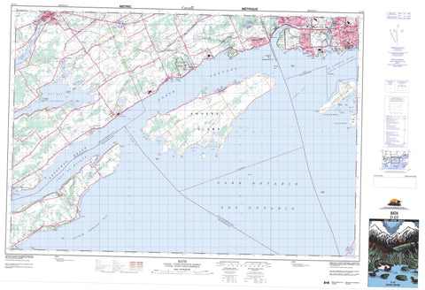
031C02 Bath Canada topo map, 1:50,000 scale
031C02 Bath NRCAN topographic map.
Includes UTM and GPS geographic coordinates (latitude and longitude). This 50k scale map is suitable for hiking, camping, and exploring, or you could frame it as a wall map.
Printed on-demand using high resolution, on heavy weight and acid free paper, or as an upgrade on a variety of synthetic materials.
Topos available on paper, Waterproof, Poly, or Tyvek. Usually shipping rolled, unless combined with other folded maps in one order.
- Product Number: NRCAN-031C02
- Parent Topo: TOPO-031C
- Map ID also known as: 031C02, 31C2, 31C02
- Unfolded Size: Approximately 26" high by 36" wide
- Weight (paper map): ca. 55 grams
- Map Type: POD NRCAN Topographic Map
- Map Scale: 1:50,000
- Geographical region: Ontario, Canada
Neighboring Maps:
All neighboring Canadian topo maps are available for sale online at 1:50,000 scale.
Purchase the smaller scale map covering this area: Topo-031C
Spatial coverage:
Topo map sheet 031C02 Bath covers the following places:
- Amherst Bay - Bay of Quinte - Cataraqui Bay - Collins Bay - Hay Bay - Horsey Bay - Kerr Bay - Kingston Harbour - Long Point Bay - Loyalist Cove - Mary Cove - Marys Cove - Parrott Bay - Parrotts Bay - Portsmouth Bay - Portsmouth Harbour - Preston Cove - Prince Edward Bay - Prinyer Cove - Salmon Bay - Sand Bay - Sand Bay - Sand Bay - Stella Bay - Wemps Bay - Wright Bay - Allens Point - Barry Point - Bath Point - Bell Point - Bells Point - Bluff Point - Cape Vesey - Carruthers Point - Cole Point - Cressy Point - Drain's Point - Emeric Point - Everett Point - Four Mile Point - Fourmile Point - Griffin Point - Gull Point - Indian Point - Indian Point - Kerr Point - Lemoine Point - Nicholsons Point - Nine Mile Point - Parrott Point - Pig Point - Pleasant Point - Pleasant Point - Point Pleasant - Prinyer Point - Samson Point - Staley Point - Stella Point - The Head - The Rock - Wemps Point - Boat Channel - Lower Gap - North Channel - Upper Gap - Kingston - Prince Edward - Adolphustown - Amherst Island - Ernestown - Fredericksburgh - Frontenac - Kingston - Lennox and Addington - Marysburgh - North Fredericksburgh - North Marysburgh - Prince Edward - Richmond - South Fredericksburgh - South Marysburgh - Wolfe Island - Amherst Island - Bass Island - Brother Islands - Centre Brother - Centre Brother Island - Charter Island - Clark Island - Grape Island - Green Island - Green Islet - Hare Island - Horseshoe Island - Huffmans Island - LaForce Island - Lyons Island - Nut Island - Nut Island - Pigeon Island - Salmon Island - Simcoe Island - Snake Island - Thousand Islands - Waupoos Island - Waupoos Island - White Island - Wolfe Island - Lac Ontario - Lake Ontario - Lost Lake - Lost Lake - Mill Pond - Roblin Hill - Frontenac - Lennox and Addington - Adolphustown - Ameliasburgh - Amherst Island - Athol - Ernestown - Fredericksburgh - Frontenac Islands - Hallowell - Hillier - Howe Island - Kingston - Loyalist - Marysburgh - North Fredericksburgh - North Marysburgh - Pittsburgh - Richmond - Sophiasburgh - South Fredericksburgh - South Marysburgh - Wolfe Island - Bellevue House National Historic Site of Canada - Lemoine Point Conservation Area - Lieu historique national du Canada de la Villa-Bellevue - Little Cataraqui Creek Valley Lands (Conservation Area) - Napanee Conservation Area - North Fredericksburgh Conservation Area - Ontario - Big Creek - Cameron Creek - Collins Creek - Cressy Creek - Fleuve Saint-Laurent - Little Cataraqui Creek - Little Creek - Loyst Creek - Millhaven Creek - Napanee River - Platts Creek - Selby Creek - Spring Creek - St. Lawrence River - Sucker Creek - Townline Creek - Wilton Creek - Adolphus Reach - Amherst Bar - Berdans Shoal - Big Bar Shoal - Charity Shoal - Keith Shoal - Kerr Point Shoal - Melville Shoal - Middle Ground - Penitentiary Shoal - Snake Island Bank - South Charity Shoal - Greater Napanee - Amherstview - Anderson - Asselstine - Auden Park - Balmoral Park - Balsam Grove - Bath - Bath Road - Bay Centre - Bayridge - Bayview - Bongard - Bongard Corners - Calvin Park - Chambers - Collins Bay - Conway - Cressy - Elmwood - Emerald - Ernestown - Fredericksburg - Galts Corner - Grenville Park - Gretna - Hawley - Hay Bay - Hayburn - Henderson Place - High Gate Park - Hillendale - Hillview - Kingscourt - Kingston - Lakeland Acres - Lakeland Point - LaSalle Park - Lawrence Park - Links Mills - Little Creek - McIntyre - Millers Corner - Millhaven - Morven - Napanee - Nicholsons Point - Parma - Point Pleasant - Polson Park - Portsmouth - Queens Acres - Reddendale - Sandhurst - Sandhurst Shores - Sillsville - Simcoe Island - South Napanee - Stella - Storms Corners - Valleyview - Waupoos - Waupoos East - Weller - Woodlands - Cressy Marsh


