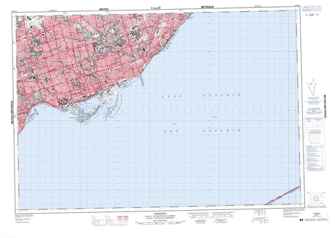
030M11 Toronto Canada topo map, 1:50,000 scale
030M11 Toronto NRCAN topographic map.
Includes UTM and GPS geographic coordinates (latitude and longitude). This 50k scale map is suitable for hiking, camping, and exploring, or you could frame it as a wall map.
Printed on-demand using high resolution, on heavy weight and acid free paper, or as an upgrade on a variety of synthetic materials.
Topos available on paper, Waterproof, Poly, or Tyvek. Usually shipping rolled, unless combined with other folded maps in one order.
- Product Number: NRCAN-030M11
- Parent Topo: TOPO-030M
- Map ID also known as: 030M11, 30M11
- Unfolded Size: Approximately 26" high by 36" wide
- Weight (paper map): ca. 55 grams
- Map Type: POD NRCAN Topographic Map
- Map Scale: 1:50,000
- Geographical region: Ontario, Canada
Neighboring Maps:
All neighboring Canadian topo maps are available for sale online at 1:50,000 scale.
Purchase the smaller scale map covering this area: Topo-030M
Spatial coverage:
Topo map sheet 030M11 Toronto covers the following places:
- Ashbridges Bay - Blockhouse Bay - Brigantine Cove - Humber Bay - Inner Harbour - Outer Harbour - Snug Harbour - Turning Basin - Balmy Beach - Cherry Beach - Cherry Street Beach - Eastern Beaches - Kew Beach - Mimico Beach - Sunnyside Beach - Woodbine Beach - Gibraltar Point - Hanlan Point - Hanlans Point - Hanlan's Point - Outer Harbour East Headland - Coatsworth Cut - Deep Pike Cut - Eastern Gap - Keating Channel - Main Harbour Channel - Outer Harbour Channel - Ship Channel - St. Andrews Cut - Sunfish Cut - Western Gap - Toronto - Toronto Junction - East York - Etobicoke - North York - Scarborough - York - Algonquin Island - Centre Island - East Island - Forestry Island - Îles de Toronto - Junior Yacht Club Island - Muggs Island - Mugg's Island - Olympic Island - Ontario Place - R.C.Y.C. Island - Royal Canadian Yacht Club Islands - Snake Island - South Island - Sunfish Island - Toronto Island - Toronto Islands - Wards Island - Ward's Island - West Island - Bond Lake - Grenadier Pond - Lac Ontario - Lake Ontario - Lighthouse Pond - Long Pond - West Pond - Toronto Harbour - Scarborough Bluffs - Metropolitan Toronto - Ontario - Pickering - Bellamy Ravine Creek - Black Creek - Cawthra Creek - Don River - Don River - Don River - Don River East Branch - Don River West Branch - Highland Creek - Humber River - Little Don River - Lornewood Creek - Maple Leaf Creek - Mimico Creek - Rivière Don - Rivière Humber - Southwest Highland Creek - Taylor Creek - Tyler Creek - Wilket Creek - West Toronto Junction - Alderwood - Armour Heights - Baby Point - Beaches - Bedford Park - Bennington Heights - Birch Cliff - Birchmount Park - Brimley - Browns Line - Cabbagetown - Cedarvale - Clairlea - Cliffcrest - Cliffside - Crescent Town - Danforth Station - Davisville - Deer Park - Del Ray - Don Mills - Don Vale - Downsview - East Toronto - East York - Etobicoke - Etobicoke - Fairbank - Flemingdon Park - Forest Hill - Glen Leven - Guildwood - Guildwood Village - Hanlans Point - High Park - Humber Bay - Humberside - Iondale Heights - Ionview - Keelesdale - Kennedy Park - Lawrence Heights - Lawrence Manor - Lawrence Park - Leaside - Meadow Wood - Mimico - Mimico Beach - Moore Park - Mount Dennis - Mulholland - North Park - North Toronto - North York - Oakridge - Oakwood - Old Mill - Orchard Heights - Parkdale - Parkview Hill - Ranee - Rattray Park Estates - Regent Park - Regents Park - Riverdale - Rosedale - Runnymede - Scarboro - Scarborough - Scarborough - Scarborough Bluffs - Scarborough Junction - Scarborough Station - Scarborough Village - Silverthorne - Silverthorne West - St. James Town - Sunnyside - Swansea - The Annex - The Beaches - The Golden Mile - The Junction - Thorncliffe - Todmorden - Toronto - Victoria Village - Wexford - Wexford Heights - Wilmar Heights - Wilson Heights - Winston Park - Woodbine Gardens - Woodbine Heights - Wychwood Park - York - York Mills - Yorkville - Hogg's Hollow - Eglinton Flats - West Toronto


