
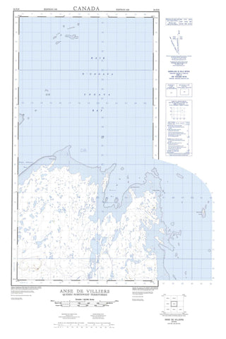
024N06 Anse De Villiers Canada topo map, 1:50,000 scale
024N06 Anse De Villiers NRCAN topographic map.
Includes UTM and GPS geographic coordinates (latitude and longitude). This 50k scale map is suitable for hiking, camping, and exploring, or you could frame it as a wall map.
Printed on-demand using high resolution, on heavy weight and acid free paper, or as an upgrade on a variety of synthetic materials.
Topos available on paper, Waterproof, Poly, or Tyvek. Usually shipping rolled, unless combined with other folded maps in one order.
- Product Number: NRCAN-024N06
- Parent Topo: TOPO-024N
- Map ID also known as: 024N06, 24N6, 24N06
- Unfolded Size: Approximately 26" high by 36" wide
- Weight (paper map): ca. 55 grams
- Map Type: POD NRCAN Topographic Map
- Map Scale: 1:50,000
- Geographical region: Nunavut, Canada
Neighboring Maps:
All neighboring Canadian topo maps are available for sale online at 1:50,000 scale.
Purchase the smaller scale map covering this area: Topo-024N
Spatial coverage:
Topo map sheet 024N06 Anse De Villiers covers the following places:
- Anse De Villiers - Anse De Villiers - Baie d'Ungava - Baie d'Ungava - Baie Hopes Advance - Ungava Bay - Grève Saakittuq - Camp Aupaluup - Camp Aupaluup Illuvigartulinga - Camps Tupirviturliulaurtuviniit - Pointe Aupaluarusiq - Pointe De Villiers - Pointe Gable - Pointe Takiyok - Escarpement Tryon - Île Maniittuajuk - Île Naujaaralik - Île Pikiulik - Île Pikiuliq - Île Qikirtaujaq - Îles Pikiuliapiik - Low Islands - Nanertak Island - Rocher Arpalirtuvik - Young Island - Lac Pikiuliup - Butte Aupaluarusiq - Butte Saakittuup - Cap Aupaluk - Colline Aupaluk - Colline Qimatualuk - Black Rock - Nanertak Reefs - Sawtooth Reef - Takiyok Reef


