
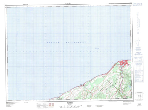
022B13 Matane Canada topo map, 1:50,000 scale
022B13 Matane NRCAN topographic map.
Includes UTM and GPS geographic coordinates (latitude and longitude). This 50k scale map is suitable for hiking, camping, and exploring, or you could frame it as a wall map.
Printed on-demand using high resolution, on heavy weight and acid free paper, or as an upgrade on a variety of synthetic materials.
Topos available on paper, Waterproof, Poly, or Tyvek. Usually shipping rolled, unless combined with other folded maps in one order.
- Product Number: NRCAN-022B13
- Parent Topo: TOPO-022B
- Map ID also known as: 022B13, 22B13
- Unfolded Size: Approximately 26" high by 36" wide
- Weight (paper map): ca. 55 grams
- Map Type: POD NRCAN Topographic Map
- Map Scale: 1:50,000
- Geographical region: Quebec, Canada
Neighboring Maps:
All neighboring Canadian topo maps are available for sale online at 1:50,000 scale.
Purchase the smaller scale map covering this area: Topo-022B
Spatial coverage:
Topo map sheet 022B13 Matane covers the following places:
- Anse à Pineault - Baie des Capitaines - Bassin des Îles - Havre de Matane - La Grande Anse - Camping de la Baleine - Camping de la Rivière-Matane - Pointe au Naufrage - Pointe Bérubé - Matane - Les Écores - Chute à Ti-Mé - Le Bon-Pasteur - Le Bon-Pasteur - Le Très-Saint-Rédempteur - Le Très-Saint-Rédempteur - MacNider - Matane - Matane - Saint-Jérôme - Saint-Rédempteur - Saint-Ulric - Tessier - Barrage Mathieu-D'Amours - Îles des Croûtes - Les Roches Noires - Roche à Camel - Étang Moose - Étang Tallard - Lac à Horace - Lac Albert - Lac Bernier - Lac Blanchette - Lac de l'Orignal - Lac Dugal - Lac Dugal - Lac Minouche - Lac Samuel - Petit lac Rond - Le Vieux Port - Marina de Matane - Port de Matane - Quai des Jobbers - Quai des Pêcheurs - Halte de la Marina - Promenade des Capitaines - Mont Castor - Montagne à Ti-Jaune - Monts Chic-Chocs - Monts Notre-Dame - Monts Shickshock - Matane - La Seigneurie-du-Chevreuil - Parc des Îles - Cours d'eau Bélanger - Cours d'eau Bélanger - Cours d'eau de la Commune - Cours d'eau Durette - Cours d'eau Fortin - Cours d'eau J.-B.-Paquet - Cours d'eau Quimper - Fleuve Saint-Laurent - Le Petit Bras - Petite rivière Blanche - Rivière Alex - Rivière Blanche - Rivière Matane - Rivière Tartigou - Ruisseau à Roch - St. Lawrence River - Fosse Léonard - La Coulée - La Petite Montagne - Le Cap Dubé - Le Pont de Matane - Le Pont Durette - Le Rapide de la Roche à Camel - Le Rapide de la Roche à Camelle - L'Étang - Côte de la Facterie - Côte de Matane - Pont Marie-Marsolet - Pont Michaud - Pont Pierre-Carrier - Le Barachois - Saint-Ulric - Barrage-de-Grand-Détour - Grand-Détour - Lac-Minouche - Le Cap-des-Pilotes - Le Pont-Durette - Le Portage - Matane - Matane-sur-Mer - Mont-Castor - Parc industriel de Matane - Place-Chaleur - Saint-Jérôme-de-Matane - Saint-Ulric - Tartigou - Coulée de Saint-Léandre - Baie-des-Sables - Petit-Matane - Rivière-Blanche - Saint-Jérôme-de-Matane - Saint-Luc-de-Matane - Saint-Ulric - Saint-Ulric-de-Matane


