
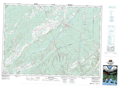
021H14 Petitcodiac Canada topo map, 1:50,000 scale
021H14 Petitcodiac NRCAN topographic map.
Includes UTM and GPS geographic coordinates (latitude and longitude). This 50k scale map is suitable for hiking, camping, and exploring, or you could frame it as a wall map.
Printed on-demand using high resolution, on heavy weight and acid free paper, or as an upgrade on a variety of synthetic materials.
Topos available on paper, Waterproof, Poly, or Tyvek. Usually shipping rolled, unless combined with other folded maps in one order.
- Product Number: NRCAN-021H14
- Parent Topo: TOPO-021H
- Map ID also known as: 021H14, 21H14
- Unfolded Size: Approximately 26" high by 36" wide
- Weight (paper map): ca. 55 grams
- Map Type: POD NRCAN Topographic Map
- Map Scale: 1:50,000
- Geographical region: New Brunswick, Canada
Neighboring Maps:
All neighboring Canadian topo maps are available for sale online at 1:50,000 scale.
Purchase the smaller scale map covering this area: Topo-021H
Spatial coverage:
Topo map sheet 021H14 Petitcodiac covers the following places:
- Gibson Falls - Gordon Falls - Hermit Falls - Albert - Brunswick - Cardwell - Coverdale - Elgin - Havelock - Kings - Queens - Salisbury - Studholm - Westmorland - Champ de manoeuvre Mill Hill - Mill Hill Training Area - Anagance Ridge - Boyd Mountain - Carty Mountain - Collier Mountain - Dunsinane Hill - Garland Mountain - Gowland Mountain - Harrison Mountain - Hubley Hill - Mount Boyd - Mount Pisgah - Mount Zackie Jonah - Paper Mill Hill - Pleasant Mountain - Powell Hill - Samp Hill - Tingley Hill - Anagance River - Babcock Brook - Bannister Brook - Barchard Brook - Barchard Brook - Bennett Brook - Blakney Brook - Bull Creek - Calamingo Brook - Chapman Brook - Colpitts Brook - Corey Brook - Cusack Brook - Dave Hollow Brook - Dee Brook - Dingley Brook - Dove Hollow Brook - Dry Brook - Duncan Brook - East Branch Calamingo Brook - East Branch Little River - Ferndale Brook - Foley Brook - Four Mile Brook - Gibson Brook - Gordon Brook - Gould Brook - Harper Brook - Harrison Brook - Hawkes Brook - Hayward Brook - Higgins Brook - Holmes Brook - Hopper Brook - Jordan Brook - Keith Brook - Kennebecasis River - Ketchums Brook - King Brook - Lee Brook - Lewis Brook - Little River - Little South Branch Kennebecasis River - MacLeod Brook - Malone Brook - Mapleton Brook - Marney Brook - McDermott Brook - McLeod Brook - Miller Brook - Millstream River - Mitton Brook - Montgomery Brook - Nigus Brook - North Branch Windgap Brook - North River - North Windgap Brook - O'Blenis Brook - Petitcodiac River - Pinnacle Brook - Pollet River - Pollett River - Popple Intervale Brook - Price Brook - Price Brook - Ridge Brook - Robinson Brook - Sally Brook - Salmon Hole Creek - Salt Springs Brook - Shaffer Brook - Sherman Brook - Smith Creek - Smiths Creek - South Branch - Spring Brook - Springhill Brook - Springhill Brook - Steeves Brook - Stiles Brook - Stone Brook - Studholm Brook - Studholm Mill Stream - Studholms Mill Stream - Teakles Brook - Thorne Brook - Thornes Brook - Trites Brook - Webster Brook - Whiteside Brook - Windgap Brook - Wright Brook - Anagance - Anagance Ridge - Blakney - Buckley Settlement - Butternut Ridge - Church Corner - Churchs Corner - Cornhill - Cornhill East - Cosman Settlement - Creek Road - Crockets Corner - Dubec - Dubee Settlement - Dunsinane - Elgin - Fawcett - Fawcett Hill - Ferndale - Five Points - Forest Hill - Glenvale - Goshen - Gowland Mountain - Grub Road - Harper Settlement - Harrison Settlement - Havelock - Hill Grove - Hillgrove - Hillside - Intervale - Jordan Mountain - Kay Settlement - Kinnear Settlement - Knightville - Lindys - Lower Ridge - Mannhurst - Mapleton - Marven - McCully - Meadow - Middlesex - Midland - Mount Hebron - Mount Pisgah - Newtown - Penobsquis - Perry Settlement - Petitcodiac East - Pleasant Mountain - Pleasant Vale - Plumweseep - Pollett River - Portage Vale - Queenville - River Glade - River View - Ryan Corner - Samp Hill - Smith Creek - Smiths Creek - Springdale - The Glades - Thornbrook - Upper Goshen - White Mountain - Whites Mountain - Arthur Jonah Hollow - Barry Hollow - Gilford Hollow - Harry Jonah Hollow - Purtill Hollow - Tommy Long Hollow - Whitenect Hollow - Will DeMille Hollow - Petitcodiac


