
021G13 Fosterville Canada topo map, 1:50,000 scale
021G13 Fosterville NRCAN topographic map.
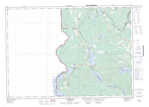
Includes UTM and GPS geographic coordinates (latitude and longitude). This 50k scale map is suitable for hiking, camping, and exploring, or you could frame it as a wall map.
Printed on-demand using high resolution, on heavy weight and acid free paper, or as an upgrade on a variety of synthetic materials.
Topos available on paper, Waterproof, Poly, or Tyvek. Usually shipping rolled, unless combined with other folded maps in one order.
- Product Number: NRCAN-021G13
- Parent Topo: TOPO-021G
- Map ID also known as: 021G13, 21G13
- Unfolded Size: Approximately 26" high by 36" wide
- Weight (paper map): ca. 55 grams
- Map Type: POD NRCAN Topographic Map
- Map Scale: 1:50,000
- Geographical region: New Brunswick, Canada
Neighboring Maps:
All neighboring Canadian topo maps are available for sale online at 1:50,000 scale.
Purchase the smaller scale map covering this area: Topo-021G
Spatial coverage:
Topo map sheet 021G13 Fosterville covers the following places:
- Balm of Gilead Cove - Cattail Cove - North Bay - Trout Cove - Balm of Gilead Point - Bear Trap Point - Blueberry Point - Green Point - North Lake Point - Spruce Point - North Lake Thoroughfare - Second Lake Thoroughfare - The Gorge - Third Lake Thoroughfare - Eel River Falls - Risteen Falls - Canterbury - Carleton - North Lake - Richmond - Woodstock - York - Stockfords Dam - Burnt Island - Carr Island - Club Island - Dibblees Island - Frog Island - HalfwayIsland - Mill Island - Northcott Island - Pine Island - Wilson Island - Belle Lake - Chiputneticook Lakes - First Eel Lake - Grand Lake - La Coote Lake - Little Mud Lake - Mud Lake - North Lake - Pocowogamis Lake - Riley Lake - Second Eel Lake - Skiff Lake - Third Eel Lake - Annies Mountain - Benton Ridge - Browns Mountain - Carroll Ridge - Golden Ridge - Green Mountain Hill - Inches Ridge - Oak Mountain - Poplar Mountain - Sam Foster Hill - Sugarloaf Mountain - Whalen Hill - North Lake Provincial Park - Aarons Brook - Alder Brook - Back Brook - Belle Brook - Big La Coote Stream - Birch Brook - Bright Eye Brook - Bull Brook - Bull Creek - Davidson Brook - Dead Brook - Dead Creek - Eel River - Fish Creek - Four Mile Brook - Gidney Brook - Hay Brook - Jiggertown Brook - Johnson Brook - Little Hay Brook - Little La Coote Stream - Little Tamarack Brook - Meadow Brook - Mill Brook - Mistake Brook - Monument Brook - Mud Brook - Peggys Brook - Penio Brook - Pine Swamp Brook - Pirate Brook - Pirate Brook - Pocomoonshine Brook - Pocowogamis Brook - Pocowogamis Stream - Pokomoonshine Brook - Risteen Brook - Rivière Saint-Jean - Saint John River - South Pirate Brook - Sucker Brook - Tamarack Brook - Trout Brook - Upper Mistake Brook - Whirly Brook - Aarons Deadwater - Pocowogamis Deadwater - Third Lake Deadwater - Mollys Rock - Benton - Blackies Landing - Dead Creek - Eel River Lake - Fosterville - Graham Corner - Green Mountain - Hartin Settlement - Kirkland - Maxwell - Monument - North Lake - North Lake - Porten Settlement - Scott Siding - Skiff Lake - Springfield


