
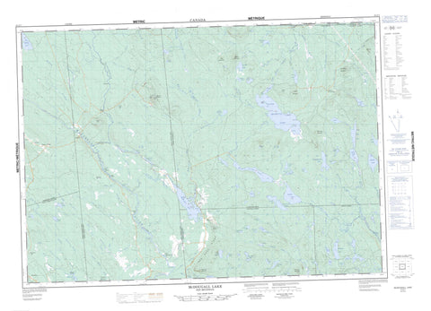
021G07 Mcdougall Lake Canada topo map, 1:50,000 scale
021G07 Mcdougall Lake NRCAN topographic map.
Includes UTM and GPS geographic coordinates (latitude and longitude). This 50k scale map is suitable for hiking, camping, and exploring, or you could frame it as a wall map.
Printed on-demand using high resolution, on heavy weight and acid free paper, or as an upgrade on a variety of synthetic materials.
Topos available on paper, Waterproof, Poly, or Tyvek. Usually shipping rolled, unless combined with other folded maps in one order.
- Product Number: NRCAN-021G07
- Parent Topo: TOPO-021G
- Map ID also known as: 021G07, 21G7, 21G07
- Unfolded Size: Approximately 26" high by 36" wide
- Weight (paper map): ca. 55 grams
- Map Type: POD NRCAN Topographic Map
- Map Scale: 1:50,000
- Geographical region: New Brunswick, Canada
Neighboring Maps:
All neighboring Canadian topo maps are available for sale online at 1:50,000 scale.
Purchase the smaller scale map covering this area: Topo-021G
Spatial coverage:
Topo map sheet 021G07 Mcdougall Lake covers the following places:
- Birch Cove - McLean Cove - The Basin - Barters Point - Birch Point - Deer Point - Indian Point - Long Point - Ragged Point - The Jaws - Little Falls - McDougall Falls - Munson Falls - Blissville - Charlotte - Clarendon - Dumbarton - Lepreau - Pennfield - Petersville - Queens - Saint George - Saint Patrick - Sunbury - Alder Island - Bradt Island - Coxs Islands - Grassy Islands - Hatch Island - Horse Island - Turnover Island - A Lake - Adelaide Lake - Antonia Lake - Back Meadow Lake - Bear Lake - Bear Lake - Bear Lake - Big Kedron Lake - Blind Lake - Blind Lake - Boone Lake - Borea Lake - Caribou Lake - Coronary Lake - Cranberry Lake - Cranberry Lake - Crystal Lake - Cundy Lake - Deer Lake - Deer Lake - Digdeguash Lake - Disappointment Lake - Duck Lake - Duck Lake - Duck Lake - East Long Lake - Gardner Pond - Half Moon Lake - Ham Lee Lake - Heart Lake - Hurd Lake - Kedron Lake - Kerr Lake - Lake A - Lake Anthony - Lake Ormond - Little Cranberry Lake - Little Long Lake - Little McDougall Lake - Long Lake - Loon Lake - McCready Lake - McDougall Lake - Mistake Lake - Mosquito Lake - Mud Lake - Mud Lake - Mud Lake - Newton Lake - Newton Lakes - Nicholl Lake - October Lake - Ormond Lake - Otter Lake - Otter Lake - Oxbow Lake - Piskahegan Lake - Pocologan Lakes - Poqueawis Lake - Pug Hole - Red Rock Lake - Reserve Lake - Robinsons Pond - Rocky Lake - Rocky Lake - Sand Brook Lake - Sangus Lake - Scoullar Lake - Seely Lake - Smith Lake - Smith Lake - South Oromocto Lake - Spruce Lake - Strange Lake - Sunday Lake - Tamarack Lake - Tomoowa Lake - Unknown Lake - Victoria Lake - Wellington Lake - West Long Lake - Widgeon Lake - Wildcat Lake - Williamson Lake - York Dam Flowage - Bald Head - Bald Hill - Bear Mountain - Beech Hill - Bell Tower Mountain - Clarence Hill - Jimmy Hill - Logans Mountain - Mount Pleasant - New River Mountain - Pleasant Mountain - Red Rock Mountain - Red Rock Ridge - Sand Brook Mountain - Scoullar Mountain - Squaw Mountain - Stevenson Hill - True Hill - Billy Smith Rips - Indian Rips - Long Rips - Skulkin Rips - Back Meadow Brook - Bear Brook - Bear Lake Brook - Big Brook - Black Brook - Bonny River Lake - Clarence Brook - Clarence Stream - Clarence Stream Run Round - Clarence Stream Runround - Clear Brook - Cranberry Brook - Deadwater Brook - Digdeguash River - Dowdall Meadow Brook - Eagle Mountain Brook - East Branch Brook - East Branch McDougall Inlet - Elm Brook - First Brook - Front Meadow Brook - Gardner Brook - Guntree Brook - Hatch Brook - Hiram Brook - Horse Brook - Hubble Brook - Jim Lee Brook - John Lee Brook - Jones Brook - Kedron Brook - Kedron Stream - Lake Anthony Brook - Lake Stream - Lepreau River - Lintons Meadow Brook - Lower Niles Brook - Magaguadavic River - Mahood Brook - McDougall Inlet - McDougall Lake Inlet - McDougall Lake Inlet - McDougall Lake Stream - McDougall Outlet - McDougall Stream - McDougall Stream - McLean Brook - Meadow Brook - Meadow Brook - Milligan Brook - Millikens Brook - Mistake Brook - Nason Brook - New River - Nicholl Brook - North Branch Lepreau River - Nutter Brook - Otter Lake Brook - Oxbow Brook - Perley Brook - Piskahegan River - Piskahegan Stream - Pughole Brook - Red Rock Stream - Rocky Brook - Sand Brook - Scoullar Brook - Seely Brook - Shin Creek - Simpson Brook - Snake Brook - South Branch Oromocto River - South Branch Shin Creek - South Oromocto River - Spring Brook - Stewart Meadow Brook - Tamarack Brook - Three Bridge Brook - Tom Stein Brook - Upper Niles Brook - Watering Place Brook - Watty Brook - West Branch Lepreau River - West Branch McDougall Inlet - Wildcat Brook - Williamsons Meadow Brook - Diamond Pools - Victoria Deadwater - Back Clarendon - Elmcroft - Elmsville - Lee Settlement - Pleasant Ridge - Pomeroy - Scott Brook - Lower Notch - Upper Notch - Dowdall Meadows - Freeman Barren


