
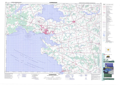
011L05 Summerside Canada topo map, 1:50,000 scale
011L05 Summerside NRCAN topographic map.
Includes UTM and GPS geographic coordinates (latitude and longitude). This 50k scale map is suitable for hiking, camping, and exploring, or you could frame it as a wall map.
Printed on-demand using high resolution, on heavy weight and acid free paper, or as an upgrade on a variety of synthetic materials.
Topos available on paper, Waterproof, Poly, or Tyvek. Usually shipping rolled, unless combined with other folded maps in one order.
- Product Number: NRCAN-011L05
- Parent Topo: TOPO-011L
- Map ID also known as: 011L05, 11L5, 11L05
- Unfolded Size: Approximately 26" high by 36" wide
- Weight (paper map): ca. 55 grams
- Map Type: POD NRCAN Topographic Map
- Map Scale: 1:50,000
- Geographical region: Prince Edward Island, Canada
Neighboring Maps:
All neighboring Canadian topo maps are available for sale online at 1:50,000 scale.
Purchase the smaller scale map covering this area: Topo-011L
Spatial coverage:
Topo map sheet 011L05 Summerside covers the following places:
- Bakers Cove - Bedeque Bay - Bentick Cove - Bentinck Cove - Bouquet Cove - Carleton Cove - Carrs Creek - Chichester Cove - Clarks Creek - Durant Creek - Golfe du Saint-Laurent - Gordon Cove - Granville Creek - Gulf of St. Lawrence - Guy Cove - Harding Creek - MacLaurins Cove - Malpeque Bay - Mandersons Cove - Miscouche Cove - Oyster Cove - Port Borden - Richmond Cove - Rush Creek - Russ Creek - Salutation Cove - Sandy Cove - Seven Mile Bay - Sevenmile Bay - Summerside Harbour - Sunbury Cove - Webber Cove - Chelton Shore - Gardiner Shore - Glovers Shore - Linkletter Shore - Shooting Gallery Shore - Staverts Shore - Waites Shore - Woodside Shore - Baglole Point - Beech Point - Bentick Point - Bentinck Point - Borden Point - Bouquet Point - Burnt Point - Campbells Cape - Campbells Point - Fitzsimmons Point - Gordon Point - Graham Head - Gull Point - Hilson Point - Hird Point - Hurd Point - Indian Head - Indian Point - Indian Spit - Ives Point - Leckys Point - LeFurgeys Point - MacCallums Point - McAllisters Point - McDonald Point - McNeills Point - Mills Point - Miscouche Point - Oyster Point - Phelan Point - Saltgrass Point - Schurmans Point - Seacow Head - Shemody Point - Sunbury Point - Taylor Point - Thompsons Point - Thompsons Point - Webber Point - Wilmot Point - Yeo Point - Détroit de Northumberland - Northumberland Strait - Summerside - Lot 14 - Lot 15 - Lot 16 - Lot 17 - Lot 18 - Lot 19 - Lot 20 - Lot 21 - Lot 25 - Lot 26 - Lot 27 - Lot 28 - Lot 29 - Lot 67 - Prince - Queens - Holman Island - Indian Island - Mary Fraser Island - Murray Island - Prince Edward Island - Bradalbane Pond - Breadalbane Pond - Campbells Pond - Canns Pond - Clinton Pond - Comptons Pond - Indian River Pond - Ives Pond - Leards Pond - Leards Pond - Leckys Pond - Lords Pond - MacLeods Pond - Marchbanks Pond - Matters Pond - Middleton Pond - Paynters Pond - Perrys Pond - Ramsays Pond - Scales Pond - Sherrens Pond - Tuplins Pond - Waddells Pond - Warrens Pond - Wrights Pond - Chelton Provincial Park - Linkletter Provincial Park - Miscouche Provincial Park - Miscouche Wharf Provincial Park - Sandy Cove Provincial Park - Scales Pond Provincial Park - Union Corner Provincial Park - Île-du-Prince-Édouard - Prince Edward Island - Adams Creek - Barbara Weit River - Beaton Creek - Birch Creek - Black Bridge Creek - Bradshaw River - Brocklesby River - Burke Creek - Cape Traverse River - Compton Creek - Comptons Creek - Cross Creek - Cross River - Crossman Creek - Dunk River - East Branch Tryon River - Eel Creek - Ellis Brook - Ellis River - Farrells Brook - Founds River - Gillespies Creek - Goose Creek - Goose River - Grahams Road Brook - Grand River - Granville Creek - Indian River - Inman Creek - Linkletter Creek - Little Trout River - Long River - Middle Creek - Middle Creek - Muddy Creek - Nebraska Creek - Nebraska River - North Brook - Old Mill River - Paynters Creek - Plat River - Platte River - Rayner River - Rayners Creek - Reads Creek - River Platte - Rush Creek - Schooner Creek - Schurmans Brook - Shemody River - Shipyard River - Silliker Brook - Smelt River - South Arm - Southwest Brook - Southwest River - Southwest River - Sutherland Creek - Tilton Creek - Tryon River - Tuplin Creek - Tupling Creek - Waite Creek - Waites Creek - Westmoreland River - Westmorland River - Wilmot River - Yeo Creek - Bentick Shoal - Little Dutchman Rock - Miscouche Bank - Kensington - Albany - Albany Corner - Belmont - Belmont Lot 16 - Borden - Bradford - Burlington - Carleton - Carleton Corner - Carleton Siding - Carleton Siding - Central Bedeque - Central Lot 16 - Chelton - Clermont - Clermont Station - Clinton - Cross River - Days Corner - Ellis River - Emerald - Emerald Junction - Fernwood - Freetown - Gamble Corner - Gambles Corner - Graham Road - Grahams Road - Grangemount - Hamilton - Indian River - Irishtown - Kelvin - Kelvin - Kelvin Grove - Kinkora - Lady Fane - Long River - Lot 16 - Lower Bedeque - Lower Freetown - Lower New Annan - Maple Plains - Margate - Middleton - Mill Valley - Mills Point - Muddy Creek - New Annan - New London - Newton - Norboro - Norborough - North Bedeque - North Carleton - North St. Eleanor - North St. Eleanors - North Tryon - Port Borden - Read Corner - Reads Corner - Reids Corner - Rosehill - Ross Corner - Seabrook - Searletown - Shamrock - Sherbrooke - Slemon Park - South Freetown - Southwest - Southwest Lot 16 - Spring Valley - Springbrook - Springfield - St. Eleanors - St. Eleanors Station - St. Nicholas - St-Nicholas - Summerfield - Travellers Rest - Union Corner - Wellington - Wellington Centre - Wellington Station - West Newton - Wilmot - Wilmot Valley - Big Marsh - Long Swamp - Noonans Marsh - Bedeque - Borden-Carleton - Breadalbane - Central Bedeque - Central Lot 16 - Kinkora - Linkletter - Malpeque Bay - Miscouche - Richmond - Sherbrooke - Sherbrooke - St. Eleanors - St. Nicholas - Wellington - Wilmot


