
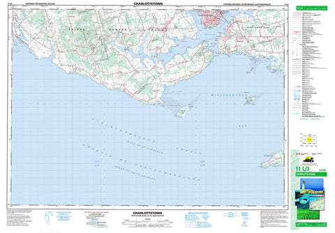
011L03 Charlottetown Canada topo map, 1:50,000 scale
011L03 Charlottetown NRCAN topographic map.
Includes UTM and GPS geographic coordinates (latitude and longitude). This 50k scale map is suitable for hiking, camping, and exploring, or you could frame it as a wall map.
Printed on-demand using high resolution, on heavy weight and acid free paper, or as an upgrade on a variety of synthetic materials.
Topos available on paper, Waterproof, Poly, or Tyvek. Usually shipping rolled, unless combined with other folded maps in one order.
- Product Number: NRCAN-011L03
- Parent Topo: TOPO-011L
- Map ID also known as: 011L03, 11L3, 11L03
- Unfolded Size: Approximately 26" high by 36" wide
- Weight (paper map): ca. 55 grams
- Map Type: POD NRCAN Topographic Map
- Map Scale: 1:50,000
- Geographical region: Prince Edward Island, Canada
Neighboring Maps:
All neighboring Canadian topo maps are available for sale online at 1:50,000 scale.
Purchase the smaller scale map covering this area: Topo-011L
Spatial coverage:
Topo map sheet 011L03 Charlottetown covers the following places:
- Alexandra Bay - Allen Cove - Bacon Cove - Bass Cove - Bellevue Cove - Black Creek - Canceaux Cove - Canoe Cove - Charlottetown Harbour - Codys Creek - Crapaud Road - Feehans Creek - Ferguson Creek - French Creek - Golfe du Saint-Laurent - Goose Creek - Gulf of St. Lawrence - Hillsborough Bay - Holland Cove - Hydes Cove - Indian Cove - Jardines Bay - Kelly Cove - Kellys Cove - MacEacherns Creek - MacEwens Creek - Pownal Bay - Pownall Bay - Squaw Bay - St. Peter Road - St. Peters Road - Stewart Cove - Stuart Creek - Victoria Harbour - Warren Cove - Webster Creek - Webster Creek - Wilsons Creek - Woods Bay - Brighton Shore - Keppoch Beach - Langley Beach - St. Peters Island Bar - Alchorn Point - Alexandra Point - Bacon Point - Battery Point - Beacon Point - Bellevue Point - Black Point - Blockhouse Point - Brocklesby Head - Burhoes Point - Cameron Island - Cameron Point - Canceaux Point - Canceaux Spit - Crosby Point - Crown Point - Crown Point - Dickiesons Point - Dickieson's Point - Drakes Point - Duchess Point - Duffys Point - Ferguson Point - Ferry Point - George Point - Haszard Point - Hyde Point - Hydes Point - Jardines Point - Kelly Point - Kellys Point - Kensington Point - Lewis Point - Lobster Point - MacIvors Point - MacNeills Point - May Point - McMullan Point - McMullen Point - North Point - Old Battery Point - Parks Point - Point Prim - Pownal Peninsula - Prim Point - Primrose Point - Rice Point - Rocky Point - Rosebank Point - Sand Point - Seatrout Point - Squaw Point - St. Peter Spit - St. Peters Spit - Wilsons Point - Woods Point - Wrights Point - York Point - Yorke Point - Détroit de Northumberland - Northumberland Strait - Charlottetown - Paul Bluff - Pauls Bluff - Charlottetown - Lot 29 - Lot 30 - Lot 31 - Lot 32 - Lot 48 - Lot 49 - Lot 57 - Lot 58 - Lot 65 - Prince - Queens - Rocky Point 3 - Governor Island - Governors Island - Judson Island - Prince Edward Island - St. Peter Island - St. Peters Island - Websters Island - Crosbys Pond - Dickiesons Pond - Hatchery Pond - Holms Pond - Hydes Pond - Ings Pond - Lake Aberdeen - MacDonalds Pond - MacEacherns Lake - Mermaid Pond - Stewarts Pond - Alexandra Point Range - Champ de tir Alexandra Point - Jones Hill - Tea Hill - Tea Hill - Argyle Provincial Park - Argyle Shore Provincial Park - Bonshaw Provincial Park - Lieu historique national du Canada de Port-la-Joye--Fort-Amherst - Lieu historique national du Canada Province House - Port-la-Joye--Fort Amherst National Historic Site of Canada - Province House National Historic Site of Canada - Strathgartney Provincial Park - Tea Hill Provincial Park - Victoria Provincial Park - Île-du-Prince-Édouard - Prince Edward Island - Bovyer Creek - Brocklesby River - Brocklesby River - Burhoes Creek - Burkes Creek - Clyde River - De Sable River - DeSable River - East (Hillsborough) River - East Branch Westmoreland River - Eliot River - Ellens Creek - Franklyn Creek - Fullerton Creek - Fullertons Creek - Greens Brook - Hampton Creek - Hillsborough River - Howard Creek - Howards Creek - Howells Brook - Hyde Creek - Ingenuity Creek - Long Creek - Mabey Creek - MacFaydens Creek - MacLaughlins Creek - MacLeods Creek - McEwens Creek - McKenzie Creek - McKies Creek - McPhee Creek - Mill Creek - Mill Creek - Nine Mile Creek - North (Yorke) River - North Creek - North River - West (Eliot) River - West River - Westmoreland River - Westmoreland River - Westmorland River - Westmorland River - Yorke River - Alexandra Shoal - Astyanax Rock - Fitzroy Rock - Governor Shoals - Governors Shoals - Huntley Rock - Inman Reef - Inman Rock - Middle Ground - Prim Reefs - Spithead - Squaw Shoal - St. Peter Shoals - St. Peters Shoals - Trout Rock - Cornwall - Stratford - Alexandra - Appin Road - Argyle Shore - Bonshaw - Brighton - Bunbury - Canoe Cove - Churchill - Churchill - Clyde River - Crosby Mills - Crosbys Mill - Cross Roads - Crossroads - Cumberland - De Sable - DeSable - Dunedin - Elmwood - Englewood - Fairview - Green Road - Hampton - Hillsborough - Kenloch - Keppoch - Keppoch Beach - Kinloch - Kinlock - Langley - LewisPoint - Long Creek - Meadow Bank - Mount Herbert - New Argyle - New Dominion - New Haven - Newhaven - Nine Mile Creek - Ninemile Creek - Parkdale - Point Prim - Rice Point - Riverdale - Rocky Point - Rosebank - South Melville - Southport - St. Catherines - Strathgartney - Tea Hill - York Point - Fullertons Marsh - Afton - Alexandra - Alexandra - Belfast - Bonshaw - Clyde River - Crapaud - Cross Roads - Hazelbrook - Kingston - Meadow Bank - New Haven-Riverdale - North River - Southport - Victoria - West River - West Royalty - Winsloe


