
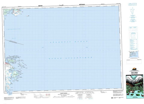
011F07 Cape Canso Canada topo map, 1:50,000 scale
011F07 Cape Canso NRCAN topographic map.
Includes UTM and GPS geographic coordinates (latitude and longitude). This 50k scale map is suitable for hiking, camping, and exploring, or you could frame it as a wall map.
Printed on-demand using high resolution, on heavy weight and acid free paper, or as an upgrade on a variety of synthetic materials.
Topos available on paper, Waterproof, Poly, or Tyvek. Usually shipping rolled, unless combined with other folded maps in one order.
- Product Number: NRCAN-011F07
- Parent Topo: TOPO-011F
- Map ID also known as: 011F07, 11F7, 11F07
- Unfolded Size: Approximately 26" high by 36" wide
- Weight (paper map): ca. 55 grams
- Map Type: POD NRCAN Topographic Map
- Map Scale: 1:50,000
- Geographical region: Nova Scotia, Canada
Neighboring Maps:
All neighboring Canadian topo maps are available for sale online at 1:50,000 scale.
Purchase the smaller scale map covering this area: Topo-011F
Spatial coverage:
Topo map sheet 011F07 Cape Canso covers the following places:
- Anse à Mallet - Black Duck Cove - Canso Harbour - Chapel Gully - Chedabucto Bay - Deep Cove - Dover Bay - False Cove - Georges Harbour - Ghost Cove - Glasgow Harbour - Herring Cove - Indian Cove - Joshuas Cove - Ketch Harbour - Mackerel Cove - Negrowac Cove - Penaul Cove - Petit-de-Grat Harbour - Petit-de-Grat Inlet - Petite Anse - Portage Cove - Seal Cove - Shag Cove - Sherewink Cove - Spinney Gully - Squid Cove - Three Islands Cove - Three Islets Cove - Walkers Bay - Barre au Chat - Betsys Beach - Cape Breaker - Lanigan Beach - Long Breaker - Maneys Breaker - Sallys Wash - Shag Rock Breaker - Arrow Point - Barachois Point - Barse Point - Betsys Point - Birch Point - Burns Point - Cap Rouge - Cape Canso - Coles Point - Fort Point - Gannet Point - Glasgow Head - Guet Point - Heath Head - Hydrant Point - Jersey Point - Joshuas Point - Ketch Harbour Head - Lock Point - Long Point - Mackerel Point - Madeline Point - Pointe à Siméon - Red Head - Walker Head - Walkers Head - Whistler Point - White Head - White Point - Andrew Passage - False Passage - Little Dover Run - Tickle Channel - Guysborough - Richmond - Andrew Island - Bear Island - Big Cranberry Island - Big Gooseberry Island - Birch Island - Black Island - Bull Head - Charity Island - Charlotte Island - Clarke Island - Cranberry Islands - Crow Island - Davis Island - Derabies Island - Derabies Islands - Durell Island - Durells Island - Eastern Black Island - George Island - Grassy Island - Grave Island - Green Island - Gull Egg Island - Gull Island - Gully Island - Hart Island - Hog Island - Isle Madame - Little Cranberry Island - Little Dover (White) Island - Little Gooseberry Island - Mouse Island - Neale Island - Oliver Island - Pea Island - Petit Pas - Petit-de-Grat Island - Pettipas Island - Pigeon Island - Piscatiqui Island - Sherewink Island - Snows Island - Spider Island - Spinney Gully Island - The Goose - Thrumcap Island - Walsh Island - Welsh Island - White Island - Big Pond - Forest Lake - Great Barachois - Mahons Lake - Mound Lake - Negrowac Lake - Petit Lac Rond - Publicover Lake - Warrens Lake - Guysborough - Richmond - Canso Islands National Historic Site of Canada - Grassy Island Fort National Historic Site of Canada - Lieu historique national du Canada des Îles-Canso - Lieu historique national du Canada du Fort-de-l'Île-Grassy - Winter Creek - The Tittle - Bald Reef - Bald Rock - Barrys Rock - Barse Rock - Bass Rock - Beacon Ledges - Berrigans Ledges - Big Arrow Rock - Big Fish Shoal - Big Ledge - Black Rock - Black Rocks - Boom Rock - Bootes Bank - Britons Shoal - Broad Shoal - Budget Rock - Calf Rock - Canso Ledges - Cape Rock - Carousse Bank - Castle Rock - Charity Island Ledges - Cow Rock - Crab Shoal - Crow Island Ledges - Crow Reef - David Rock - Derabies Bar - Doreys Rock - East Rock - Eastern Patch Rock - False Passage Ledge - Fanning Rock - Fiddle Shoal - Five Fathom Shoal - Flahertys Shoal - Flat Ledge - Frying Pan Shoal - Gannet Ledges - Gannet Rock - Gannet Shoal - Grassy Reef - Grime Rock - Gull Island Ledges - Gunning Rocks - Harbour Shoal - Harbour Shoal - Hauling Rock - Haulover Ledge - Ingraham Shoal - Inner Bass Reef - Joe Bonds Shoal - Keeper Reef - Kelp Rocks - Kennedys Rock - Kirby Rock - La Baleine - Long Point Ledges - Mackerel Rock - Man of War - Middle Rock - Middle Rock - Net Rocks - Nickerson Rock - North Rock - North Rock Shoal - Old Man Rock - Orpheus Rock - Park Ledge - Pas Reef - Patch Rock - Patch Rock - Pettipas Bar - Pink Rock - Roaring Bull - Roche de Platte - Sand Shoal - Scott Rock - Seal Ledge - Seal Ledge - Seal Ledges - Shag Ledge - South Shoal - Southeaster Ledges - Southern Shoal - Stanley Shoal - Stanley Shoals - Starling Rock - The Madeline - The Rampers - The Reef - The Washball - Three Fathom Shoal - Tinker Shoal - Twin Ledges - Washball - White Point Ledges - White Rock - Whitman Rock - Canso - Little Anse - Sampson Cove - Sampsons Cove - Turf Bog


