
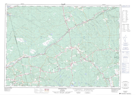
011E04 Kennetcook Canada topo map, 1:50,000 scale
011E04 Kennetcook NRCAN topographic map.
Includes UTM and GPS geographic coordinates (latitude and longitude). This 50k scale map is suitable for hiking, camping, and exploring, or you could frame it as a wall map.
Printed on-demand using high resolution, on heavy weight and acid free paper, or as an upgrade on a variety of synthetic materials.
Topos available on paper, Waterproof, Poly, or Tyvek. Usually shipping rolled, unless combined with other folded maps in one order.
- Product Number: NRCAN-011E04
- Parent Topo: TOPO-011E
- Map ID also known as: 011E04, 11E4, 11E04
- Unfolded Size: Approximately 26" high by 36" wide
- Weight (paper map): ca. 55 grams
- Map Type: POD NRCAN Topographic Map
- Map Scale: 1:50,000
- Geographical region: Nova Scotia, Canada
Neighboring Maps:
All neighboring Canadian topo maps are available for sale online at 1:50,000 scale.
Purchase the smaller scale map covering this area: Topo-011E
Spatial coverage:
Topo map sheet 011E04 Kennetcook covers the following places:
- Minas Basin - Hants - Indian Brook 14 - Shubenacadie Indian Reserve 14 - Allen Lake - Allens Lake - Allison Lake - Anthony Lake - Big Lake - Blueberry Lakes - Brazil Lake - Burton Lake - Butler Lake - Carrigan Lake - Cayley Lake - Fentons Lake - Grays Lake - Hines Lake - Ingram Lake - Lagoon Lakes - Law Lake - Laws Lake - MacLaren Lake - Mason Lake - McCleave Lake - McDonald Lake - McGrath Lake - Porter Lake - Ray Lake - Rocky Lake - Sarah Jane Lake - Shaky Lake - Shields Lake - Smith Lake - Story Lake - Storys Lake - Three Cornered Lake - Toole Lake - Tooles Pond - Valley Lake - Wallace Lake - Withrow Lake - Bull Meadow Mountain - Captains Hill - Courthouse Hill - Oak Hill - Pinnacle Hill - Rawdon Hills - East Hants - West Hants - Smileys Provincial Park - Sandy Desert - Long Lake Run - Allison Brook - Barr Brook - Bartletts Brook - Beaver Brook - Beaver Brook - Bills Brook - Bills Brook - Birch Brook - Blois Brook - Bull Meadow Brook - Bulmer Brook - Burns Brook - Capt. McPhee Brook - Captain McPhee Brook - Carrigan Brook - Cayley Brook - Clarke Brook - Cogmagun River - Cogmagun River - Cool Brook - Cox Brook - Ettinger Brook - Fisher Brook - Five Mile River - Fivemile River - Four Mile Brook - Glen Brook - Grant Brook - Grays Brook - Grumbley Brook - Gulf Brook - Hanna Brook - Haynes Brook - Hennigar Brook - Herbert River - Indian Brook - Kennetcook River - Lagoon Brook - Lake Brook - Lattie Brook - Latties Brook - Little Meander River - Little Nine Mile River - Little Ninemile River - Little River - Lively Brook - Long Lake Brook - McInnis Brook - McLean Brook - McLeod Brook - Meadow Brook - Meander River - Mill Brook - Miller Brook - Nine Mile River - Ninemile River - Nix Brook - Nolans Brook - North Branch Cogmagun River - North Brook - North Brook - Old Sandford Brook - O'Toole Brook - Philip Brook - Rawdon Brook - Red Brook - Rines Brook - Robinson Brook - Robinson Brook - Ross Brook - Salty Brook - Shaky Lake Brook - Simpson Brook - South Branch Cogmagun River - Sugarloaf Brook - Tennycape River - Tomcod River - Tracey Brook - Turples River - Uniacke Brook - Wallace Brook - Walton River - Weir Brook - West Tennycape River - Whale Brook - Whale Creek - White Horse Brook - Whittier Brook - Whittier Brook - Wilcox Brook - Murdock Springs - Ashdale - Barr Settlement - Belnan - Burtons - Burton's - Centre Rawdon - Cheese Factory Corner - Clarksville - Doddridge - Dunns Corner - East Gore - East Walton - Five Mile River - Fivemile River - Georgefield - Gore - Gore - Grant Valley - Greenfield - Hardwood Lands - Hennigar - Kennetcook - Latties Brook - Lower Nine Mile River - MacPhees Corner - McKay Section - McPhee Corner - McPhees Corner - Micmac - Millers Corner - Mosherville - Nine Mile River - Noel Road - North Noel Road - Northfield - Rawdon - Rawdon Gold Mines - Renfrew - Riverside Corner - Roulston Corner - Scotch Village - Stanley - Upper Kennetcook - Upper Newport - Upper Nine Mile River - Upper Rawdon - Walton - West Gore - West Indian Road - White Settlement - Woodville - Colin Bog - Cox Bog - East Meadows - King Meadows - MacLean Meadow - McCulloch Meadow - McDonald Bog - Petite Bog - The Barrens - The Bog - Thompson Meadow - Walton Barrens - Weir Meadows


