
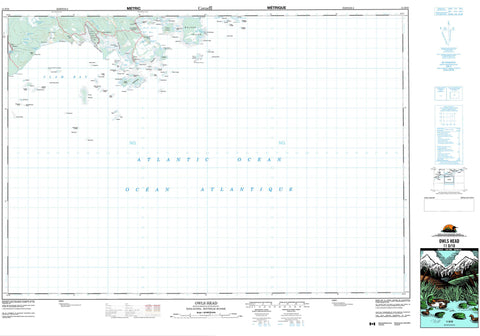
011D10 Owls Head Canada topo map, 1:50,000 scale
011D10 Owls Head NRCAN topographic map.
Includes UTM and GPS geographic coordinates (latitude and longitude). This 50k scale map is suitable for hiking, camping, and exploring, or you could frame it as a wall map.
Printed on-demand using high resolution, on heavy weight and acid free paper, or as an upgrade on a variety of synthetic materials.
Topos available on paper, Waterproof, Poly, or Tyvek. Usually shipping rolled, unless combined with other folded maps in one order.
- Product Number: NRCAN-011D10
- Parent Topo: TOPO-011D
- Map ID also known as: 011D10, 11D10
- Unfolded Size: Approximately 26" high by 36" wide
- Weight (paper map): ca. 55 grams
- Map Type: POD NRCAN Topographic Map
- Map Scale: 1:50,000
- Geographical region: Nova Scotia, Canada
Neighboring Maps:
All neighboring Canadian topo maps are available for sale online at 1:50,000 scale.
Purchase the smaller scale map covering this area: Topo-011D
Spatial coverage:
Topo map sheet 011D10 Owls Head covers the following places:
- Back Cove - Big Sandy Cove - Black Duck Cove - Camp Cove - Clam Bay - Clam Harbour - Duck Cove - Five Island Cove - Frenchmans Cove - Harrys Cove - Jeddore Harbour - Little Harbour - Little Whale Cove - Lobster Cove - Long Cove - Long Creek - Owl Cove - Owls Head Bay - Owl's Head Bay - Palmer Cove - Palmers Cove - Porter Cove - Sandy Cove - Sandy Cove - Southwest Cove - Webbers Cove - Broad Breaker - Clam Harbour Beach - Lanes Beach - Power Shore - Stoney Beach - The Sand Bar - Western Breaker - Black Point - Burnt Point - Cable Point - Campbells Head - Charles Point - East Head - George Point - Gunning Point - Harbour Point - Heron Point - Little Harbour Head - Little Harbour Head - Lloyds Point - Long Point - Owls Head - Owl's Head - Porter Head - Porters Head - Scanlans Point - Sleepy Head - Stoddart Point - Wintersons Point - Wisdom Head - Wisdom Point - Wolf Point - Wolfes Point - Cow Pen - False Passage - Green Tickle - Harleys Run - John Warrens Gap - Porters Passage - The Drain - Wreck Cliff - Halifax - Backmans Island - Bald Island - Barren Island - Black Duck Island - Borgles Island - Burnt Island - Cable Island - Calf Island - Caribou Island - Charles Island - Charlies Island - Common Island - Cow Island - Cranberry Island - Cuckold Island - Cut Leg Island - Cutfinger Island - Duck Island - Egg Island - Friar Island - Goose Island - Harbour Island - Houselog Island - Johns Island - Keg Island - Key Island - Laney Island - Laybold Island - Little Friar - Little Friar Island - Long Island - Manuels Island - Middle Island - Monahan Island - Nichol Island - Outer Island - Porter Island - Porters Island - Roger Island - Roger Islet - Shaws Island - Step Island - Sugarloaf - Sugarloaf Island - Western Islands - Wolfes Island - Woody Island - Abbiecombec Lake - Crows Hill Lake - Grassy Lake - Long Lake - Murphys Lake - The Pond - Weston Lake - Wreck Hill Pond - Wreck Hill - Halifax - Clam Harbour Beach Provincial Park - Mary River - Marys River - Anchor Shoal - Bald Island Shoal - Bald Rock - Bald Rock Bull - Barse Rock - Bay Shoal - Bear Rock - Bear Shoal - Big Hurley Shoal - Black Ledge - Black Rock - Brig Rock - Brig Shoal - Broad Bank - Broad Shoal - Bull Rock - Bull Rock - Bull Shoal - Camp Rock - Cat Rocks - Chain Rocks - Charles Ledges - Cow Rock - Dry Ledge - Duck Bank - Duck Island Ledges - Duck Rock - Duck Shoal - East Bull - East Mehanny Rock - East Pollock - Faulkners Shoal - Fish House Rock - Five Eyed Bull - Five Eyed Bulls - Flat Ledge - Flat Ledges - Flint Ledge - Friar Ledges - Georges Spot - Gravelly Ledge - Grizzle Rock - Gull Rock - Gunning Rock - Henrys Shoal - Hopkin Rock - Hurley Shoal - Inner Clearing Shoal - Inner Pollock - Inner Red Bank - Joe Dooks Lump - John Bank - John Borgles Ledges - Johns Rock - Little Bald Rock - Little Brig Rock - Little Hurley Shoal - Little Ledge - Little Old Man - Little Rock - Little Shag Rock - Little Tommys Ledge - Lloyds Rock - Lloyds Rock Reef - Long Ledge - Macdonald Rock - Mehanny Rock - Mehanny Rocks - Mehanny Rocks - Middle Ground - Middle Ground - Middle Rock - Nauffts Rock - North Sister Rock - Northeast Shoal - Old Man - Old Man Shoal - Outer Clearing Shoal - Outer Pollock - Outer Red Bank - Owl Rock - Owls Head Rock - Passage Bull - Passage Rock - Pollock Ground - Pollock Shoal - Pot Rock - Psyche Rock - Pyches Rock - Ragged Ledges - Robs Rock - Rocky Ground - Seal Rocks - Shag Ledges - Shag Rock - Ship Ledges - Silver Shoal - Sister Rock - Siteman Rock - Sleepy Shoal - Southeast Shoal - Southwest Ledges - Sow Ground - Spritsail Ledge - Spritsail Rock - Step Shoal - Steve Harpells Ground - Stoddart Ledge - Tangier Shoal - The Beefsteak - The Big Spot - The Bull - The Horn - The Spot - The Squince - Tom Bank - Tomfool Shoals - Transport Ledges - West Bull - Whalesback - White Shoal - Yankee Rock - Clam Bay - Clam Harbour - East Jeddore - Ecum Secum Bridge - Little Harbour - Owls Head Harbour - Owl's Head Harbour - Southwest Cove - Abbiecombec Marshes - East Marsh - West Marsh


