
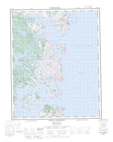
003D13 Snug Harbour Canada topo map, 1:50,000 scale
003D13 Snug Harbour NRCAN topographic map.
Includes UTM and GPS geographic coordinates (latitude and longitude). This 50k scale map is suitable for hiking, camping, and exploring, or you could frame it as a wall map.
Printed on-demand using high resolution, on heavy weight and acid free paper, or as an upgrade on a variety of synthetic materials.
Topos available on paper, Waterproof, Poly, or Tyvek. Usually shipping rolled, unless combined with other folded maps in one order.
- Product Number: NRCAN-003D13
- Parent Topo: TOPO-003D
- Map ID also known as: 003D13, 03D13, 3D13
- Unfolded Size: Approximately 26" high by 36" wide
- Weight (paper map): ca. 55 grams
- Map Type: POD NRCAN Topographic Map
- Map Scale: 1:50,000
- Geographical region: Newfoundland and Labrador, Canada
Neighboring Maps:
All neighboring Canadian topo maps are available for sale online at 1:50,000 scale.
Purchase the smaller scale map covering this area: Topo-003D
Spatial coverage:
Topo map sheet 003D13 Snug Harbour covers the following places:
- Back Cove - Bar Cove - Break Heart Cove - Camels Cove - Cape Bluff Harbour - Cox Cove - Dead Islands Bay - Delaney Cove - Duck Harbour - Fortune Arm - Green Cove - Hambrook Cove - Harpers Cove - Hawke Bay - Herring Cove - Indian Cove - Island Harbour - Ladys Arm - Lord Arm - Martin Bay - New York Bay - New York Cove - Newtown Cove - Nowlan Harbour - Old Cove - Otter Bay - Pikes Cove - Red Island Cove - Round Harbour - Schooner Cove - Snappers Cove - Snug Harbour - Southwest Arm - St. Michaels Bay - Sugarloaf Cove - Tims Arm - Triangle Harbour - Trout Cove - Tub Harbour - Whitefish Cove - Wild Bight - Wild Bight - Wild Cove - Woody Cove - Bar Cove Head - Browns Neck - Cape Bluff - Cooper Head - Gun Point - Hamburg Head - Hawks Nest Point - Knowling Harbour Head - Knowling Point - Murray Point - Salmon Point - Seal Cove Head - Sloops Head - Southern Head - Standstill Point - Steves Point - Western Point - White Point - White Point - Gambles Tickle - Lewis Tickle - Long Tickle - Macy Tickle - Seal Cove - Shoal Tickle - The Wavers - Venison Tickle - Bake Apple Island - Banger Island - Bar Tickle Island - Blubber Island - Bottle Island - Bull Island - Burn Island - Burnt Island - Butler Island - Camping Island - Canton Island - Carnabhus Island - Cliffty Island - Clifty Island - Cooper Island - Dark Tickle Island - Dead Islands - Deepwater Island - Deepwater Island - Double Island - Duck Island - Duck Island - Duck Islands - Eastern Island - Eddystone Island - Feltons Island - Flat Island - Flats Island - Fox Island - Goose Island - Gull Island - Gull Island - Gull Island - Gull Island - Iron Island - Jennifer Island - Jims Island - Juniper Island - Lewis Island - Little Gull Island - Macy Island - Mailmans Island - Meadow Island - North Island - Pigeon Island - Pigeon Island - Red Island - Sculpin Island - Seal Island - Seal Island - Ships Island - Square Island - Stony Island - Tinker Island - Venison Island - West Island - White Fox Island - White Islands - White Shot Island - Whitefish Island - Wild Bight Island - Wolf Islands - Woody Island - Bobs Pond - Cape Bluff Pond - Coffee Pond - Cox Cove Pond - Gull Pond - Murphys Pond - New York Pond - Norman Bay Pond - Osberns Pond - Salt Pond - Salt Pond - Smitt Pond - Southwest Pond - Trout Cove Pond - Trout Pond - Wild Bight Pond - Sugarloaf - Labrador Sea - Mer du Labrador - Black Rock - Black Rock - Cod Rock - Coopers Block - Greys Rock - Gull Rock - Gull Rock - Gun Rocks - Harbour Rock - Hen and Chickens - King - Mad Moll - Matthews Bank - Northward Rock - Queen - The Flats - The Rib - The Skelligs - The Skerries - Upper Rock - Dead Islands - Normans Bay - Norman's Bay - Snug Harbour - Triangle - Venison Islands


