
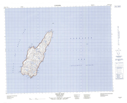
002M14 Belle Isle Canada topo map, 1:50,000 scale
002M14 Belle Isle NRCAN topographic map.
Includes UTM and GPS geographic coordinates (latitude and longitude). This 50k scale map is suitable for hiking, camping, and exploring, or you could frame it as a wall map.
Printed on-demand using high resolution, on heavy weight and acid free paper, or as an upgrade on a variety of synthetic materials.
Topos available on paper, Waterproof, Poly, or Tyvek. Usually shipping rolled, unless combined with other folded maps in one order.
- Product Number: NRCAN-002M14
- Parent Topo: TOPO-002M
- Map ID also known as: 002M14, 02M14, 2M14
- Unfolded Size: Approximately 26" high by 36" wide
- Weight (paper map): ca. 55 grams
- Map Type: POD NRCAN Topographic Map
- Map Scale: 1:50,000
- Geographical region: Newfoundland and Labrador, Canada
Neighboring Maps:
All neighboring Canadian topo maps are available for sale online at 1:50,000 scale.
Purchase the smaller scale map covering this area: Topo-002M
Spatial coverage:
Topo map sheet 002M14 Belle Isle covers the following places:
- Barbers Cove - Bateau Cove - Beauty Cove - Blandfords Cove - Green Cove - Greenham Bight - Gull Battery Cove - Hook Cove - Lark Harbour - Lighthouse Cove - Ringbolt Cove - Roundhead Cove - Scotswood Cove - Showerbath Cove - Three Brooks Cove - White Point Cove - Wreck Cove - Round Head - South Point - White Point - Détroit de Belle Isle - Belle Isle - Lark Island - Bateau Pond - Three Islands Pond - Roundhead Rock


