
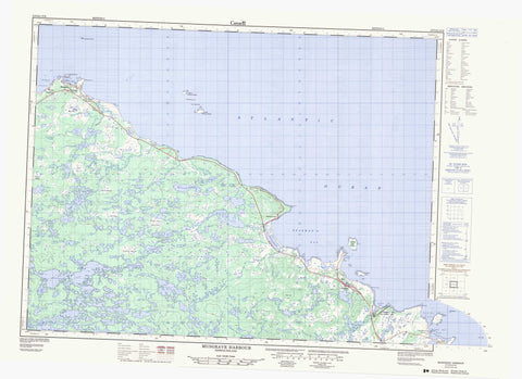
002F05 Musgrave Harbour Canada topo map, 1:50,000 scale
002F05 Musgrave Harbour NRCAN topographic map.
Includes UTM and GPS geographic coordinates (latitude and longitude). This 50k scale map is suitable for hiking, camping, and exploring, or you could frame it as a wall map.
Printed on-demand using high resolution, on heavy weight and acid free paper, or as an upgrade on a variety of synthetic materials.
Topos available on paper, Waterproof, Poly, or Tyvek. Usually shipping rolled, unless combined with other folded maps in one order.
- Product Number: NRCAN-002F05
- Parent Topo: TOPO-002F
- Map ID also known as: 002F05, 02F5, 2F5, 02F05, 2F05
- Unfolded Size: Approximately 26" high by 36" wide
- Weight (paper map): ca. 55 grams
- Map Type: POD NRCAN Topographic Map
- Map Scale: 1:50,000
- Geographical region: Newfoundland and Labrador, Canada
Neighboring Maps:
All neighboring Canadian topo maps are available for sale online at 1:50,000 scale.
Purchase the smaller scale map covering this area: Topo-002F
Spatial coverage:
Topo map sheet 002F05 Musgrave Harbour covers the following places:
- Adams Harbour - Anchor Brook Bight - Brandy Cove - Cellar Beach Cove - Deadman's Bay - Dog Cove - Doting Cove - Lumsden Harbour - Middle Bill Cove - Muddy Hole - North Bill Cove - Ragged Harbour - Rocky Cove - Shalloway Cove - Windmill Bight - Deadmans Bay Beach - Long Beach - Straight Shore - Burn Head - Burnt Head - Cape Freels - Deadmans Bay Point - Deadman's Point - Gunning Point - Long Point - Lumsden Head - Man Point - Muddy Hole Point - Muddy Point - Muddy Pond Point - North Bill - Queens Head - Rocky Cove Point - Salmon Point - South Bill - Southern Point - Windmill Head - Deadman Bay Gut - North Tickle - Ships Run - South Tickle - Gull Island - Inner Cat Island - Man Island - Muddy Shag Island - North Penguin Island - Northern Cat Island - Outer Cat Island - Penguin Islands - Red Island - Scrub Island - South Penguin Island - Southern Cat Island - Sugar Loaf - Abe Goodyears Pond - Anchor Brook Pond - Anchor Brook Waters - Banting Lake - Beaver House Long Steady - Beaver House Pond - Beaver Steadies - Big Anchor Pond - Big Dinner Pond - Big Island Pond - Big Rocky Pond - Big Steady - Big Steady - Billy Butts Pond - Billy Butts Steady - Billy Whites Pond - Black Duck Steady - Black Pond - Black Spruce Pond - Bobcat Pond - Brandy Cove Pond - Bun Pond - Burn Ridge Pond - Burn Ridge Pond - Butts Pond - Cannings Pond - Cape Pond - Carey Pond - Cat Harbour Pond - Cheese Man Pond - Churchill Pond - Churchwaters Pond - Cranberry Pond - Cranberry Pond - Cranberry Ponds - Deadman's Pond - Dolphs Pond - Double Pond - Double Ponds - Double Ponds - Double Tilt Pond - Duck Pond - Eagle Steady - Ed Hicks Pond - Eugene Pond - First Pond - Flat Fish Pond - Flat Pond - Foolish Pond - Forked Pond - Freds Pond - Golden Cup - Goose Pond - Goose Ponds - Green Grub Pond - Gull Pond - Gull Pond - Gull Steady - High Bank Pond - High Bank Pond - Hill Pond - Humphries Pond - Inside Stag Pond - Jabes Pond - Jim Ways Pond - Joes Pond - Joes Steady - L Steady - Laddys Pond - Little Anchor Pond - Little Burnt Pond - Little Flat Pond - Little Island Pond - Little Rocky Pond - LittleBirchy Pond - Long Pond - Long Pond - Long Steady - Long Steady - Meeting House Pond - Mile Pond - Millennial Steady - Newmans Pond - Otter Pond - Otter Pond - Paddys Pond - Parlour Ponds - Peters Pond - Peters Pond - Peters Pond - Piercey Pond - Piper Pond - Rocky Pond - Rocky Pond - Rocky Pond - Rocky Steady - Round Pond - Round Pond - Salt Pond - Saltwater Pond - Schooner Ponds - Second Pond - Second Pond - Seven-Mile Pond - Shalloway Waters Big Pond - Side Pond - Slip Hole - Smith Pond - Smiths Pond - Southwest Waters - Stag Pond - Stock Pond - Surveyors Pond - Swallow Tail Pond - Teal Pond - Third Pond - Three Corner Pond - Three Corner Pond - Thunder Bolt Pond - Tobys Pond - Twin Pond - Upper Saltwater Pond - Walts Pond - Windmill Pond - Windmill Pond - Black Pond Ridge - Cape Ridge - Elias Hill - Red Hill - Stock Pond Ridge - Musgrave Harbour-Doting Cove - Deadman's Bay Provincial Park - Windmill Bight Provincial Park - Anchor Brook - Big Brook - Birchy Drook - Burrys Brook - Cat Harbour Brook - Cellar Beach Cove Brook - Deadman's Brook - Long Pond Brook - Middle Brook - Pardys Brook - Second Brook - Shalloway Brook - Southern Brook - Straight Shore Brook - Windmill Brook - Bolden Rock - Deadmans Rock - Edwards Reef - Golden Rock - Gull Rock - Gull Rocks - Hadmo Rock - Halfway Rocks - Halfway Rocks - Hancock Rocks - Hennessy Rock - Horns Rock - Johnnys Rock - Johnsons Ground - Lynch Ground - Mad Moa Rock - Moores Rock - Motion Rock - Mussel Shoal - North Sister - Northeast Skerries - Northern Bank - Pike Rock - Pouks Rock - Saddle Rock - Seal Rock - Snows Rock - South Rock - South Sister - Southern Bank - Swell Rock - Tago Rock - The Admiral - The Knob - The Plains - Willow Rock - Lumsden - Musgrave Harbour - Cape Freels North - Cape Freels North - Deadman's Bay - Doting Cove - Lumsden South - Barbours Marsh - Big Marsh - Cuffs Marsh - Fridays Marsh - High Marsh - High Marsh - High Marsh - Howell Hill Marsh - Inside Stag Horn Marshes - Morley Marsh - Otter Marsh - Outside Stag Horn Marshes - Philips Marsh - Stag Horn Marshes - Steady Marsh


