
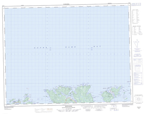
002E11 Exploits Canada topo map, 1:50,000 scale
002E11 Exploits NRCAN topographic map.
Includes UTM and GPS geographic coordinates (latitude and longitude). This 50k scale map is suitable for hiking, camping, and exploring, or you could frame it as a wall map.
Printed on-demand using high resolution, on heavy weight and acid free paper, or as an upgrade on a variety of synthetic materials.
Topos available on paper, Waterproof, Poly, or Tyvek. Usually shipping rolled, unless combined with other folded maps in one order.
- Product Number: NRCAN-002E11
- Parent Topo: TOPO-002E
- Map ID also known as: 002E11, 02E11, 2E11
- Unfolded Size: Approximately 26" high by 36" wide
- Weight (paper map): ca. 55 grams
- Map Type: POD NRCAN Topographic Map
- Map Scale: 1:50,000
- Geographical region: Newfoundland and Labrador, Canada
Neighboring Maps:
All neighboring Canadian topo maps are available for sale online at 1:50,000 scale.
Purchase the smaller scale map covering this area: Topo-002E
Spatial coverage:
Topo map sheet 002E11 Exploits covers the following places:
- Abbott Cove - Arnold Cove - Bay of Exploits - Bellens Cove - Boot Cove - Burnt Cove - Burton Cove - Butler Cove - Butt Cove - Caplin Cove - Chitman Cove - Deep Gulch - Deepwater Bight - Doater Cove - Dog Fish Gulch - East Bear Cove - Exploits Lower Harbour - Exploits Upper Harbour - Farvell Cove - Fleury Bight - Fortune Harbour - Garden Cove - Grass Gulch - Green Island Cove - Gull Island Bight - Indian Cove - Jacob Cove - Job Cove - Josiah Spencer Cove - Lady Cove - Lobster Cove - Logy Cove - Longer Cove - Lower Black Point Cove - Luke Manuel Cove - Manuel Gulch - Mooring Cove - Nanny Hole - New Bay - Northwest Arm - Pig Cove - Rowsell Cove - Salmon Bight - Sealing Cove - Shoal Cove - Shoal Ground Gulch - Silver Buckle Cove - Slime Cove - Southeast Arm - Southwest Arm - Sparks Cove - Squid Cove - Squid Coves - Surgeon Cove - Tom Wall Harbour - Upper Black Point Cove - Waldron Cove - Webber Bight - West Bear Cove - West Gull Island Bight - Western Head Cove - Wild Bight - Wild Bight - Woody Island Bight - Bagg Head - Ball Point - Bear Head - Bellens Point - Big Head - Black Point - Breakheart Point - Crow Head - Deepwater Head - Deepwater Point - Doater Point - Eastern Head - Fox Head - Fox Point - Grebe Head - Gunning Point - Hell Grapple Head - Indian Cove Point - Lacy Head - Lacy Point - Little Marble Head - Long Point - Long Point - Lower Caplin Cove Point - Mad Moll Head - Man Point - Manuel Point - Marble Head - Moses Head - Nanny Hole Head - New Bay Head - North Head - Nosworthy Point - Perry Point - Ragged Point - Red Point - Salmon Point - Shoal Point - Sims Point - Stride Point - Surgeon Cove Point - Upper Caplin Cove Point - Waldron Cove Point - West Head - Western Head - Wild Bight Point - Ship Run - Sloop Run - Blow Me Down - Gull Cliff - Shag Cliff - Alcock Island - Burnt Island - Button Island - Cull Island - Double Island - Exploits Islands - Fish Island - Gillespie Island - Gillot Island - Goat Island - Green Island - Green Island - Gull Island - Gull Island - Hamilton Island - Hare Island - High Gull Island - Jim Day Island - Keogh Island - Matthew Lane Island - North Harbour Gull Island - Pig Island - Quirk Island - Red Island - Round Island - Sculpin Island - Sculpin Island - Silver Buckle Island - Sweeny Island - Tailor Nose Island - Tarpaulin Island - Thomas Rowsell Island - Tinker Island - West Gull Island - Woody Island - Woody Island - Abbot Pond - Abbott Pond - Captain Cook Ponds - Squid Pond - Crows Nest - Fortune Hill - Man of War Hill - Manuel Stores - Silver Buckle - The Lookout - Leading Tickles - Tiger Rock - Bantam Rock - Bed Rock - Bishop Rock - Brandies Rocks - Burnt Island Ground - Callaghan Ground - Caplin Cove Banks - Cherry Ground - Chitman Spot - Colonial Bank - Cook Rock - Deepwater Bank - Eastern Bank - Eastern Ground - Friday Ledge - Friday Ledge - Friday Spot - Gruffy Ground - Gull Island Ground - Gull Island Ground - Gull Rock - Gull Rock - Gunning Rock - Gunning Rock - Halfway Ground - Harbour Bank - Harbour Rock - Hare Rock - Ice Ledge - Lanning Ground - Lilly Bank - Little Harbour Bank - Lobster Ledge - Long Point Ground - Loveman Bank - Mad Moll Rocks - Miller Rock - Naked Man - Nanny Hole Rock - New Bay Head Rocks - New Bay Head Shoal - New Ground - Nip Gut Ledge - North East Rock - North Tickle Bank - North West Bank - North West Rocks - Northern Head Ground - Offer Bed Rock - Offer Shoal Ground - Outside Spot - Paddy Outside Spot - Paddy Spot - Pelly Ground - Pipers Ledge - Red Island Bank - Sculpin Bank - Sculpin Rock - Sebright Bank - Ship Run Rock - Shoal Ground - Shoal Ground - Skinner Ledge - Snorter Ledge - South East Ground - Southern Ground - Sprunes Bank - The Field - The Ladle - Tiger Rock - Two Gull Island Ground - Walker Ledge - Western Bank - Western Ground - Western Head Rock - Woody Island Bank - Woody Island Bank - Leading Tickles - Leading Tickles West - Cull Island - Exploits - Fleury Bight - Fortune Harbour - Moore's Cove - Waldron Cove - Black Gulch - Crow Gulch


