
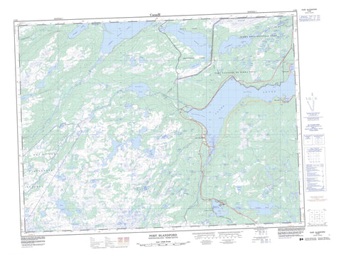
002D08 Port Blandford Canada topo map, 1:50,000 scale
002D08 Port Blandford NRCAN topographic map.
Includes UTM and GPS geographic coordinates (latitude and longitude). This 50k scale map is suitable for hiking, camping, and exploring, or you could frame it as a wall map.
Printed on-demand using high resolution, on heavy weight and acid free paper, or as an upgrade on a variety of synthetic materials.
Topos available on paper, Waterproof, Poly, or Tyvek. Usually shipping rolled, unless combined with other folded maps in one order.
- Product Number: NRCAN-002D08
- Parent Topo: TOPO-002D
- Map ID also known as: 002D08, 02D8, 2D8, 02D08, 2D08
- Unfolded Size: Approximately 26" high by 36" wide
- Weight (paper map): ca. 55 grams
- Map Type: POD NRCAN Topographic Map
- Map Scale: 1:50,000
- Geographical region: Newfoundland and Labrador, Canada
Neighboring Maps:
All neighboring Canadian topo maps are available for sale online at 1:50,000 scale.
Purchase the smaller scale map covering this area: Topo-002D
Spatial coverage:
Topo map sheet 002D08 Port Blandford covers the following places:
- Black Duck Cove - Bryans Hole - Bunyan's Cove - Clode Sound - Fifields Cove - Grants Cove - Ivanys Cove - Love Cove - Muddy Cove - Northwest Arm - Peters Cove - Platter Cove - Port Blandford - Seal Cove - Sparkes Cove - Spracklins Cove - The Angle - Youngs Cove - Yudle Cove - Bluff Head - Church Point - Fifields Point - Georges Point - Howes Point - Long Point - Middle Point - Myles Point - Narrows Point - Rainy Head - Sandy Point - Spracklins Point - Tuckers Point - White Point - Yudle Cove Head - The Narrows - Black Cliff - Black Cliff - The Scrape - Governors Island - Ams Pond - Ams Pond - Arns Pond - Baggs Pond - Barren Island Pond - Battle Pond - Beachy Pond - Bear Pond - Beaver Brook Pond - Beaver Pond - Beaver Pond - Beaver Waters - Bengers Pond - Benjamins Pond - Big Bread Bag Pond - Big Breadbag Pond - Big Gull Pond - Big Northwest Steady - Big Pond - Big Pond - Billy Harris Pond - Billy Harris Pond - Bittern Pond - Black Marsh Waters - Blind Pond - Blood Pond - Bottle Pond - Broom Pond - Bulls Pond - Camels Pond - Camp Pond - Chain Pond - Chain Ponds - Charlie Chaulk's Pond - Chaulk Pond - Churchills Pond - Close Season Pond - Cobblers Pond - Crooked Pond - Double Pond - Duceys Pond - Duck Pond - Duck Pond - Duncans Pond - Dunphys Pond - Dunphy's Pond - Eastern Salmon Pond - Eddys Nest Pond - Emmet Pond - Emmett Pond - First Pond - First Shute Steady - Friday Pond - Georges Pond - Goose Pond - Grandfathers Pond - Grassy Pond - Grassy Pond - Grassy Pond - Grassy Pond - Grassy Pond - Green Feeder Ponds - Green Island Pond - Greenwood Feeder Ponds - Gull Pond - Gull Pond - Haleys Pond - Harris Pond - Henrys Pond - Hideaway Pond - High Bank Pond - Holloways Pond - Hornet Pond - Island Pond - Island Pond - Island Pond - Island Pond - Island Ponds - Jessies Pond - John Hermans Pond - John Perrys Pond - Juiceys Pond South - Little Bread Bag Pond - Little Gull Pond - Little Pitts Pond - Little Rocky Pond - Little Trout Pond - Lois Lake - Long Gullies - Long Pond - Long Pond - Long Pond - Long Pond - Long Pond - Long Pond South - Long Waters - Loon Pond - Loon Pond - Lost Pond - Lynx Pond - Lynx Pond - Middle Brook Pond - Middle Brook Steadies - Mile Pond - Mile Pond - Monday Pond - Mondays Pond - Moon Pond - Muddy Pond - Murphys Pond - Muskrat Pond - Nappers Pond - Narrows Pond - New Years Pond - North Brook Pond - Northeast Pond - Northwest Pond - Noseworthys Pond - Odeas Pond - Odies Pond - Otter Pond - Otter Pond - Otter Pond - Our Ponds - Pencil Pond - Pine Tilt Pond - Pinsents Pond - Pinsons Pond - Pitts Pond - Roaches Pond - Rocky Pond - Rocky Pond - Rocky Pond - Saddle Pond - Salmon Pond - Salt Lake - Salt Lake Steadies - Sams Pond - Sams Pond - Sandy Pond - Saw Pit Pond - Second Pond - Second Shute Steady - Sextons Pond - Shell Bird Pond - Shellbird Pond - Shoal Pond - Shoal Pond - Shoal Pond - Simmonds Pond - Small Breadbag Pond - Small Gull Pond - Small White Hill Pond - Snelgroves Pond - Split Rock Pond - Split-rock Pond - Spoon Pond - Spracklin Pond - Stag Pond - Stag Pond - Stag Pond - Stephens Pond - Stocking Pond - Sugar Pond - Terra Nova Lake - Terrances Pond - Terrences Pond - The Feeder - Third Shute Steady - Thorburn Lake - Tommys Pond - Tommys Pond - Trout Gully - Trout Pond - Trout Pond - Twin Ponds - Twin Ponds - Twin Ponds - Uncle Toms Pond - Water Chute Pond - White Hill Pond - White Hill Pond - White Point Pond - Yudle Pond - Blue Hills - Burnt Knob - Churchills Ridge - Doctors Hills - Grants Country - Larrys Lookout - Lower White Hill - Murphys Lookout - Salmon Head - Strouds Ridge - Upper White Hill - Bay du Nord Wilderness Reserve - Newfoundland T'Railway Provincial Park - Parc national du Canada Terra-Nova - Pitt's Pond Provincial Park - Terra Nova National Park of Canada - Thorburn Lake Provincial Park - Baggs Brook - Bread Cove Brook - Bunyans Cove Brook - Camels Brook - Cobblers Brook - Crooked Brook - Georges Brook - Georges Brook - Green Feeder Brook - Ivanys Brook - Middle Brook - Mile Pond Brook - North Brook - Northwest River - Pitts Brook - Russells Brook - Salmon Brook - Sams Brook - Shute Brook - Southwest River - Stones Brook - Sweetapples Brook - Terra Nova North River - Terra Nova River - Twin Brook - The Elbow - Narrows Rock - Port Blandford - Bunyan's Cove - Charlottetown - Muddy Brook - Thorburn Lake - The Saddle - Brown Marsh - Gros Marsh - Ivanys Downs - Stones Marsh - White Point Marsh


