
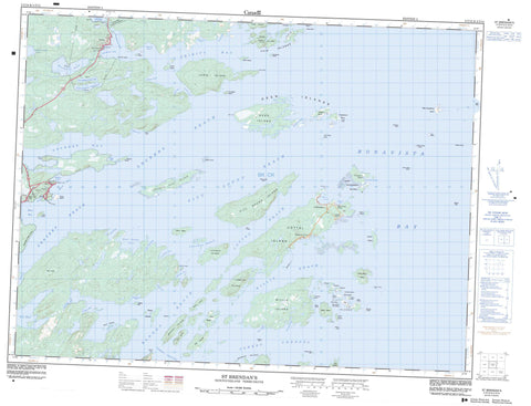
002C13 St Brendan s Canada topo map, 1:50,000 scale
002C13 St Brendan s NRCAN topographic map.
Includes UTM and GPS geographic coordinates (latitude and longitude). This 50k scale map is suitable for hiking, camping, and exploring, or you could frame it as a wall map.
Printed on-demand using high resolution, on heavy weight and acid free paper, or as an upgrade on a variety of synthetic materials.
Topos available on paper, Waterproof, Poly, or Tyvek. Usually shipping rolled, unless combined with other folded maps in one order.
- Product Number: NRCAN-002C13
- Parent Topo: TOPO-002C
- Map ID also known as: 002C13, 02C13, 2C13
- Unfolded Size: Approximately 26" high by 36" wide
- Weight (paper map): ca. 55 grams
- Map Type: POD NRCAN Topographic Map
- Map Scale: 1:50,000
- Geographical region: Newfoundland and Labrador, Canada
Neighboring Maps:
All neighboring Canadian topo maps are available for sale online at 1:50,000 scale.
Purchase the smaller scale map covering this area: Topo-002C
Spatial coverage:
Topo map sheet 002C13 St Brendan s covers the following places:
- Ackwards Cove - Ashes Cove - Askel Cove - Back Badger Cove - Back Cove - Badger Cove - Bait Cove - Bait Cove - Barracks Cove - Beaches Cove - Beaches Harbour - Bear Cove - Bear Cove - Big Dog Cove - Black Duck Cove - Black Duck Cove - Black Duck Cove - Blacks Cove - Blacks Cove - Bonavista Bay - Bullocks Cove - Butchers Cove - Butlers Cove - Cannon Head Cove - Carters Cove - Cat Bay - Chalky Cove - Clay Cove - Cottels Arm - Cranberry - Deep Cove - Deep Cove - Dick Allens Cove - Dog Cove - Dog Cove - Drake Cove - Eagle Cove - Fish Cove - Frost Cove - Gander Cove - Gander Cove - Garden Cove - Gilliams Harbour - Goodwithy Harbour - Goose Cove - Gooseberry Harbour - Great Content Cove - Gut Cove - Hancocks Cove - Hare Bay - Hide Away Cove - Iris Cove - Jim Sydneys Cove - Joeys Farm - Lanes Harbour - Little Bait Cove - Little Content Cove - Little Dog Cove - Lockers Bay - Loo Cove - Lower Gander Cove - Man Point Cove - Martins Cove - Mole Cove - Morris Cove - Mouse Island Cove - Muddy Cove - Northeast Bottom - Northern Harbour - Northwest Arm - Northwest Arm - Old House Cove - Old Womans Cove - Osmonds Cove - Pennys Cove - Powell Cove - Rocky Bay - Rocky Bay - Round Harbour - Round Harbour - Salvage Mans Harbour - Seal Cove - Seal Cove - Shadows Harbour - Shoal Bay - Shoal Cove - Southern Harbour - Southwest Arm - Squid Arm - Swile Cove - Three Brooks - Tom Whites Cove - Trinity Bay - Turnip Cove - Upper Gander Cove - Virgin Cove - Western Harbour - Western Harbour - Wild Cove - Winsors Harbour - Yellow Point Cove - Cashins Beach - Deer Island Lane - Long Beach - Man Point Shore - Nealers Beach - The Beaches - The Pipeberry - Wild Beach - Angel Head - Ashes Cove Head - Beaches Head - Birchy Head - Birchy Head - Bloody Bay Point - Bloody Point - Braggs Point - Burnt Point - Cannon Head - Chalky Head - Charles Head - Connors Point - Deer End - Deer Island End - Dog Point - Draining Point - Goose Cove Point - Gull Point - Hare Cut Point - Hobbs Head - Lewis Head - Little Chalky Head - Long Point - Long Point - Long Point - Man Point Head - Nealers Head - North Point - Pelleys Head - Pinchers Head - Powell Cove Head - Rocky Bay Point - Skerries Head - Souther Point - Southern Point - Stage Head - The Owl - Willis Island Point - Big Tickle - Blind Tickle - Burnt Island Tickle - Cat Gut - Cottels Tickle - Dark Hole - Dark Hole - Deer Island Tickle - Gilliams Tickle - Great Swerry Tickle - Long and Hungry - Long Tickle - Marys Tickle - Morris Channel - Pinchers Tickle - Shoal Tickle - Souther Tickle - The Rattle - Trinity Gut - Varket Channel - Ackwards Island - Ash Island - Ballast Island - Bar Island - Bard Islands - Beef Island - Belle Isle - Berry Head - Bessy Island - Black Duck Island - Black Duck Island - Black Island - Black Puffin - Bloody Island - Braggs Island - Bragg's Island - Broad Island - Brown Islands - Burnt Island - Burnt Island - Card Island - Castle Island - Clay Cove Island - Coal Harbour Island - Coal Island - Coleman Islet - Columbia Island - Cook Room Island - Cottel Island - Cottells Island - Courting Island - Coward Islands - Cut Off - Daleys Island - Deer Island - Deer Islands - Deer Shag Islets - Double Shag Island - Drake Island - Fair Island - Fair Islands - Flat Island - Flat Island - Flat Islands - Flips Island - Fox Island - Fryingpan Island - Full Island - Fuzz Island - Grassy Gull Islet - Grassy Island - Grassy Island - Great Black Island - Green Island - Grindstone Island - Gulch Island - Gull Island - Gull Islets - Hail Island - Hare Bay Island - Hare Island - Hare Island - Hollands Island - Horsechops - Hunch Island - Indian Island - Inner Gooseberry Islands - Inside Battery Island - Jack Barrs Island - Kanes Island - Kellys Island - Lakeman Island - Lewis Island - Little Barr Island - Little Burnt Island - Little Fryingpan Island - Little Grassy Island - Little Island - Little Lakemans Islands - Little Mouse Island - Lockers Flat Island - Martin Island - Martin Sheppards Island - Marys Island - Mole Islands - Morris Island - Mouse Island - North Island - North Island - Offer Gooseberry Island - Old Burnt Island - Outside Battery Island - Partridge Island - Pat Whites Island - Pauls Island - Perlican Island - Philphotts Island - Pincher Island - Pitt Sound Island - Pitts Island - Popplestone Island - Pork Island - Powderhorn Island - Puffin Island - Puffin Island - Puffin Island - Rocky Islands - Round Bottle Island - Saint Island - Samson (Flat) Islands - Sand Islands - Shag Island - Shag Island - Shag Islet - Shelf Island - Shellbird Islands - Ship Island - Shoal Island - South Shag Island - Southern Island - Southwest Island - Taylors Island - The North Brandies - The South Brandies - Tinker Island - Tumbler Island - Turners Island - Varket Islet - Willis Island - Wings Island - Woody Island - Wreck Island - Ackwards Pond - Ashes Cove Pond - Bear Cove Pond - Beaver Pond - Blind Pond - Cashins Pond - Chalky Head Pond - Charles Head Pond - Charles Head Steady - Cottels Pond - First Church Pond - First Loo Cove Pond - First Southwest Feeder Pond - First Three Brooks Pond - Flashet - Fourth Three Brooks Pond - Franks Pond - Fryingpan Pond - Georges Pond - Gull Pond - Long Pond - Man Point Pond - Mouse Island Steady - Muddy Pond - Northwest (First) Pond - Northwest Pond - Old Womans Pond - Puncheon Pond - Round Pond - Salt Water Pond - Salt Water Pond - Second Church Pond - Second Loo Cove Pond - Second Pond - Second Southwest Feeder Pond - Second Southwest Pond - Second Three Brooks Pond - Skembisses Pond - Southwest Pond - Third Pond - Third Three Brooks Pond - Tom Whites Pond - Treasures Pond - Treasures Steadies - Turnip Cove Pond - Blacks Head - Chalky Hills - Hart Hill - Man Peak - Blacks Brook - Content Brook - Northwest River - Southwest River - Bloody Bay Reach - Bloody Reach - Content Reach - Cottel Reach - Lakeman Reach - Lockers Reach - Pitt Sound Reach - Willis Reach - Anstey Rock - Bakers Loaf - Berry Rocks - Big Grassy Gull Rocks - Billy Rock - Black Rock - Black Rock - Black Rock - Blue Gull Rock - Braggs Rock - Bruce Cove Rock - Columbia Rock - Content Rocks - Easter Rocks - Fishing Rock - Flat Rock - Freds Rock - Grassy Rock - Grassy Rocks - Grassy Rocks - Grassy Shag Rock - Gulch Island Rock - Gull Rocks - Inner Brandy Rock - Johnny Browns Rocks - Keans Rock - Lackington Rock - Malone Rock - Man of War Rock - Middle Rocks - Mooring Rocks - Mount Stamford Rock - North Brown Rocks - Pinchers Rocks - Prentice Rock - Rugged Rocks - Saint Rock - Saturday Ledge - Shag Rock - Ships Rock - South BrownRocks - Stoney Rock - The Dumpling - Twin Rock - Virgin Rock - Whelping Rock - Centreville-Wareham-Trinity - Dover - Hare Bay - St. Brendan's - Wellington - Bragg's Island - Deer Island - Dock Cove - Fair Island - Flat Islands - Gooseberry Island - Haywards Cove - Round Harbour - Samson - Shalloway Cove - Sydney Cove - Trinity - Big Marsh - Tims Marsh


