
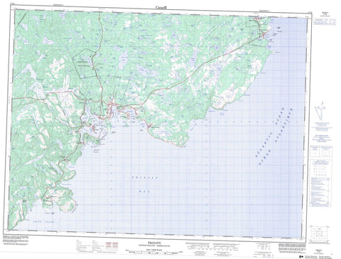
002C06 Trinity Canada topo map, 1:50,000 scale
002C06 Trinity NRCAN topographic map.
Includes UTM and GPS geographic coordinates (latitude and longitude). This 50k scale map is suitable for hiking, camping, and exploring, or you could frame it as a wall map.
Printed on-demand using high resolution, on heavy weight and acid free paper, or as an upgrade on a variety of synthetic materials.
Topos available on paper, Waterproof, Poly, or Tyvek. Usually shipping rolled, unless combined with other folded maps in one order.
- Product Number: NRCAN-002C06
- Parent Topo: TOPO-002C
- Map ID also known as: 002C06, 02C6, 2C6, 02C06, 2C06
- Unfolded Size: Approximately 26" high by 36" wide
- Weight (paper map): ca. 55 grams
- Map Type: POD NRCAN Topographic Map
- Map Scale: 1:50,000
- Geographical region: Newfoundland and Labrador, Canada
Neighboring Maps:
All neighboring Canadian topo maps are available for sale online at 1:50,000 scale.
Purchase the smaller scale map covering this area: Topo-002C
Spatial coverage:
Topo map sheet 002C06 Trinity covers the following places:
- Back Cove - British Harbour - Cap Cove - Cat Cove - Champney's Cove - Cuckold Cove - Devils Cove - Dog Cove - English Bay - Fisher Cove - Fox Bay - Goose Cove - Green Bay - Herring Cove - Island Cove - Kerleys Harbour - Melrose Harbour - Northern Cove - Northwest Arm - Robinhood Bay - Smith Sound - Somerset Cove - Southern Bight - Southwest Arm - Spaniards Cove - Trinity Bay - Trinity Harbour - Trouty Cove - West Arm - White Cove - Battery Point - Bonaventure Head - Calf's Nose - Cap Point - Doughfig Point - English Head - Fort Point - Fox Head - Green Point - Hogs Nose - Horse Chops - Huzzie Head - Job's Head - Low Point - Mackerel Point - Maiden Point - Melrose Point - Norther Point - Nuddick Point - Oarblade Point - Pudding Point - Salmon Point - Salvage Head - Skerwink Head - South Head - Tabins Point - Walter Point - White Point - White Point - Wolf Head - Admiral Island - Green Island - Maiden Islet - Pinchgut Island - Ragged Islands - Stone Island - Angle Pond - Angle Pond - Angle Pond - Angle Pond - Angle Pond - Baileys Pond - Bartletts Ponds - Beaver House Pond - Beaver Pond - Beaver Pond - Beaver Pond - Beaver Pond - Beaver Pond - Beaver Steady - Bendys Pond - Bens Pond - Big Codger Pond - Big Path Pond - Big Pond - Big Pond - Big Pond - Box Iron Pond - Bread Pond - Bull Pond - Burnt Pond - Carys Long Pond - Church Pond - Church Pond - Church Pond - Coffee Pond - Cooks Steady - Corals Pond - Cove Pond - Cow Pond - Crockers Pond - Cross Cove Pond - Crow Pond - Dam Pond - Deep Pond - Deer Marsh Pond - Doughfig Point Pond - Duck Pond - Duck Pond - Duck Pond - Easter Pond - Fifields Pond - First Pond - Fish Pond - Five Mile Ponds - Four Ponds - Freshwater Pond - Furlongs Steady - Geese Pond - Glenns Pond - Gotts Pond - Green Bay Pond - Green Point Pond - Gull Pond - Gull Pond - Gull Pond - Gull Pond - Halfway House Pond - Halfway Pond - Harbour Pond - Harbour Pond - Harts Pond - Head Pond - Head Waters - Herring Pond - Hoddey Pond - Humber Ponds - Indian Pond - Island Pond - Island Pond - Island Pond - Island Pond - Island Pond - Jones Pond - Juniper Pond - Juniper Pond - Juniper Pond - Kearleys Pond - Keoughs Island Pond - Kerbys Pond - Kerleys Pond - Kings Pond - Kings Steadies - Kirbys Pond - Lawlors Pond - Lawyers Pond - Long Gerry - Long Pond - Long Pond - Long Pond - Long Pond - Long Pond - Long Pond - Long Pond - Long Pond - Lookout Pond - Loop Pond - Low Point Pond - Millers Pond - Morris Pond - Muddy Pond - Newcastle Pond - Nine Islands Pond - North Pond - North Pond - North West Pond - North West Ponds - Northern Cove Pond - Northwest Pond - Oarblade Pond - Philpots Pond - Plate Cove Pond - Ploughs Pond - Plows Pond - Rainbow Pond - Rattling Pond - Rex Pond - Ricketts Pond - Ricketts Steadies - Riverhead Pond - Rocky Pond - Rocky Pond - Rocky Pond - Rocky Steadies - Round Pond - Round Pond - Saddle Back Pond - Salmon Cove Pond - Salmon Pond - Salvage Pond - Sandy Pond - Schoolhouse Pond - Second Pond - Second Pond - Second Pond - Seven Pond Lakes - Southwest Pond - Spirit Pond - Square Pond - Stage Hill Ponds - Star Pond - Steady Waters - Steady Waters Ponds - Stock Cove Big Pond - Stock Pond - Stock Pond - Swyers Pond - Tea Pond - Temples Pond - Third Pond - Thomas Steadies - Tom Randells Pond - Trinity Pond - Trout Pond - Trout Pond - Trout Pond - Trout Pond - Trouty First Pond - Trouty Pond - Trouty Pond - Trouty Pond - Trouty Second Pond - Trouty Third Pond - Twin Pond - Twin Ponds - Two Northwest Ponds - Uncle Andys Pond - Walshes Pond - Walshs Pond - Watts Pond - Wolf Pond - World Pond - Port Rexton - Ass Hill - Huzzie Hill - Rider Hill - Rocky Hill - Salvage Hill - Skerries Hill - Sugar Loaf - Lockston Path Provincial Park - Indian Brook - Lockston River - Rattling Brook - Salmon Cove River - Trouty River - Ass Rock - Flat Rock - Fox Rock - Herring Rocks - Jack Rocks - Low Point Grounds - Morris Rocks - Mussel Rock - Naked Man - Ragged Rocks - Shag Rock - Skerwink Rocks - Somerset Cove Rocks - Stone Shoal - Port Rexton - Trinity - Trinity Bay North - British Harbour - Champney's - Champney's Arm - Champneys East - Champneys West - Champney's West - Dunfield - Dunfield - English Harbour - Goose Cove - Kerleys Harbour - Lockston - Melrose - New Bonaventure - Old Bonaventure - Plate Cove West - Port Union - Trinity East - Trouty - Deer March


