
001M07 Baine Harbour Canada topo map, 1:50,000 scale
001M07 Baine Harbour NRCAN topographic map.
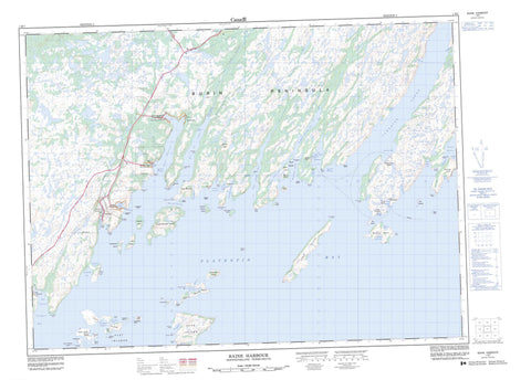
Includes UTM and GPS geographic coordinates (latitude and longitude). This 50k scale map is suitable for hiking, camping, and exploring, or you could frame it as a wall map.
Printed on-demand using high resolution, on heavy weight and acid free paper, or as an upgrade on a variety of synthetic materials.
Topos available on paper, Waterproof, Poly, or Tyvek. Usually shipping rolled, unless combined with other folded maps in one order.
- Product Number: NRCAN-001M07
- Parent Topo: TOPO-001M
- Map ID also known as: 001M07, 01M7, 1M7, 01M07, 1M07
- Unfolded Size: Approximately 26" high by 36" wide
- Weight (paper map): ca. 55 grams
- Map Type: POD NRCAN Topographic Map
- Map Scale: 1:50,000
- Geographical region: Newfoundland and Labrador, Canada
Neighboring Maps:
All neighboring Canadian topo maps are available for sale online at 1:50,000 scale.
Purchase the smaller scale map covering this area: Topo-001M
Spatial coverage:
Topo map sheet 001M07 Baine Harbour covers the following places:
- Baileys Cove - Baine Harbour - Bay de l'Eau - Beachy Cove - Beckford Cove - Big Cove - Big Cove - Boat Harbour - Bobbys Hole - Browns Cove - Buntons Cove - Butter Cove - Cape Roger Bay - Cape Roger Harbour - Channels Harbour - Claypit Cove - Coles Cove - Collins Cove - Coopers Cove - Councils Cove - Darbys Harbour - D'Argent Bay - Deep Cove - Deep Cove - Deep Cove - Doctors Cove - East Broad Cove - Eastern Head Cove - Flat Island Cove - Flat Island Harbour - Footes Cove - Footes Garden - Fowlers Cove - Gallows Harbour - Gilberts Cove - Grandys Cove - Great Bona Cove - Grebe Cove - Hay Cove - Jigger Cove - Jigging Cove - Jigging Cove - Jigging Cove - Jigging Cove - John Clarkes Gardens - Jude Harbour - Keeping Harbour - Killaminki Cove - Kings Cove - Lakes Cove - Little Bona Cove - Little Gallows Harbour - Little Harbour - Little Paradise Harbour - Mare Cove - Marticot Back Cove - Marticot Cove - Martin Harrons Cove - Mooring Cove - Mother Whittles Cove - Mussel Cove - Nonsuch Inlet - Normans Cove - Northeast Nonsuch Arm - Oderin Harbour - Paradise Harbour - Paradise Sound - Parkers Cove - Petit Forte Cove - Petit Forte Harbour - Placentia Bay - Presque Harbour - Pumblys Cove - Red Cove - Red Harbour - Red Scrape - Rodways Cove - Rushoon Harbour - Salamander Cove - Salmons Cove - Ship Cove - South East Bight - Southeast Bight - Southwest Nonsuch Arm - St. Joseph's Harbour - Sunker Cove - The Gully - The Rattle - Tides Hole - Traverses Cove - Vaters Cove - Watering Cove - West Broad Cove - Wild Cove - Wild Cove - Wild Cove - Long Beach - Southwest Beach - Bay de l'Eau Head - Big Head - Black Point - Blue Point - Bluff Head - Boat Harbour Head - Brimstone Point - Broad Cove Head - Cape Roger - Crawleys Point - Deadman Head - Deep Cove Head - Dog Head - East Broad Cove Head - Eastern Head - Eastern Head - Eddy Point - Flat Island Point - Foots Point - Fox Point - Friar Point - Gallows Harbour Head - Green Point - Hobins Nose - Inkmans Point - Inside Sandy Point - Jigging Cove Head - Little Head - Long Island Point - Manny Point - Meadow Point - Millers Point - Nipper Head - Nonsuch Head - Northwest Point - Otter Burr - Poplars Head - Puffing Pig - Rattle Head - Red Cove Head - Red Harbour Head - Roches Head - Round Head - Rushoon Head - Salamander Point - Sams Head - Sandy Point - Sandy Point - Sandy Point - Smiths Point - Spurrier Point - Tide Point - Tides Hole Head - West Broad Cove Head - Wester Point - White Point - White Point - Holloway Passage - Pushthrough Passage - Redland - Shattered Cliff - White Sail - Burnt Island - Burnt Island - Burnt Islands - Cape Roger Island - Castle Island - Coachman Island - Cookroom Island - Cross (Grass) Island - Cross Island - Crow Island - Davis Island - Durdle Island - Emberleys Island - Flat Island - Flat Islands - Fox Island - Gallows Harbour Island - Glimshire Island - Gooseberry Island - Gooseberry Island - Green Island - Gull Island - Gull Islands - Harbour Island - Hay Island - Jerseyman Island - Jude Island - Little Copper Island - Little Gull Island - Little Island - Long Island - Marticot Island - Mouse Island - Oderin Island - Patrick Island - Petticoat Island - Shag Islands - Sound Island - Tinkershare Island - Woody Island - Woody Island - Yardie Island - Baileys Pond - Baine Harbour Pond - Bakers Pond - Ballard Pond - Beaver Pond - Big Brookside Gull Pond - Big Loo Pond - Big Pond - Big Steady - Black Duck Pond - Black Hill Pond - Broad Cove Pond - Club Pond - Coadys Garden Pond - Collins Cove Ponds - Country Pond - Crooked Pond - Deep Cove Ponds - Dirty Brook Pond - Fewers Pond - Footes Pond - Fowlers Pond - Garvet Stick Pond - Goose Pond - Goose Pond - Grassy Pond - Grebe Cove Pond - Gull Pond - Jack Fountain Gull Pond - Jigging Cove Pond - Jigging Cove Pond - Jim Jarvis Pond - Keeping Harbour Ponds - Killaminki Gullies - Killaminki Pond - Landwash Pond - Landwash Pond - Little Gull Pond - Long Gulch Pond - Long Gull Pond - Long Pond - Long Pond - Long Pond - Long Surf Big Pond - Long Surf Gull Pond - Longer Surf Pond - Loo Pond - Loo Pond - Lower Green Hill Pond - Mare Pond - Markrock Pond - Mooring Cove Ponds - Mountain Pond - Mulletts Pond - Northwest Pond - Old Tilt Pond - Otter Pond - Otter Pond - Outside Baileys Pond - Phillies Pond - Pine Pond - Powderhorn Pond - Puffing Pig Ponds - Rattle Pond - Reids Pond - Round Pond - Round Pond - Sandy Point Pond - Scotch Gullies - Scotch Pond - Shellbird Ponds - Shoestring Pond - Snooks Pond - Tides Hole Pond - Tom Butlers Loo Pond - Twin Ponds - Upper Green Hill Pond - West Harbour Big Pond - West Long Shore Gull Pond - Western Feeder Pond - Western Feeder Ponds - Western Gull Pond - Western Landwash Pond - Wild Cove Inside Ponds - Wild Cove Outside Pond - Woody Ridge Pond - Big Hill - Black Hill - Brimstone Hill - Deer Hill - Footes Hill - Hill With Rocks - Horse's Head - Jigging Cove Hill - Northwest Hill - Osmond Hill - Otters Hill - Powderhorn Hill - Powderhorn Hill - Roche Peak - Roches Peak - Rushoon Hill - Snooks Hill - White Sail Head - Woody Ridge - Bay de l'Eau River - Bottom Brook - Eastern Feeder - Kings Brook - Middle Feeder - Rattle Brook - Rushoon River - Scotch Brook - Scotts Brook - Tides Hole Brook - Western Feeder - Western Feeder - Anchor Cove Sunkers - Bill White Rock - Black Rock - Breeches Rock - Chimney Rocks - Dollar Rock Sunker - Duck Rock Shoal - Fords Rock - Great Colombier Rocks - Green Island Shoal - Gull Rock - Gull Rocks - Gull Shoal - Hay Island Bank - Heptige Rock - Hiscock Rocks - Larkin Shoal - Long Island Bank - Middle Shoal - New Bank - Nonsuch Bank - Normans Cove Rocks - Rough Rocks - Stanley Rocks - Steering Rock - Steering Rocks - The Friar - The Sunker - Washball Rock - Whites Rock - Baine Harbour - Parkers Cove - Red Harbour - Rushoon - Boat Harbour West - Brookside - Burns Cove - Burnt Island - Darbys Harbour - Davis Island - Deep Cove - Flat Island - Great Bona - Great Paradise - Little Bona - Little Harbour - Little Harbour - Little Harbour West - Little Paradise - Oderin - Petit Forte - Port Anne - Port Elizabeth - South East Bight - Southeast Bight - Southeast Bight - St. Joseph's - Coadys Garden - Manuels Gulch - Toms Bottom


