
001L14 St Lawrence Canada topo map, 1:50,000 scale
001L14 St Lawrence NRCAN topographic map.
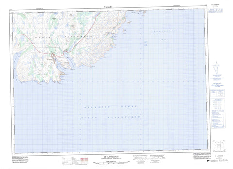
Includes UTM and GPS geographic coordinates (latitude and longitude). This 50k scale map is suitable for hiking, camping, and exploring, or you could frame it as a wall map.
Printed on-demand using high resolution, on heavy weight and acid free paper, or as an upgrade on a variety of synthetic materials.
Topos available on paper, Waterproof, Poly, or Tyvek. Usually shipping rolled, unless combined with other folded maps in one order.
- Product Number: NRCAN-001L14
- Parent Topo: TOPO-001L
- Map ID also known as: 001L14, 01L14, 1L14
- Unfolded Size: Approximately 26" high by 36" wide
- Weight (paper map): ca. 55 grams
- Map Type: POD NRCAN Topographic Map
- Map Scale: 1:50,000
- Geographical region: Newfoundland and Labrador, Canada
Neighboring Maps:
All neighboring Canadian topo maps are available for sale online at 1:50,000 scale.
Purchase the smaller scale map covering this area: Topo-001L
Spatial coverage:
Topo map sheet 001L14 St Lawrence covers the following places:
- Back Cove - Blue Beach Cove - Castle Hide Cove - Chambers Cove - Corbin Harbour - Deadmans Cove - Deep Cove - Dieters Cove - Dietor Cove - East Bass Cove - Georges Cove - Great St. Lawrence Harbour - Handiland Cove - Hay Cove - Herring Cove - Herring Cove - Herring Cove - L'Anse au Diable - L'Anse au Loup - Little Lawn Harbour - Little St. Lawrence Harbour - Middle Bight Cove - Mine Cove - Murphys Cove - Placentia Bay - Pork Cove - Red Land Cove - Salt Cove - Seal Gulch - Shoal Cove - Silver Cove - Spearns Cove - Speerin Cove - Spices Cove - Swolho Cove - Teddy Bear Cove - Watering Cove - West Bass Cove - Truxtun-Pollux Shore - Bass Point - Blue Beach Point - Cape Chapeau Rouge - Cape Rosey - Chambers Point - Corbin Head - Ferryland Head - Flat Point - Keenan Point - L'Anse au Loup Head - Lawn Head - Lawn Point - Little Lawn Point - Long Point - Manasco Head - Middle Head - Middle Head - Miller Head - Red Head - Red Head - Red Head - Sauker Head - Sculpin Point - Shalloway Head - Shingle Point - Spearns Head - Speerin Point - Wester Cove Bass Point - Western Point - Red Cliff - Island Pond Woods - Tare Fair Woods - Cat Island - Corbin Island - Goat Island - Hares Ears - Little Burin Island - Middle Bight Island - Sculpin Island - Shalloway Island - Turpins Island - Bass Cove Ponds - Beaver Pond - Birchy Gulch Pond - Black Brook Pond - Black Duck Pond - Blakes Pond - Blow Me Down Pond - Boxanator Pond - Brewers Pond - Bryant Pond - Burin Pond - Burnt Woods Pond - Camp Pond - Clam Pond - Clam Pond - Clarkes Pond - Corbin Barasway - Country String of Ponds - Doctors Pond - Eastern Clam Pond - Georges Cove Pond - Grebes Nest Pond - Grebes Nest Pond - Gull Pond - Halfway Pond - Hanamoores Pond - Hares Ears Pond - Hay Pook Pond - Island Pond - Island Pond - John Fitzpatricks Pond - Jones Pond - Juniper Brook Ponds - Knots on Juniper Pond - Lanes Pond - L'Anse au Loup Pond - Little Goose Pond - Little Lawn Pond - Little Stump Pond - Long Pond - Long Pond - Loo Pond - Loughlins Pond - Lucy Anne Pond - Lundrigans Pond - Mount Anne Pond - Mount Misery Ponds - Olands Pond - Orrels Pond - Pepper Pond - Puzzle Ponds - Reeves Pond - Rushy Pond - Salmonier Pond - Sauker Cove Pond - Sharks Pond - Shatter Cliff Pond - Shoal Pond - Silver Cove Ponds - Simmons Hole - Snooks Pond - Southern Pond - Stump Pond - Tent Pond - Three Stick Pond - Tinder Box Bottom Pond - Waterfall Pond - Welchs Pond - Western Clam Pond - Winter Pond - Big Hill - Blow Me Down Hill - Burnt Woods Hill - Calipouse - Chapeau Rouge - Coopers Ridge - Flint and Steel - Lawn Lookout - Loughlins Hill - Mount Leisure - Mount Lucy Anne - Mount St. Anne - Mount St. Margaret - Pikes Hill - Pinnacle - Ryans Hill - Southwest Hill - St. Anne Mount - St. Margaret Mount - Tinder Box - Turpins Hill - Welchs Hill - White Hills - Black Brook - Lawn River - Little Lawn River - Little St. Lawrence River - Northeast Brook - Northeast Brook - Orange Springs - Pinnacle Brook - St. Lawrence River - Waterfall Brook - Allen Bank - Bass Rock - Bugdens Rock - Burin Bank - Butler Rock - Cloué Rock - Cockle Rock - Cooper Bank - Douglas's Shoal - Emberly Rock - Fish Rock - Garden Bank - Harbour Rock - Irish Ledge - Kelper Rock - Menaska Shoal - Miller Rock - Monasco Shoal - Offer Rock - Old Harry - Point Rock - Popes Rock - Red Scrape Rock - Rocks of Gibraltar - Rosey Rock - Sauker Rock - Sculpin Rock - Shag Rock - White Ground - White Scrape Rock - St. Lawrence - Corbin - Little St. Lawrence - Tinder Box Bottom


