
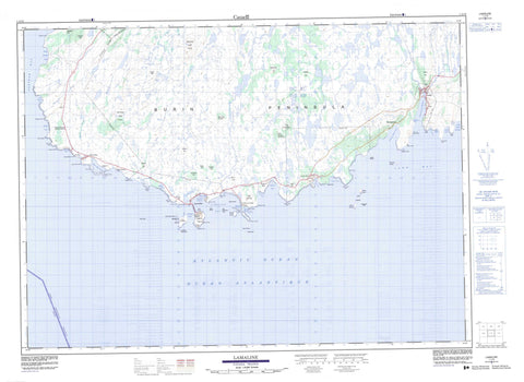
001L13 Lamaline Canada topo map, 1:50,000 scale
001L13 Lamaline NRCAN topographic map.
Includes UTM and GPS geographic coordinates (latitude and longitude). This 50k scale map is suitable for hiking, camping, and exploring, or you could frame it as a wall map.
Printed on-demand using high resolution, on heavy weight and acid free paper, or as an upgrade on a variety of synthetic materials.
Topos available on paper, Waterproof, Poly, or Tyvek. Usually shipping rolled, unless combined with other folded maps in one order.
- Product Number: NRCAN-001L13
- Parent Topo: TOPO-001L
- Map ID also known as: 001L13, 01L13, 1L13
- Unfolded Size: Approximately 26" high by 36" wide
- Weight (paper map): ca. 55 grams
- Map Type: POD NRCAN Topographic Map
- Map Scale: 1:50,000
- Geographical region: Newfoundland and Labrador, Canada
Neighboring Maps:
All neighboring Canadian topo maps are available for sale online at 1:50,000 scale.
Purchase the smaller scale map covering this area: Topo-001L
Spatial coverage:
Topo map sheet 001L13 Lamaline covers the following places:
- Alder Gulch - Back Cove - Big Gut - Calmer Cove - Cow Cove - Dantzic Cove - Deep Cove - Duck Cove - Eastern Cove - Flagstaff Cove - Fortune Bay - Great Dantzic Cove - Great Lawn Harbour - Hardings Cove - High Beach Cove - Jigging Cove - Jimmys Cove - Joes Cove - Lamaline Bay - Lamaline Harbour - Lamaline Road - Lance Cove - Lannon Cove - Lansey Bank Cove - Lansey Bark Cove - Lawn Bay - Little Dantzic Cove - Little Gut - Little Lawn Harbour - Lord's Cove - Lories Cove - Micks Cove - Muddy Hole - Nantes Cove - Old House Cove - Peters Harbour - Pieduck Cove - Piercey Cove - Point au Gaul Back Cove - Point au Gaul Cove - Point Crewe Cove - Pump Cove - Rack Gulch - Round Cove - Saints Cove - Salmonier Bight - SandyCove - Split Cove - Stabling Cove - Taylor's Bay - The Barasway - Three Sticks Cove - Tiller Cove - Watering Cove - Webbers Cove - West Sandy Cove - Western Cove - Wreck Cove - The Bar - Berry Head - Big Meadow Point - Black Head - Blow Hole Point - Blow Me Down Point - Bluff Head - Burin Peninsula - Cains Point - Calmer Point - Cousin Head - Crew Point - Crows Head - Dantzic Point - Drunkards Point - Duck Point - East Head - East Lories Point - Eastern Point - Flagstaff Point - Fox Hummock - Fox Hummock - Granny Head - Grave Point - Joes Hummock - Land Hummock - Land Point - Lannon Point - Long Point - Penny Point - Pieduck Point - Piercey Point - Pikes Ladder - Pilot Point - Point au Gaul - Point Crewe - Point May - Pump Cove Head - Ragged Head - Red Head - Sand Cove Head - Sandy Cove Point - Sheep Head - Squid Point - Taylor's Bay Point - Three Hummocks - West Woody Hummock - Western Head - Winging Point - Winging Point - Black Bank - Blue Woods - Greeks Nest - Long Black Wood - Allan's Island - Barred Island - Big Island - Cat Island - Colombier Islands - Duck Island - Lawn Islands - Little Green Island - Middle Island - Morgan's Island - Offer Island - Pigeon Island - Salmonier Island - Swale Island - American Pond - Bakeapple Pond - Bar Pond - Bartle Steaks - Bear Pond - Beaver Pond - Big Dantzic Pond - Big Duck Pond - Big Fox Hummock Pond - Big Meadow Pond - Big Pond - Big Pump Cove Pond - Big Rocky Pond - Big Woody Pond - Black Duck Pond - Black Duck Pond - Black Woods Pond - Brazils Pond - Broad Pond - Browns Pond - Cains Pond - Catchers Pond - Clam Pond - Coxs Pond - Cross Pond - Dantzic Ponds - Deer Pond - Dicks Pond - Dog Hill Pond - Eastern Spell Pond - Fishers Pond - Flagstaff Pond - Flaherty Pond - Flahertys Grove Pond - Flahertys Pond - Fortune Brook Pond - Frenchmans Pond - Garden Pond - Ghost Cop Pond - Glenn Pond - Grassy Pond - Green Hill Pond - Gull Pond - Gull Ponds - Haleys Pond - Hanns Pond - Hare Hill Pond - High Bank Pond - High Beach Pond - Horse Pond - Hungry Pond - Jack Slaneys Pond - Jacky Rat Pond - Jims Pond - Joes Pond - Juniper Pond - Kelp Pond - Kennedys Pond - L Pond - L Pond(shape) - Lanes Pond - Lansey Bark Island Pond - Lansey Bark Pond - Lily Pond - Lily Pond - Little Dantzic Ponds - Little Duck Pond - Little Fox Hummock Pond - Little Horse Pond - Little Pond - Little Rocky Pond - Long Pond - Long Pond - Long Pond - Loo Pond - Loo Pond - Lories Long Pond - Lories Three Ponds - Lousy Pond - Lower Pond - Mans Rock Pond - Middle Pond - Middle Pond - Middle Ridge Pond - Monday Pond - Mount Pleasent Pond - Nantes Cove Pond - Nebway Pond - Northeast Pond - Northwest Pond - Northwest Pond - Northwest Pond - Nut Droke Pond - Otter Pond - Otter Pond - Otter Pond - Paddys Pond - Peters Pond - Piercey Pond - Point May Pond - Poor Pond - Ramrod Pond - Robs Pond - Rocky Pond - Rocky Pond - Rocky Pond - Rocky Pond - Rocky Pond - Round Pond - Salmonier Pond - Sandy Cove Island Pond - Sandy Cove Pond - Shellbird Pond - Shellbird Pond - Shorts Pond - Snooks Barasway - Snooks Pond - Sophies Pond - Spruce Pond - Spruce Pond - Swimming Pond - Taylors Bay Pond - Three Corner Pond - Toe Pond - Tommys Pond - Tommys Pond - Uncle Franks Pond - Warm Water Pond - Watering Pond - Western Pond - Western Spell Pond - Winter Pond - Woody Island Pond - Aldery Ridge - Ben Hill - Berry Hills - Black Hill - Black Woods Hill - Blow Me Down Hill - Brown Hill - Browns Ridge - Cooks Lookout - Dantzic Hill - Eastern Hare Hills - Eastern Ridge - Flagstaff - Flaherty Hill - Fugle Hill - Halfway Hills - Hodges Hill - Kennedy Hill - Lebeach Hill - LeBeach Hill - Lee Beach Hill - Little Burnt Ridge - Lookout - Lookout - Middle Ridge - Middle Ridge - Middle Ridge - Northeast Hill - Northwest Lookout - Penny Hill - Pennys Hill - Piercey Hill - Point au Gaul Hill - Point Crewe Hill - Powderhorn Hill - Rocky Hill - Round Hill - Salmonier Hill - Salmonier Lookout - Sandy Cove Ridge - Split Cove Hill - Tapley Hill - The Breadbox - The Pinnacle - Three Stick Ridge - Western Hare Hills - White Head - French Islands Provincial Park - Big Dantzic Brook - Bobs Brook - Eastern Brook - Hamilton Brook - High Beach Brook - Lories Brook - Middle Brook - Northeast Brook - Northeast Brook - Northwest Brook - Northwest Brook - Peters Brook - Piercey Brook - Salmonier River - Sawpit Dam - Shorts Brook - Snooks Brook - Abbott Rock - Allan Rock - Bateau Bank - Big Rock - Big Salmonier Rock - Blow Hole Rock - Bluff Head Shoal - Bob Rock - Bowdridge Shoal - Breadbox Rock - Caplin Rock - Cock Bank - Collier Rock - East Black Rock - East Mark Rock - East Sunker - Faro Rock - Fish Rock - Frank Rock - Frieght Rock - Harbour Rock - Hillier Rock - Inner Bob Rock - John Thomas Rock - John Walsh Shoal - Johnnie Rocks - Kettle Rocks - Lamaline Ledges - Lamaline Shag Rock - Lawn Bank - Little Salmonier Rock - Little Whalesback Rock - Major Shoal - Middle Ground - Middle Shoal - Murphy Rock - Northwest Sunker - Northwest Sunker - Offer Johnnie Rock - Offer Rock - Otter Rock - Page Rock - Point Rock - Ragged Rock - Ragged Rock - Rogers Rocks - Saint Rock - Sally Rock - Shag Rock - Shag Rock - Shag Rock Shoal - Southeast Rock - Southeast Sunker - Southwest Rock - Strand Rock - Sugarloaf Rock - Taylor's Bay Rock - Taylor's Bay Shoal - The Whalesback - Thornhill Shoal - Thousand Rocks - Tickleace Rock - Vestal Rock - West Black Rock - West Mark Rock - Western Ground - Western Rock - Lamaline - Lawn - Lord's Cove - Point au Gaul - Point May - Allan's Island - Calmer - High Beach - Lories - Point aux Gaul - Point Crewe - Point May - Roundabout - Taylor's Bay - Webbers - Old Hill Marsh


