
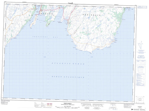
001K11 Trepassey Canada topo map, 1:50,000 scale
001K11 Trepassey NRCAN topographic map.
Includes UTM and GPS geographic coordinates (latitude and longitude). This 50k scale map is suitable for hiking, camping, and exploring, or you could frame it as a wall map.
Printed on-demand using high resolution, on heavy weight and acid free paper, or as an upgrade on a variety of synthetic materials.
Topos available on paper, Waterproof, Poly, or Tyvek. Usually shipping rolled, unless combined with other folded maps in one order.
- Product Number: NRCAN-001K11
- Parent Topo: TOPO-001K
- Map ID also known as: 001K11, 01K11, 1K11
- Unfolded Size: Approximately 26" high by 36" wide
- Weight (paper map): ca. 55 grams
- Map Type: POD NRCAN Topographic Map
- Map Scale: 1:50,000
- Geographical region: Newfoundland and Labrador, Canada
Neighboring Maps:
All neighboring Canadian topo maps are available for sale online at 1:50,000 scale.
Purchase the smaller scale map covering this area: Topo-001K
Spatial coverage:
Topo map sheet 001K11 Trepassey covers the following places:
- Backside - Backside (of Trepassey) - Big Johns Cove - Big Pound Cove - Biscay Bay - Biscay Bay Gut - Bobs Cove - Brians Gulch - Bristy Cove - Broad Cove - Broom Cove - Butlers Cove - Cape Cove - Caplin Cove - Chance Cove - Clam Cove - Coombs Cove - Cripple Cove - Daleys Cove - Drift Cove - Drook Cove - Eastern Cove - Frenchman's Cove - Freshwater Bay - Freshwater Cove - Freshwater Cove - Freshwater Cove - Front Cove - Gull Rock Cove - Humbug Gulch - Johnsons Gulch - Larders Cove - Laurentian Gulch - Little Pigeon Cove - Little Pound Cove - Long Cove - McCurrys Cove - Money Gulch - Moores Gulch - Mutton Bay - Natch Block - Northeast Arm - Northwest Arm - Pigeon Cove - Portugal Cove - Portugal Cove Gut - Pounden Cove - Sand Cove - Savadown Cove - Seals Cove - Thimble Cove - Trepassey Harbour - Watern Cove - Western Gulch - Yarders Cove - Long Beach - Purgatory Beach - Stoney Beach - The Dock - Avalon Peninsula - Back Cove Point - Beach Point - Big Johns Point - Blackhead - Boat Cove Point - Brook Point - Canteens Point - Cape Mutton - Cape Mutton Head - Cape Race - Cripple Cove Point - Cripple Rock Point - Daleys Point - Daniel Point - Drook Point - Eastern Head - False Baker Head - Fishers Point - French Mistaken Point - Frenchmans Point - Freshwater Point - Front Cove Point - Jagged Point - Long Point - Long Point - Meadow Point - Meadow Spit - Mistaken Point - Moores Point - Pickers Point - Portugal Cove Point - Portugal Point - Powles Head - Powles Peninsula - Shingle Head - Sims Point - Waddleton Point - Western Point - Woody Head - Baker Head - Corrigans Ladder - The Rookery - The Copse - Big Pond - Biscay Bay Pond - Black Duck Pond - Brook Pond - Broom Coal Pond - Cape Mutton Pond - Clam Ponds - Cripple Pond - Cross Pond - Fannys Pond - First Pond - First Pond - Freshwater Pond - Gulch Pond - Gull Pond - Gull Pond - Guss Pond - Hickeys Hill Pond - Hickeys Pond - Horse Cove Pond - Horse Pond - Isaac Hummock Ponds - Island Pond - Leech Pond - Little Pond - Long Beach Pond - Long Pond - Long Pond - Loop Pond - Meadow Pond - Middle Pond - O'Briens Pond - Portugal Cove Pond - Saltwater Pond - Second Pond - Short Beach Pond - Steeles Pond - Stoney River Pond - Third Pond - Tucken Bush Pond - Tuckers Pond - Two Arm Pond - Vinegar Hill Pond - Ward's Pond - Wash Pond - Watern Pond - Whalens Gully - Bread and Cheese Hill - Cahills Rock - Halfway Hill - Hickeys Hill - Kennedys Ridge - Long Hill - The Look Out - Chance Cove Provincial Park - Mistaken Point Ecological Reserve - Back Brook - Bar River - Bristy Cove River - Broom River - Cape Mutton River - Cape Race River - Caplin Cove River - Cottons River - Cripple Cove River - Drook River - Freshwater River - Freshwater River - Freshwater River on the Cape - Island Pond Brook - Long Beach River - Pigeon Cove River - Portugal Cove Brook - Pound Cove River - St. Shotts River - Stoney River - Tartan Lane River - Tucken Bush River - Watern Cove River - Whalens River - Wrights River - Bells of Clam Cove - Billies Rock - Black Rocks - Cape Race Rock - Cripple Cove Rock - Cripple Rock - Drook Rock - East Rock - Emerald Shoal - Horseshoe Rock - Meadow Bank - Pig Bank - Point Rock - Savadown Rock - Sinking Rock - Skinner Rocks - The Shoals - Western Rock - Portugal Cove South - Trepassey - Biscay Bay - Cape Race - Daniel's Point - Drook - East Landing - Long Beach - Lower Coast - Tartan Lane - Valna Fad - West Landing - Gull Pond Gulch - Long Gulch - Millers Break - Tobins Break - Long Beach Bottom - Trap Hummock Marsh


