
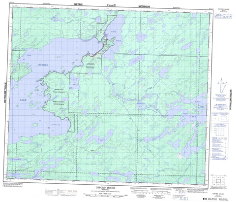
053L14 Oxford House Canada topo map, 1:50,000 scale
053L14 Oxford House NRCAN topographic map.
Includes UTM and GPS geographic coordinates (latitude and longitude). This 50k scale map is suitable for hiking, camping, and exploring, or you could frame it as a wall map.
Printed on-demand using high resolution, on heavy weight and acid free paper, or as an upgrade on a variety of synthetic materials.
Topos available on paper, Waterproof, Poly, or Tyvek. Usually shipping rolled, unless combined with other folded maps in one order.
- Product Number: NRCAN-053L14
- Parent Topo: TOPO-053L
- Map ID also known as: 053L14, 53L14
- Unfolded Size: Approximately 26" high by 36" wide
- Weight (paper map): ca. 55 grams
- Map Type: POD NRCAN Topographic Map
- Map Scale: 1:50,000
- Geographical region: Manitoba, Canada
Neighboring Maps:
All neighboring Canadian topo maps are available for sale online at 1:50,000 scale.
Purchase the smaller scale map covering this area: Topo-053L
Spatial coverage:
Topo map sheet 053L14 Oxford House covers the following places:
- Jackson Bay - Kasakahikanapiak Bay - Opapuskitew Bay - Oxford Inlet - Semple Bay - Eight Mile Point - Eightmile Point - Forestry Point - Hyers Point - Wapanakow Point - Michiskun Narrows - Opapiskak Narrows - Opawakow Narrows - Wapow Narrows - Trout Falls - Oxford House 24 - Oxford Lake North Shore - Wapisew Lake - Birch Island - Back Lake - Kamistahiatikamekoskak Lake - Kanochaskoswatek Lake - Kawakikamasik Lake - Knee Lake - McLaughlin Lake - Michikanes Lake - Michikinabish Lake - Mistuhe Lake - Mukataysip Lake - Oxford Lake - Sandy Lake - Stubbs Lake - Wapaskosowakow Lakes - Wapatakosanik Lake - Wapawakowsansees Lake - Wapisew Lake - Kawapiskachowasik Rapids - Kawepinikateekopasow Rapids - Kiasamekamik Rapids - Kiasokanowak Rapids - Knife Rapids - Wapatakosanik Rapids - Hayes River - Kapakiskok River - Kiasokanowak Creek - Laidlaw Creek - Magill Creek - Semple River - Wapatakosanik River - Oxford House - Pakitahokansik


