
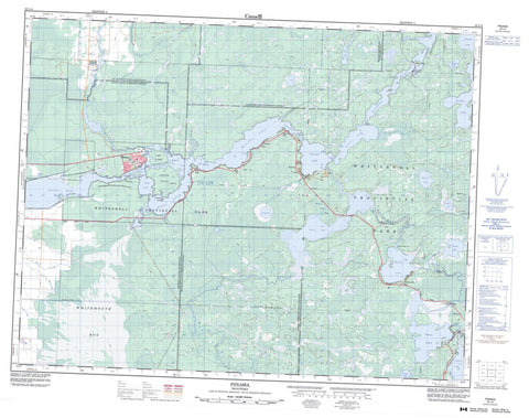
052L04 Pinawa Canada topo map, 1:50,000 scale
052L04 Pinawa NRCAN topographic map.
Includes UTM and GPS geographic coordinates (latitude and longitude). This 50k scale map is suitable for hiking, camping, and exploring, or you could frame it as a wall map.
Printed on-demand using high resolution, on heavy weight and acid free paper, or as an upgrade on a variety of synthetic materials.
Topos available on paper, Waterproof, Poly, or Tyvek. Usually shipping rolled, unless combined with other folded maps in one order.
- Product Number: NRCAN-052L04
- Parent Topo: TOPO-052L
- Map ID also known as: 052L04, 52L4, 52L04
- Unfolded Size: Approximately 26" high by 36" wide
- Weight (paper map): ca. 55 grams
- Map Type: POD NRCAN Topographic Map
- Map Scale: 1:50,000
- Geographical region: Manitoba, Canada
Neighboring Maps:
All neighboring Canadian topo maps are available for sale online at 1:50,000 scale.
Purchase the smaller scale map covering this area: Topo-052L
Spatial coverage:
Topo map sheet 052L04 Pinawa covers the following places:
- Barrier Bay - The Barrier - Goldeneye Pass - Pinawa Channel - Basket Falls - Caux Falls - Otter Falls - Rainbow Falls - Reed Falls - Reid Falls - Sturgeon Falls - Twin Falls - Twin Falls - Basket Falls Dam - Betula Lake Dam - Jessica Lake Dam - Slave Falls Generating Station - Carter Island - French Island - Furey Island - Hind Island - Porcupine Island - Woodward Island - Betula Lake - Bryan Lake - Cabin Lake - Carberry Lake - Chisnell Lake - Dorothy Lake - Dorothy Pond - Eleanor Lake - Fisher Lake - George Lake - Gibbons Lake - Heart Lake - Jessica Lake - Lake Eleanor - Lake Margaret - Lake Natalie - Lake Sylvia - Margaret Lake - Natalie Lake - Natalie Pond - Numao Lake - Nutimik Lake - Picket Lake - Shayler Lake - Sylvia Lake - Tar Lake - White Lake - Williams Lake - Alexander - Pinawa - Whitemouth - Pinawa Dam Provincial Heritage Park - Pinawa Dam Provincial Park - Whiteshell Provincial Forest - Whiteshell Provincial Park - Pine Point Rapids - Scots Rapids - Strassels Rapids - Big Creek - Bog River - Boggy Creek - Caribou Creek - English River - Fisher Creek - Oldenberg Creek - Picket Creek - Rennie River - Rivière Winnipeg - Sharkeys Channel - Smith Creek - Tie Creek - Upper Pinawa Channel - Whiteshell River - Winnipeg River - La Vérendrye Trail - Barrier Bay - Betula Lake - Dorothy Lake - Nutimik Lake - Otter Falls - Pinawa - Slave Falls - White Lake - Heart Lake Bog - Whitemouth Bog - Whitemouth Bog


