
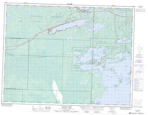
052E11 Falcon Lake Canada topo map, 1:50,000 scale
052E11 Falcon Lake NRCAN topographic map.
Includes UTM and GPS geographic coordinates (latitude and longitude). This 50k scale map is suitable for hiking, camping, and exploring, or you could frame it as a wall map.
Printed on-demand using high resolution, on heavy weight and acid free paper, or as an upgrade on a variety of synthetic materials.
Topos available on paper, Waterproof, Poly, or Tyvek. Usually shipping rolled, unless combined with other folded maps in one order.
- Product Number: NRCAN-052E11
- Parent Topo: TOPO-052E
- Map ID also known as: 052E11, 52E11
- Unfolded Size: Approximately 26" high by 36" wide
- Weight (paper map): ca. 55 grams
- Map Type: POD NRCAN Topographic Map
- Map Scale: 1:50,000
- Geographical region: Manitoba, Canada
Neighboring Maps:
All neighboring Canadian topo maps are available for sale online at 1:50,000 scale.
Purchase the smaller scale map covering this area: Topo-052E
Spatial coverage:
Topo map sheet 052E11 Falcon Lake covers the following places:
- Boat Bay - First Bay - Gull Bay - High Lake Bay - Indian Bay - Indian Bay - Laws Bay - Manitoba Bay - Monks Bay - Price Bay - Rice Bay - Snowshoe Bay - Snowshoe Bay - Falcon Beach - Faloma Beach - McKenzie Beach - Pakaska Beach - Toniata Beach - Magnet Point - Rabbit Point - Starting Point - Twin Point - Ewart - Forgie - Gundy - Falcon Lake Dam - Réserve indienne Shoal Lake 34B2 - Réserve indienne Shoal Lake 39 - Réserve indienne Shoal Lake 39A - Réserve indienne Shoal Lake 40 - Shoal Lake 34B2 - Shoal Lake 39 - Shoal Lake 39A - Shoal Lake 39A - Shoal Lake 40 - Shoal Lake 40 - Shoal Lake Indian Reserve 34B2 - Shoal Lake Indian Reserve 39 - Shoal Lake Indian Reserve 39A - Shoal Lake Indian Reserve 40 - Adele Island - Cameron Island - Cash Island - Clubb Island - Crescent Island - David Island - Dog Island - Dominique Island - Felix Island - Long Island - Picnic Island - Potato Islands - Silver Fox Island - Stevens Island - Tug Island - Twin Islands - Bare Hill Lake - Barren Lake - Baubee Lake - Camp Lake - Charuk Lake - Chiesche Lake - Crowduck Lake - Edgar Lake - Falcon Lake - Frances Lake - Franko Lake - Gundy Lake - Hammerberg Lake - High Lake - High Lake - Hunt Lake - Kilborn Lake - Lownest Lake - Lyons Lake - MacFie Lake - Macfie Lake - Man Lake - McHugh Lake - Millen Lake - Moth Lake - Mud Lake - Normandeau Lake - Royal Lake - Rye Lake - Saskatoon Pond - Shoal Lake - Shoal Lake - Snake Lake - Split Lakes - Star Lake - Talbot Lake - Wanlin Lake - West Hawk Lake - Whiteshell Game Bird Refuge - Whiteshell Provincial Forest - Whiteshell Provincial Park - Manitoba - Boggy River - Falcon Creek - Falcon River - Hamilton Creek - Hazel Creek - High Creek - High Creek - Snake Creek - La Vérendrye Trail - Falcon Beach - Falcon Lake - Faloma - Haute - Indian Bay - Kejick - Shoal Lake - Star Lake - Toniata - Waugh - West Hawk Lake - Westhawk Lake - Whiteshell - Falcon Beach Bog - Glenn Bog - Whiteshell Bog


