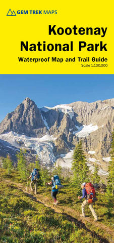
Kootenay National Park Map
Gem Treks 1:100,000 Kootenay National Park Map is designed for hikers and outdoor enthusiasts looking to explore the least visited of the four contiguous national parks of the Canadian Rockies. Whether you are touring along the roads or heading into the backcountry, youll find the waterproof and tear-resistant Kootenay National Park Map to be an invaluable tool. This map features detailed cartography, accurate hiking trails with distances, and details such as logging roads, campgrounds, equestrian routes, picnic areas, and fire lookouts. On the back are descriptions of the most popular hiking trails, as well as details of services such as campgrounds and visitor centres.
- Product Number: GEM_KOOTENAY_22
- Reference Product Number: - None -
- ISBN: 9781990161025
- Date of Publication: 6/1/2022
- Folded Size: 9.5 inches high by 4.5 inches wide
- Unfolded (flat) Size: 36 inches high by 27 inches wide
- Map format: Folded
- Map type: Trade Maps - Park
- Geographical region: Canada
- Geographical subregion: Alberta,British Columbia

