
Yoho National Park Adventure Topographic Map
Yoho National Park Map BC
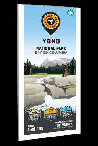
Providing a detailed overview of Yoho National Park in BC, this recreation map highlights all the main roads and trails, campgrounds and backcountry campsites, backcountry huts and cabins, picnic areas and viewpoints, trailheads and notable recreation areas, larger lakes and river systems and more! Using 1:10,000 & 1:50,000 scale data, this map features topographic relief shading. Included on the map are Abbot Pass, Amiskwi Pass, Burgess Shale, Elizabeth Parker Hut, Emerald Lake, Field, Goodsir Pass, Great Divide Trail, Hoodoo Creek Campground, Kicking Horse River, Lake McArthur, Lake OHara, Otterhead River, Ottertail River, Stanley Mitchell Hut, Takakkaw Falls, Twin Falls, Wapta Falls, Wapta Lake, Yoho River and more!
The printed version of the map is displayed at 1:90,000 scale on 61 x 94 cm (24 x 37 in) paper. You can choose between having the map printed on regular water-resistant paper or a more durable waterproof synthetic. The Wall Maps ha
- Product Number: BRM_ADV_YOHO_23
- Reference Product Number: - None -
- ISBN: - None -
- Date of Publication: 9/1/2023
- Folded Size: 9 inches high by 4 inches wide
- Unfolded (flat) Size: 37 inches high by 24 inches wide
- Map format: Folded
- Map type: Trade Maps - Outdoor Recreation Maps
- Geographical region: Canada
- Geographical subregion: British Columbia


