
EC Manning & Skagit Valley Provincial Parks Adventure Topographic Map
EC Manning & Skagit Valley Provincial Parks Map BC
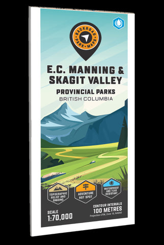
Covering EC Manning Provincial Park along with the Skagit Valley Park to the west, this topographic recreation map highlights all the nearby campgrounds, access roads, trails for hiking, horseback riding, mountain biking, cross-country skiing and snowshoeing, backcountry huts and cabins, fishing rivers and lakes and more! This Adventure map features our industry-leading topographic contours and relief shading and charts the areas around Blackwall Peak, Dewdney Trail, Eastgate, Heather (3 Brothers) Trail, Garrison Lakes, Lightning Lake, Manning Park, Monument 76 & 83, Pacific Crest Trail, Ross Lake, Skagit River, Skagit Valley Park, Similkameen River, Sumallo River, Thunder Lake, West Gate, Whatcom Trail, Whipsaw Creek and more!
The printed version of the map is displayed at 1:70,000 scale on 61 x 94 cm (24 x 37 in) paper on a durable waterproof synthetic material. The Wall Maps have been customized to display nicely and fit
- Product Number: BRM_ADV_MANNING_23
- Reference Product Number: - None -
- ISBN: - None -
- Date of Publication: 12/1/2023
- Folded Size: 9 inches high by 4 inches wide
- Unfolded (flat) Size: 37 inches high by 24 inches wide
- Map format: Folded
- Map type: Trade Maps - Outdoor Recreation Maps
- Geographical region: Canada
- Geographical subregion: British Columbia


