
Lady Evelyn Smoothwater Provincial Park Adventure Topographic Map
Lady Evelyn Smoothwater Provincial Park Map Ontario
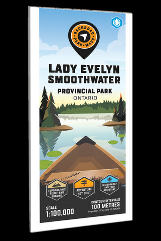
Covering Lady Evelyn Smoothwater Provincial Park in northern Ontario, this map features the canoe routes, campsites, access points, portage routes, hiking trails, fish species and lakes in the area. Use for canoeing, camping, exploring, fishing, hiking, kayaking, skiing, wildlife viewing and more. With 1:10,000 water and trail data, no other map for the area provides you with this level of recreational or topographic detail. This 1:100,000 scale printed map includes Lady Evelyn Smoothwater Provincial Park, Camp Wanapitei, Mowat Landing, Diamond Lake, Florence Lake, Lady Evelyn Lake, Makobe Lake, North Yorston Conservation Reserve, Smoothwater Lake, Temagami Lake, Willow Island Lake, and more!
The printed version of the map is displayed at 1:100,000 scale on 61 x 94 cm (24 x 37 in) paper on a durable waterproof synthetic material. The Wall Maps have been customized to display nicely and fit into common picture frame sizes s
- Product Number: BRM_ADV_EVELYN_23
- Reference Product Number: - None -
- ISBN: - None -
- Date of Publication: 12/1/2023
- Folded Size: 9 inches high by 4 inches wide
- Unfolded (flat) Size: 37 inches high by 24 inches wide
- Map format: Folded
- Map type: Trade Maps - Outdoor Recreation Maps
- Geographical region: Canada
- Geographical subregion: Ontario


