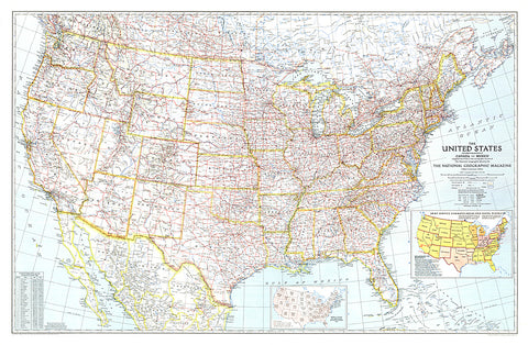
1940 United States of America Map
Great maps communicate something about the era in which they are published. This US map, first published in National Geographic in December of 1940, is a cartographic gem. This map included two insets that tell much about the time it was published. One inset shows the population shift between 1930 and 1940, following the devastation of the droughts of the 1930s. Another inset shows the Army Service Command Areas and Naval Districts as the US prepared to enter WWII. Any map collector will delight in the balance between features and extraordinary detail.
- Product Number: PODHNG_US_40
- Reference Product Number: 2321639M
- ISBN: - None -
- Date of Publication: 6/1/1940
- Unfolded (flat) Size: 27.25 inches high by 41.5 inches wide
- Map format: Wall
- Map type: Trade Maps - Political
- Geographical region: United States