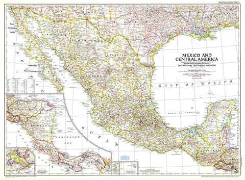
1953 Mexico and Central America Map
This map is unique in that it combines Mexico and Central America, showing the expansion of transportation in the region as roads and parts of the Pan American Highway were being built. At the time of this publication in March 1953, many regions of Central America relied on air travel as the principal means of modern transportation. Honduras in particular had more airports that roadways.
- Product Number: PODHNG_AMER_C_53
- Reference Product Number: 2321544M
- ISBN: - None -
- Date of Publication: 6/1/1953
- Unfolded (flat) Size: 27.25 inches high by 37 inches wide
- Map format: Wall
- Map type: Trade Maps - Political