Free Shipping on map orders over $300
Canyon Lake Fishing Map
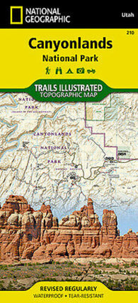
Canyonland National Park Trails
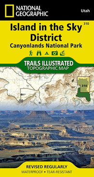
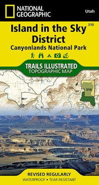
Canyonlands National Park, Island in the Sky District, Map 310
Canyonlands National Park, Island in the Sky District, Map 310 by National Geographic Maps
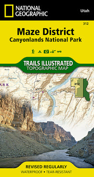
Canyonlands National Park, Maze District, Map 312 by National Geographic Maps
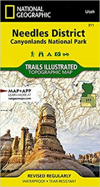
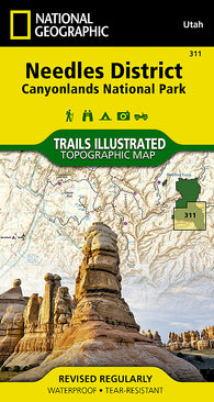
Canyonlands National Park, Needles District, Map 311
Canyonlands National Park, Needles District, Map 311 by National Geographic Maps
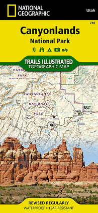
Canyonlands National Park, Utah, Map 210 by National Geographic Maps
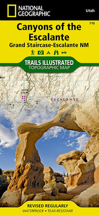
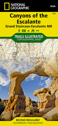
Canyons of the Escalante : Grand Staircase-Escalante, NM : Trails illustrated : topographic map
Canyons of the Escalante, Utah by National Geographic Maps
Cap Aux Oies a/to Sault-Au-Cochon by Canadian Hydrographic Service
Cap de la Tete au Chien au/to Cap Aux Oies by Canadian Hydrographic Service
Cap des Rosiers a/to Chandler by Canadian Hydrographic Service
Cap Eternite a/to Saint Fulgence by Canadian Hydrographic Service
Cap Ghir To Sidi Ifni (NGA-51300-4) by National Geospatial-Intelligence Agency
Cap Spartel To Moulay Bou Selham (NGA-51180-5) by National Geospatial-Intelligence Agency
Cap Vert to Cap de Naze (NGA-51561) by National Geospatial-Intelligence Agency
Cap Whittle a/to Havre-Saint-Pierre et/and Ile dAnticosti by Canadian Hydrographic Service
Cap-Aux-Meules by Canadian Hydrographic Service
Cap-Haitien (NGA-26146-1) by National Geospatial-Intelligence Agency
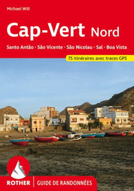
Cap-Vert Nord: Santo Antão, São Vicente, São Nicolau, Sal, Boa Vista - French Edition
Cape Mercy and Approaches/et les Approches by Canadian Hydrographic Service
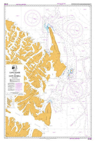
CAPE ADARE AND CAPE HALLETT (14906) by Land Information New Zealand (LINZ)
CAPE ADARE TO CAPE DANIELL (14908) by Land Information New Zealand (LINZ)
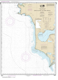
Cape Alitak to Cape lkolik (16601-11) by NOAA
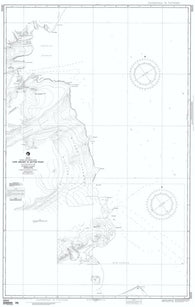
Cape Archer To Butter Point (NGA-29325-1) by National Geospatial-Intelligence Agency
Cape Baring to/a Cambridge Bay by Canadian Hydrographic Service
Cape Bay to/a Garia Bay by Canadian Hydrographic Service
Cape Beaufort (16103-6) by NOAA
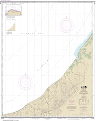
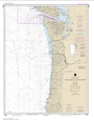
Cape Blanco to Cape Flattery (18003-20) by NOAA
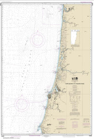
Cape Blanco to Yaquina Head (18580-23) by NOAA
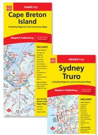
Cape Breton Island Road Map
Cape Breton to/a Cape Cod by Canadian Hydrographic Service
CAPE BRETT TO BREAM TAIL (NZ521) by Land Information New Zealand (LINZ)
CAPE BRETT TO CUVIER ISLAND (52) by Land Information New Zealand (LINZ)
Cape Calvert to Goose Island Including Fitz Hugh Sound by Canadian Hydrographic Service
Cape Canaveral - Indian and Banana Rivers
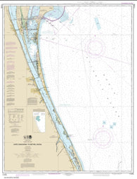
Cape Canaveral to Bethel Shoal (11476-23) by NOAA
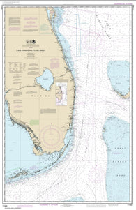
Cape Canaveral to Key West (11460-43) by NOAA
Cape Canso to Liscomb Island by Canadian Hydrographic Service