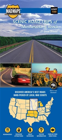
Scenic road trips of Minnesota & Iowa
Minnesota and Iowa
Road trips map: offering a Minnesota map and an Iowa map for you to take to the scenic highways and best scenic byways of the Upper Midwest via 27 trips. Our route planner gets you on the road for the best weekend getaways and day trips of this region. Explore the possibilities for motorcycle touring, RV trips and car drives in this road trip planner. Looking for the best of Minnesota State Parks, Minnesota RV camping or Iowa State Parks? Local MAD scouts found not only the best scenic highways and scenic byways-they also uncovered the best attractions that dot the landscape. Some of the best include: Split Rock Lighthouse; Mille Lacs; Lewis and Clark State Park; Backbone State Park; Lake Itasca State Park; Voyageurs National Park; and Gooseberry Falls. But this list is just the beginning. Yes, there are 10,000 lakes in Minnesota, although were not sure who actually counted them all. And, yes, there are myriad corn farms in Iowa. But this area offers so much more
- Product Number: MADM_RT_MN_IA_20
- Reference Product Number: - None -
- ISBN: 9781934955079
- Date of Publication: 6/1/2020
- Folded Size: 8.66 inches high by 3.94 inches wide
- Unfolded (flat) Size: 27.17 inches high by 36.22 inches wide
- Map format: Folded
- Map type: Trade Maps - Road
- Geographical region: Canada,United States
- Geographical subregion: Iowa,Minnesota,Ontario

