
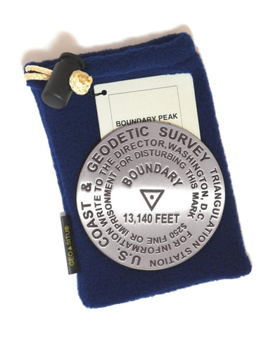
Boundary Peak, Nevada paperweight
3 1/4 inch diameter
Cast in fine pewter
Felt backing
With soft fleece pouch
In clear-vinyl covered box
PLACE NAME: Boundary Peak
ELEVATION: 13,140 ft.
COORDINATES: N37° 50 46 W118° 21 00
LOCATION: Inyo National Forest, Nevada, USA
MARKERSLEUTH PHOTO CONTRIBUTOR: Greg and Mary Stone
Boundary Peak is the highest point of the state of Nevada and is located in the White Mountain range. It is characterized by its challenging elevation gain of 2300 feet in 1.5 miles followed by a half mile of poor trail to the summit. Boundary Peak derives its name from its position on the boundary line shared by Nevada and California.
- Product Number: GSU_PW_BOUNDARY
- Reference Product Number: 2306071M
- ISBN: - None -
- Map format: - None -
- Map type: Accessories - Other Accessories
- Geographical region: United States
- Geographical subregion: Nevada


