
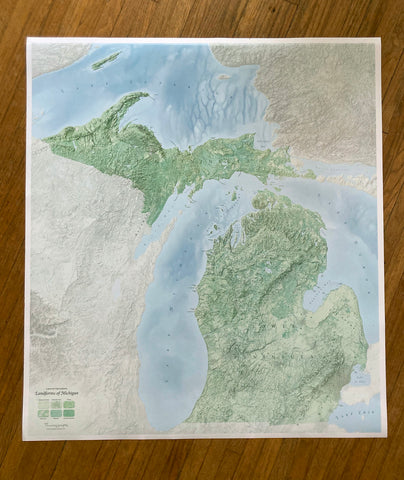
Landforms of Michigan Wall Map
This detailed, 37-by-33-inch poster covers the many islands, rivers, lakes, hills, wetlands, plains, moraines, and uplands of Michigan. The most thorough map of its kind; the result of a huge amount of painstaking research, with hundreds of labeled features. It provides a rich picture of the physical terrain of the Great Lakes State.
- Product Number: DH_LANDFORMS_MICHIGAN
- Reference Product Number: - None -
- ISBN: - None -
- Unfolded (flat) Size: 33 inches high by 37 inches wide
- Map format: Wall
- Map type: Topographic - General Topographic
- Geographical region: United States
- Geographical subregion: Michigan


