
Lake OHara - Yoho National Park Adventure Topographic Map
Lake OHara - Yoho National Park Map BC
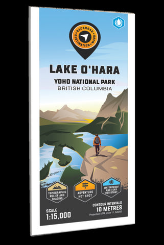
Focusing on the Lake OHara area of Yoho National Park British Columbia, this BRMB Adventure topographic map highlights all the backcountry huts and cabins, campgrounds, trails for hiking, horseback riding, mountain biking, cross-country skiing and snowshoeing, fishing lakes, rock climbing areas, viewpoints, waterfalls and more! This Adventure map features our industry-leading topographic contours and relief shading and includes the areas surrounding Lake OHara, Abbot Pass Hut, Cathedral Lakes, Elizabeth Parker Hut, Lake McArthur, Lake OHara Lodge, Lake Oesa, Linda Lake, Mary Lake, Morning Glory Lakes, Opabin Plateau, Park Mountain, Seven Veil Falls, Vera Lake, Victoria Falls and more!
The printed version of the map is displayed at 1:15,000 scale on 61 x 94 cm (24 x 37 in) paper on a durable waterproof synthetic material. The Wall Maps have been customized to display nicely and fit into common picture frame sizes so you can hang on t
- Product Number: BRM_ADV_OHARA_23
- Reference Product Number: - None -
- ISBN: - None -
- Date of Publication: 9/1/2023
- Folded Size: 9 inches high by 4 inches wide
- Unfolded (flat) Size: 37 inches high by 24 inches wide
- Map format: Folded
- Map type: Trade Maps - Outdoor Recreation Maps
- Geographical region: Canada
- Geographical subregion: British Columbia


