
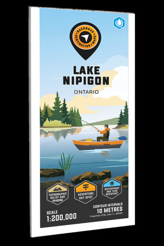
Lake Nipigon Adventure Topographic Map
Lake Nipigon - Ontario Adventure Map
Covering Lake Nipigon, from Nipigon north to Armstrong in northern Ontario, this recreation map features the campsites, fishing lakes and streams, hiking trails, ATV and snowmobile trails, paddling routes, access points and boat launches and countless other visitor facilities. Use for hiking, canoeing, camping, exploring, fishing, kayaking, ATVing, snowmobiling, skiing, wildlife viewing and more. With 1:10,000 water and trail data, no other map for the area provides you with this level of recreational or topographic detail. This map includes Lake Nipigon, Armstrong, Beardmore, Black Sturgeon Lake, Gull Bay, Macdiarmid, Nipigon, North Wind Lake, Pine Portage, Poplar Lodge and more!
The printed version of the map is displayed at 1:200,000 scale on 61 x 94 cm (24 x 37 in) paper on a durable waterproof synthetic material. The Wall Maps have been customized to display nicely and fit into common picture frame sizes so you can hang on the cabi
- Product Number: BRM_ADV_NIPIGON_23
- Reference Product Number: - None -
- ISBN: - None -
- Date of Publication: 12/1/2023
- Folded Size: 9 inches high by 4 inches wide
- Unfolded (flat) Size: 37 inches high by 24 inches wide
- Map format: Folded
- Map type: Trade Maps - Outdoor Recreation Maps
- Geographical region: Canada
- Geographical subregion: Ontario


